What is SLAM? A Beginner to Expert Guide
What is SLAM? A Beginner to Expert Guide

Introduction
From robot vacuums and self-driving cars to warehouse automation and augmented reality, SLAM technology is revolutionizing the way machines navigate the world. But what is SLAM and how does SLAM work exactly?
SLAM, or Simultaneous Localization and Mapping, enables autonomous systems to build maps of unknown environments while tracking their own position in real time. This game-changing technology has seen massive advancements since its early days in the 1980s, thanks to faster processing power, affordable sensors, and high-precision cameras. Today, SLAM-equipped systems can map up to 3,000 square meters without interruption—achieving pinpoint accuracy down to just 6 millimeters.
This comprehensive guide explores SLAM's core concepts, algorithms, and practical applications. Whether you're interested in visual SLAM, LiDAR SLAM, or multi-sensor approaches, this article will help you understand how SLAM works and its significance in shaping the future of autonomous systems.
What is SLAM?

Simultaneous Localization and Mapping (SLAM) is a computational framework that allows autonomous systems to navigate unfamiliar environments by building a map while concurrently estimating their position within it. This process relies on sophisticated algorithms and sensor data fusion to enable robots, drones, self-driving vehicles, and other autonomous agents to operate effectively without prior knowledge of their surroundings.
SLAM is not a singular algorithm but a broad concept encompassing multiple implementations. It integrates sensor data from various sources such as LiDAR, cameras, wheel encoders, and inertial measurement units (IMUs) to develop a comprehensive spatial understanding.
Advanced mathematical models process these inputs to estimate both an agent’s motion and the structure of its environment.
Mathematically, SLAM is framed as a probabilistic state estimation problem, often utilizing techniques such as Extended Kalman Filters (EKF), Particle Filters, Covariance Intersection, or GraphSLAM. These approaches estimate the posterior probability distribution of the agent’s pose (position and orientation) and environmental features based on accumulated sensor observations and control inputs.
A notable subset of SLAM, known as Visual SLAM (vSLAM), employs camera systems to process image data through feature extraction, pose estimation, and map construction. This technique identifies distinct visual elements, such as edges, corners, or textures, across sequential frames to infer motion and reconstruct environmental structures.

The Core Problem SLAM Solves
SLAM addresses a fundamental challenge in autonomous navigation: How can a system determine its position in an environment without a pre-existing map while simultaneously creating that map without knowing its precise location. This presents a classic circular dependency: accurate mapping requires precise localization, yet precise localization traditionally depends on an accurate map.

A key breakthrough in SLAM is understanding that errors in mapping landmarks are closely connected to the robot’s own localization errors. Since the robot’s position isn’t always precise, the absolute locations of landmarks may be uncertain. However, their positions relative to each other can often be determined with high accuracy. This correlation is what makes SLAM so effective in building reliable maps.
SLAM algorithms address this challenge by maintaining a probabilistic representation of both the agent’s position and the environmental features. As new sensor data becomes available, these estimates are continuously updated, reducing uncertainty through iterative refinement. Over time, the system converges toward a solution that balances both mapping and localization requirements.
This dual challenge in SLAM can be broken down into two interconnected problems: mapping and localization. Mapping involves constructing a coherent representation of the environment by identifying and positioning landmarks, while localization focuses on determining the agent’s precise position relative to these mapped features. Effective SLAM solutions must tackle both problems simultaneously, ensuring that as the agent refines its map, it also improves its ability to localize within it.
The Evolution of SLAM Technology

Origins and Theoretical Foundations
The origins of probabilistic SLAM can be traced back to the 1986 IEEE Robotics and Automation Conference in San Francisco, where researchers first raised a critical question: Can a mobile robot, placed in an unknown environment, incrementally build a consistent map while simultaneously determining its location? This question sparked a wave of research that shaped the foundation of SLAM theory.
Throughout the late 1980s and early 1990s, researchers developed essential theoretical frameworks to address the challenges of spatial uncertainty and map consistency. One influential early contribution introduced a stochastic approach to representing and estimating spatial relationships—an idea that became central to modern SLAM algorithms. The term “SLAM” itself, however, wasn’t formally introduced until the 1995 International Symposium on Robotics Research, where it was used in a mobile robotics survey paper. This marked the field’s emergence as a recognized and distinct domain within robotics.
Early Theoretical Advances
A significant breakthrough in SLAM’s theoretical development came with Csorba’s work on convergence properties. His research demonstrated that as a robot navigates an environment and makes observations, the correlation between landmark estimates increases monotonically, eventually approaching unity. This insight is crucial to understanding SLAM’s reliability.
Following these theoretical advancements, several research institutions, including MIT, the University of Zaragoza, and the Australian Centre for Field Robotics (ACFR), began developing practical SLAM applications across diverse environments such as indoor, outdoor, and underwater settings.
Development of the SLAM Research Community
The 1999 International Symposium on Robotics Research (ISRR'99) was a pivotal moment, featuring the first dedicated SLAM session. This gathering catalyzed SLAM’s emergence as a specialized research field, leading to increased collaboration and focused studies.
The growing interest in SLAM prompted educational initiatives, such as the 2004 SLAM summer school in Toulouse and subsequent programs at Oxford, fostering knowledge exchange and accelerating technological progress.
Evolution of Visual SLAM

A V-SLAM Guided and Portable System for Photogrammetric Applications by Alessandro Torresani
Visual SLAM (V-SLAM) has become a prominent branch of SLAM, leveraging camera-based data for navigation, mapping, and environmental understanding. Over the years, various methodologies have been developed to enhance V-SLAM’s accuracy and efficiency.
ORB-SLAM Progression
ORB-SLAM is one of the most influential V-SLAM frameworks, evolving through multiple versions:
Sensor Input and Tracking: ORB-SLAM1 utilizes a single input source, ORB-SLAM2 incorporates three, and ORB-SLAM3 extends this to four, improving pose estimation and frame generation.
Local Mapping: All versions handle keyframe insertion and map creation, with ORB-SLAM3 enhancing feature detection through additional bundle adjustment techniques.
Loop Closing: ORB-SLAM2 and ORB-SLAM3 introduce advanced map merging and bundle adjustment welding, optimizing accuracy.
Output Preparation: Each iteration refines final map outputs, supporting 2D and 3D spatial representations.
ROVIO-SLAM: Advancements in Sensor Fusion
ROVIO-SLAM (Robust Visual-Inertial Odometry SLAM) integrates visual and inertial data for improved navigation accuracy. It follows a three-stage workflow:
Data Acquisition: Captures and pre-processes camera and IMU data.
Feature Processing: Detects and tracks features while preparing IMU data for integration.
State Transition: Performs keyframe insertion, loop closure, and data filtering, culminating in 3D landmark mapping.
ROVIO-SLAM is known for its low computational demands and robustness to varying lighting conditions, making it ideal for long-term robotic operations in dynamic environments.
Kimera-SLAM: Real-Time Metric-Semantic Mapping
Kimera-SLAM is an open-source framework that builds upon ORB-SLAM, VINS-Mono SLAM, OKVIS, and ROVIO-SLAM. It follows a five-stage process:
Input Pre-processing: Utilizes dense stereo and semantic segmentation for precise state estimation.
Pose Graph Optimization: Enhances global trajectory accuracy.
3D Mesh Generation: Creates spatial representations of the environment.
Semantic Annotation: Integrates semantic data into 3D meshes.
Output Visualization: Provides high-fidelity environmental reconstructions.
Kimera-SLAM excels in both indoor and outdoor applications, offering robustness in dynamic environments and varying lighting conditions.
RGB-D and SCE-SLAM Innovations
RGB-D SLAM Framework
RGB-D SLAM integrates color and depth data to enhance mapping accuracy. Its five-stage process includes:
Data Acquisition: Captures RGB-D camera inputs.
Processing: Extracts features and aligns depth-related information.
Preparatory Steps: Removes noise and detects loop closures.
Pose Estimation: Optimizes positional accuracy.
Output Generation: Produces trajectory and environmental maps.
SCE-SLAM: A New Approach
SCE-SLAM (Spatial Coordinate Errors SLAM) was designed to enhance adaptability in dynamic environments. Its three-stage methodology comprises:
Semantic Module: Uses YOLOv2 for object detection and noise filtering.
Geometry Module: Processes depth images for spatial recovery.
ORB-SLAM3 Integration: Incorporates loop closure techniques for improved precision.
SCE-SLAM merges semantic and geometric data, employing YOLOv7 for real-time object recognition, significantly improving performance in changing environments.
Contemporary SLAM Research Focus
The focus of SLAM research has shifted over time. Early efforts centered on establishing theoretical foundations, while later advancements have prioritized computational efficiency, robustness, and data association challenges like loop closure.
Recent progress in visual SLAM has driven breakthroughs in robotics and computer vision, with researchers continually refining methodologies to address real-world challenges. Benchmark datasets now facilitate rigorous testing and evaluation, ensuring continued innovation in the field.
Understanding SLAM Algorithms
Mathematically, SLAM is framed as a state estimation problem, in which the system infers hidden state variables from noisy sensor data. This section explores the mathematical foundations, graph-based representations, and optimization techniques that underpin modern SLAM algorithms.
Mathematical Formulation of SLAM
SLAM is commonly formulated as a nonlinear estimation problem involving a motion model and observation model, as explained in this foundational SLAM tutorial by Bailey and Durrant-Whyte.

where:
xk represents the robot’s pose (position and orientation) at time k.
f(.)is the motion model, describing how the robot’s state evolves based on the previous pose xk-1, control input uk, and motion noise wk.
zk,j is the observation of landmark j from pose k.
g(.) is the observation model, mapping the robot’s state xk and landmark position yj to a sensor measurement, with observation noise vk,j.
In a 2D environment, the robot’s pose is typically represented as:
xk=[x,y,θ]
where x and y denote position coordinates, and θ represents orientation.
Since SLAM involves uncertainties in both motion and perception, it must incorporate probabilistic estimation techniques to refine the robot’s trajectory and environmental map.
State Estimation in SLAM
The goal of SLAM is to estimate the system's state (robot trajectory and landmark positions) while accounting for sensor noise and motion uncertainty. Depending on the mathematical properties of the motion and observation models, SLAM can be categorized into:
Linear Gaussian Systems – Solved optimally using Kalman Filters (KF) when both motion and measurement models are linear with Gaussian noise.
Nonlinear Gaussian Systems – Addressed using Extended Kalman Filters (EKF), which linearize nonlinear models around the current estimate.
Nonlinear Non-Gaussian Systems – Handled via nonlinear optimization methods, such as Graph SLAM, which optimize a pose graph to refine the map and trajectory simultaneously.
Due to real-world nonlinearities, modern SLAM implementations favor graph-based optimization techniques over traditional filtering approaches.
Graph-Based SLAM: Structural Representation
A powerful way to represent the SLAM problem is through graph-based optimization, where:
Nodes represent robot poses and mapped landmarks.
Edges encode constraints, such as odometry measurements, landmark observations, and loop closures (when the system revisits a previously mapped area).
The graph-based formulation enables efficient optimization of the robot’s trajectory and environment map by minimizing the error in these constraints.
Graph Element | Physical Meaning | Mathematical Representation |
Pose Node | Robot’s position and orientation at time t | xt=(x,y,θ) (2D) |
Landmark Node | Fixed feature in the environment | mi=(x,y) (2D) |
Odometry Edge | Estimated movement between poses | ut=(Δx,Δy,Δθ) |
Observation Edge | Sensor measurement of a landmark | zt=(r,ϕ) (range, bearing) |
By solving for the most probable configuration of nodes given all available constraints, Graph SLAM minimizes error and improves localization accuracy.
Mathematical Foundations and Coordinate Transformations
To accurately model the environment and robot motion, SLAM algorithms heavily rely on coordinate transformations, particularly:
Euclidean Transformations
Rigid-body transformations in SLAM combine rotation and translation operations while preserving spatial relationships. These are represented as:
Rotation Matrices (R) – Orthogonal matrices preserving orientation.
Translation Vectors (t) – Representing displacement in space.
Homogeneous Transformation Matrices (T) – Combining rotation and translation into a single 4×4 matrix for 3D transformations.
Rotation Representations
Rotations in SLAM can be represented using:
Rotation Matrices – Full 3×3 representations, but require 9 elements.
Rotation Vectors – Compact representations using an axis-angle format.
Quaternions – Four-element representations providing a singularity-free alternative to rotation matrices.
A fundamental conversion between rotation matrices and axis-angle representation is given by Rodrigues’ formula:

Where:
n is the unit rotation axis
n^ is the skew-symmetric matrix of n
These transformations allow SLAM algorithms to correctly model robot motion and align sensor observations within a common reference frame.
The Three Major SLAM Algorithm Types
Over time, three dominant algorithmic paradigms have emerged in SLAM research: Kalman filter-based approaches, particle filter-based methods, and graph-based optimization techniques. Each paradigm offers unique advantages and trade-offs based on its mathematical framework and practical implementation.
Kalman Filter Approach
The Kalman filter, particularly the Extended Kalman Filter (EKF), represents one of the earliest and most widely used SLAM techniques. It frames SLAM as a recursive state estimation problem, leveraging probabilistic modeling to maintain a Gaussian belief distribution over the robot’s state and map.
Filter Cycle and Implementation
The EKF SLAM algorithm follows a structured cycle:
State prediction – Updates the robot’s pose using motion models
Measurement prediction – Estimates expected sensor readings
Data acquisition – Collects actual sensor data
Data association – Matches observations to known landmarks
State update – Adjusts the estimated state based on observed deviations
During prediction, the robot’s state is updated while landmark positions remain unchanged. The covariance matrix is adjusted to reflect increased uncertainty due to movement. EKF SLAM assumes known data association, meaning each observation is correctly linked to a corresponding landmark.
For a 2D system using velocity-based motion and range-bearing sensors, the state transition is modeled by:

where GtG_t is the Jacobian of the motion model, and RtR_t represents motion noise covariance.
Particle Filter Approach
Particle filter-based SLAM, commonly implemented using Rao-Blackwellized particle filters (RBPF), provides an alternative probabilistic framework that is well-suited for handling non-Gaussian noise and non-linear motion models.
Advantages and Challenges
Key benefits of particle filter-based SLAM include:
Ability to represent multimodal distributions
Robustness to non-linear motion and observation models
Simplicity compared to graph-based methods
However, it also presents challenges:
High computational demand, scaling with the number of particles
Risk of particle depletion in high-dimensional state spaces
Lower accuracy than graph-based methods in large-scale environments
Performance depends on factors such as resampling strategies, particle count, and noise handling, creating a balance between computational efficiency and estimation accuracy.
Graph-Based Approach
Graph-based SLAM has become the dominant paradigm due to its ability to produce highly accurate and globally consistent maps. It reformulates SLAM as a pose graph optimization problem, where:
Nodes represent robot poses and landmarks
Edges encode spatial constraints based on sensor measurements or odometry
Edge weights reflect uncertainty in observations
Technical Advantages and Implementation
Graph-based SLAM offers:
Superior accuracy compared to filter-based methods
Flexibility to incorporate delayed measurements and adjust data associations
Strong loop closure capabilities for global consistency
Suitability for functional safety applications due to its deterministic nature
Implementation typically involves:
Front-end – Performs data association and graph construction
Back-end – Optimizes the graph to minimize estimation errors
Optimization solvers such as g2o, GTSAM, and iSAM2 are widely used for solving the graph optimization problem efficiently.
Comparative Analysis of SLAM Approaches
Each SLAM paradigm has distinct characteristics:
Feature | Kalman Filter (EKF) | Particle Filter (RBPF) | Graph-Based SLAM |
Uncertainty Handling | Assumes Gaussian noise | Handles arbitrary distributions | Models uncertainty in constraints |
Computational Complexity | O(n^2) (number of landmarks) | Scales with particles & landmarks | Scales with nodes & edges |
Data Association | Requires accurate association | Supports multiple hypotheses | Can refine associations retrospectively |
Loop Closure Handling | Limited correction ability | Struggles with large loops | Excels at global consistency |
Temporal Processing | Sequential estimation | Sequential with resampling | Incorporates measurements from any time |
Graph-based methods have gained widespread adoption due to their scalability and accuracy, though specific applications may still favor filter-based approaches based on constraints such as real-time processing requirements or computational resources.
Multi-Sensor Fusion SLAM: LiDAR and Camera Integration

Multi-sensor fusion SLAM, particularly the integration of LiDAR and camera data, has become a cornerstone in advancing robust, accurate, and adaptable simultaneous localization and mapping (SLAM) systems. By leveraging the complementary strengths of both LiDAR and visual sensors, hybrid SLAM systems overcome the limitations inherent to single-sensor approaches, providing superior performance in diverse and challenging environments.
Motivation for Fusion
Complementary Strengths:
LiDAR offers precise geometric and distance measurements, excelling in low-light or textureless environments.
Cameras provide rich semantic and color information, enabling object recognition and scene understanding, but can struggle in poor lighting or with repetitive textures.
Single-Sensor Limitations:
LiDAR-only SLAM may fail in environments with sparse features or high dynamics5.
Visual-only SLAM is susceptible to drift, occlusion, and lighting changes..
Fusion Benefits:
Enhanced robustness, accuracy, and environmental adaptability.
Improved resilience to sensor-specific failures and environmental challenges.
Fusion Framework and Pipeline
A typical LiDAR-camera fusion SLAM pipeline consists of the following stages::
Front-End:
Data Preprocessing: Calibration, undistortion, and feature extraction from both LiDAR and camera streams.
System Initialization: Estimating initial pose, scale, and sensor biases.
Data Association: Aligning spatial and temporal data from both modalities, ensuring accurate correspondence between LiDAR points and camera features.
Back-End:
Sensor Fusion: Integrating measurements using probabilistic frameworks such as Extended Kalman Filters (EKF), Unscented Kalman Filters (UKF), or graph-based optimization.
Pose Estimation and Map Update: Joint optimization of robot trajectory and map, leveraging both geometric (LiDAR) and visual (camera) constraints.
Loop Closure: Detecting revisited locations using both visual features and geometric consistency to correct accumulated drift.
Visual Camera based SLAM :
Visual SLAM has become a cornerstone of autonomous navigation, enabling robots and other intelligent systems to map their surroundings while determining their own position using visual data. Unlike conventional localization techniques that depend on external references such as GNSS or IMUs (discussed in the Localization section), Visual SLAM operates independently, relying solely on image data captured by cameras.
This section explores the core methodologies of Visual SLAM, its various implementations, and how different sensor modalities influence mapping accuracy and efficiency in real-world applications.
Fundamentals of Visual SLAM
At its core, Visual SLAM operates by extracting and tracking visual features from an environment to establish spatial relationships and estimate motion. The process can be broken down into three key stages:
Feature Extraction – Algorithms such as ORB (Oriented FAST and Rotated BRIEF), SIFT (Scale-Invariant Feature Transform), or FAST (Features from Accelerated Segment Test) identify distinctive elements like corners, edges, or textures in camera frames. These features serve as landmarks for tracking the system’s movement across successive frames.
Pose Estimation – By matching extracted features between frames, Visual SLAM estimates changes in the camera’s position and orientation. This is typically achieved through epipolar geometry in monocular setups or depth triangulation in stereo configurations.
Map Construction – As the system moves, it continuously updates and refines a map of the environment, integrating new observations while correcting errors through optimization techniques such as Bundle Adjustment and Pose Graph Optimization.
A critical challenge in Visual SLAM is loop closure detection, which enables the system to recognize previously visited locations. By identifying known areas, loop closure corrects drift errors that accumulate over time, improving global map consistency. Advanced Visual SLAM implementations use techniques like pose graph optimization to refine trajectory estimates when a loop is detected.
Modern Visual SLAM systems must overcome various environmental challenges, including dynamic objects, textureless surfaces, and varying lighting conditions. To enhance robustness, some implementations integrate deep learning models to improve feature detection, object segmentation, and loop closure recognition, enabling SLAM to operate reliably in complex real-world settings.
Visual SLAM Sensor Modalities and Implementations
The effectiveness of visual SLAM depends heavily on the type of camera sensor used. Different camera configurations and sensing technologies influence the accuracy, scale estimation, and environmental adaptability of SLAM systems.
Monocular SLAM
Monocular SLAM systems use a single camera to capture image sequences, estimating motion by tracking visual features across frames. However, monocular setups suffer from scale ambiguity, meaning they cannot determine absolute distances without additional information. To mitigate this, some approaches assume known object dimensions, camera height constraints, or incorporate motion priors from an IMU.
Monocular SLAM techniques typically follow two methodologies:
Feature-based methods (e.g., ORB-SLAM) rely on keypoint detection and descriptor matching to track features across frames.
Direct methods (e.g., Direct Sparse Odometry, DSO) work directly with pixel intensities, optimizing photometric consistency between consecutive images to estimate motion.
While monocular SLAM systems are computationally efficient and hardware-light, their inability to recover absolute depth limits their accuracy in large-scale environments.
Stereo SLAM
Stereo SLAM systems use two cameras with a known baseline distance to compute depth via triangulation. By identifying feature correspondences between left and right images, these systems can directly infer scene geometry, eliminating the scale ambiguity present in monocular SLAM.
Stereo-based SLAM excels in applications requiring precise metric reconstruction, such as autonomous vehicles and augmented reality. However, stereo vision increases computational complexity and demands precise camera calibration to ensure accurate depth estimation.
RGB-D SLAM
RGB-D SLAM integrates traditional color (RGB) images with depth information obtained from structured light or time-of-flight sensors. By providing dense depth maps, RGB-D cameras significantly simplify feature extraction and mapping, particularly in low-texture environments where traditional feature-based methods struggle.
Notable RGB-D SLAM implementations include:
KinectFusion, which reconstructs dense 3D models using a volumetric representation of the environment.
ElasticFusion, an advanced system that enables real-time, non-rigid scene reconstruction.
Despite their advantages in indoor environments, RGB-D cameras face limitations such as limited range, infrared interference, and sensitivity to sunlight, making them less effective in outdoor applications.
Camera Specifications for Effective SLAM
The quality and usability of visual data for SLAM-based spatial reconstruction depend on specific camera characteristics. Several factors influence the effectiveness of Visual SLAM implementations.
Frame Rate Considerations
The camera's frame rate significantly impacts mapping accuracy, particularly in dynamic environments or when the camera is in motion. Higher frame rates improve feature correspondence between consecutive frames, ensuring continuous and accurate map construction. Recommended frame rates include:
15 fps: Suitable for robots moving at 1-2 m/s
30 fps: Optimal for vehicle-based mapping applications
50+ fps: Essential for extended reality (XR) applications to prevent motion sickness and maintain mapping precision during rapid movements
Field of View (FoV)
The camera's field of view determines the extent of environmental features captured in each frame, influencing mapping accuracy and robustness. A horizontal FoV exceeding 100 degrees is preferred for robotics applications, as it allows for the detection of a broader range of environmental landmarks. However, wide FoV lenses introduce distortion that must be corrected using distortion correction techniques to ensure geometric accuracy.
Shutter Technology
Shutter technology plays a crucial role in SLAM accuracy, particularly during motion:
Global shutter cameras capture all pixels simultaneously, providing undistorted snapshots that represent precise moments in time. This makes them ideal for high-accuracy mapping applications.
Rolling shutter cameras record frames line by line, introducing temporal distortion when capturing moving objects or when the camera is in motion. This distortion can lead to systematic errors in feature positioning, complicating SLAM accuracy, especially at high speeds.
Dynamic Range
A camera's dynamic range—defined as the contrast ratio between the darkest and brightest tones it can capture—affects feature extraction quality across varying lighting conditions. A limited dynamic range results in the loss of feature details in both shadowed and bright areas, creating mapping gaps. Cameras with higher dynamic range maintain consistent feature information across diverse lighting conditions, enhancing the completeness and reliability of SLAM maps.
LiDAR SLAM

LiDAR-based SLAM has advanced significantly, enabling precise 3D mapping in complex environments. Cutting-edge approaches integrate sophisticated algorithms for feature extraction, motion compensation, and optimization, allowing for the creation of accurate 3D point cloud maps while maintaining real-time performance.
Core Frameworks in LiDAR SLAM
The foundation of modern LiDAR SLAM systems stems from the LOAM (LiDAR Odometry and Mapping) framework, which introduced a two-stage process for processing 3D point clouds. However, LOAM has notable limitations, such as the absence of loop closure detection, which can reduce localization and mapping accuracy over extended operations. Additionally, its reliance on a uniform motion model often leads to degraded performance during rapid or abrupt movements.
LeGO-LOAM (Lightweight and Ground-Optimized LOAM) improved upon LOAM by incorporating ground feature points for point cloud matching and utilizing Levenberg-Marquardt optimization with line and surface feature points. These enhancements addressed computational challenges while maintaining mapping accuracy.
A more recent advancement, PBS-LeGO-SLAM, refines the framework by projecting 3D point clouds into range images, applying the Patchwork++ algorithm for advanced ground segmentation, and classifying points as either ground or non-ground. This method enables more robust feature identification in complex environments, improving overall mapping accuracy.
Advanced Feature Extraction and Matching
High-precision LiDAR SLAM systems extend beyond basic point representation by employing sophisticated feature extraction techniques. Traditional methods rely on raw point clouds, whereas modern approaches identify spatially extended features such as line segments and planar patches, which offer greater environmental context—particularly in structured settings like urban landscapes.
PBS-LeGO-SLAM utilizes LinK3D descriptors for matching 3D point features through a keypoint aggregation algorithm, significantly enhancing feature association reliability compared to conventional nearest-neighbor methods.
Unlike purely point-based systems, feature-based SLAM defines residual errors relative to matching features, enabling precise optimization. When coupled with factor graph optimization—widely used in visual SLAM—this method improves accuracy, particularly by leveraging high-level geometric structures like planar surfaces and edges for better feature matching and registration.
Optimization Strategies for Enhanced Precision
Factor Graph Optimization
Factor graph optimization has emerged as a robust alternative to traditional filtering-based fusion techniques, offering greater resilience against measurement outliers. It models the SLAM problem as a graph, where nodes represent robot poses and landmarks, while edges encode measurement constraints. Minimizing overall error in this graph ensures globally consistent mapping and localization.
The optimization process frequently employs the Levenberg-Marquardt algorithm to refine transformation matrices and minimize point cloud registration errors. This approach maintains high precision, even in dynamic environments with multiple loop closures.
Motion Distortion Compensation
Motion distortion can significantly impact mapping precision, especially with rotating LiDAR sensors. Advanced SLAM implementations mitigate this issue through nonlinear compensation techniques that integrate low-frequency LiDAR data with high-frequency inertial measurements. This fusion corrects distortions introduced during sensor movement, resulting in more accurate localization and mapping.
Loop Closure Detection and Correction
Maintaining global map consistency requires effective loop closure detection. Modern systems employ multi-level strategies, including:
Local loop detection via Bag-of-Words (BoW3D) algorithms to identify revisited areas and update local maps in real-time.
Global loop closure using descriptors like Scan Context, which generate compact point cloud scene representations for efficient comparison.
Double-judgment candidate loop-frame strategies that enhance reliability by requiring multiple confirmation steps before finalizing a loop closure.
Advanced techniques, such as those implemented in LeGO-LOAM-FN, have demonstrated superior performance in environments with multiple loopback events, significantly reducing errors compared to traditional SLAM frameworks.
Key Technical Components for Precision Mapping
Ground Segmentation
Ground segmentation plays a crucial role in LiDAR SLAM by enhancing feature extraction and registration accuracy. PBS-LeGO-SLAM employs the Patchwork++ algorithm to differentiate ground from non-ground points, providing a stable reference for pose estimation in varied terrain.
Point Cloud Registration Techniques
Accurate point cloud registration is fundamental to high-precision mapping. While traditional approaches rely on variants of the Iterative Closest Point (ICP) algorithm, more advanced techniques include:
Normal Distribution Transform (NDT) – Uses probability distributions within voxelized point clouds to improve alignment.
Hessian Matrix Optimization – Optimizes the minimum value of point cloud probability distribution functions for better accuracy.
Feature-Based Registration – Matches high-level geometric structures instead of raw points, enhancing robustness in complex environments.
These methodologies significantly refine point cloud alignment, improving precision in diverse settings.
Sensor Fusion for High-Precision Mapping:
LiDAR-IMU Calibration
Precise LiDAR-IMU calibration is essential for accurate mapping. State-of-the-art calibration techniques, such as OA-LICalib, utilize continuous-time batch optimization to refine multiple parameters simultaneously, including:
Intrinsic sensor parameters
Temporal offsets between sensors
Spatial-temporal extrinsic relationships
This eliminates the need for manually designed calibration targets, allowing for seamless sensor integration and more precise trajectory estimation.
GNSS Integration
For absolute positioning, modern SLAM systems integrate Global Navigation Satellite System (GNSS) modules. Certain LiDAR scanners, such as the SLAM200, feature built-in GNSS receivers that connect to Continuously Operating Reference Stations (CORS). This integration provides absolute position references, supporting real-time map coloring, georeferencing, and orientation with Real-Time Kinematic (RTK) data.
Performance Metrics for LiDAR SLAM Systems
High-precision LiDAR SLAM systems are evaluated using standard error metrics:
Absolute Trajectory Error (ATE) – Measures the absolute deviation between the estimated trajectory and ground truth.
Relative Trajectory Error (RTE) – Assesses the relative pose error between consecutive timestamps.
Root Mean Square Error (RMSE) – Quantifies the overall mapping accuracy.
State-of-the-art SLAM frameworks achieve ATE and RTE values below 0.01 in controlled conditions, demonstrating exceptional precision for applications requiring detailed structural mapping. In environments with complex loop closures, optimized implementations like LeGO-LOAM-FN achieve RMSE values of approximately 0.45m, with a standard deviation of 0.26m, showcasing significant improvements in accuracy.
Radar SLAM
Radar-based SLAM is an alternative approach that operates reliably in adverse weather conditions where cameras and LiDAR struggle. Utilizing frequency-modulated continuous wave (FMCW) radar, these systems map environments by detecting reflections from electromagnetic waves.
Challenges in Radar SLAM include:
High noise levels due to multi-path reflections.
Limited feature density compared to visual sensors.
To address these issues, specialized feature extraction techniques and motion compensation models are employed to refine radar-based mapping accuracy.
Event-Based SLAM
Event-based SLAM leverages neuromorphic cameras that detect pixel-level brightness changes instead of capturing full frames at fixed intervals. These event cameras offer:
High temporal resolution (microsecond-level updates).
Minimal motion blur, making them ideal for high-speed applications.
However, event-based data is inherently sparse, requiring fundamentally different processing algorithms compared to conventional frame-based SLAM.
Omnidirectional SLAM
Omnidirectional SLAM systems employ 360° cameras or multi-camera rigs to achieve full environmental perception. Unlike standard cameras with limited fields of view, omnidirectional SLAM improves loop closure detection and feature tracking, particularly in urban and indoor environments.
Advanced omnidirectional implementations, such as MCOV-SLAM, integrate:
Optimized sensor layout for panoramic scene capture.
Multi-camera loop closure mechanisms to improve global consistency.
This approach is particularly beneficial for autonomous navigation in complex environments.
Inertial Measurement Units (IMUs) in SLAM
Inertial Measurement Units (IMUs) play a pivotal role in modern SLAM (Simultaneous Localization and Mapping) by providing essential motion data that enhances localization accuracy and system robustness. By measuring acceleration and angular velocity, IMUs offer high-frequency motion tracking that remains effective even in challenging environments where other sensors may struggle, such as featureless corridors, rapid movement scenarios, or low-light conditions.
Role of IMUs in SLAM Localization
IMUs serve as a foundational component in SLAM localization by enabling continuous tracking of position and orientation. Unlike vision-based or LiDAR-based SLAM, which rely on external environmental features, IMUs offer self-contained motion estimation, ensuring uninterrupted operation in adverse conditions. This makes them indispensable in GNSS-denied environments such as underground tunnels, underwater exploration, and indoor navigation.
A primary challenge of IMU-based localization is drift accumulation due to sensor noise and bias. Over time, errors in acceleration and angular velocity measurements compound, leading to degraded localization accuracy. To mitigate this, IMUs are commonly integrated with complementary sensors—such as cameras, LiDAR, and odometers—through sensor fusion techniques that refine motion estimates and correct drift errors.
IMU Pre-Integration and Sensor Fusion Strategies
One of the most significant advancements in IMU utilization for SLAM is pre-integration, a technique that aggregates multiple IMU readings between keyframes to reduce computational overhead while maintaining accuracy. Rather than processing each measurement individually, pre-integration constrains motion estimates over time, improving real-time performance and reducing accumulated errors.
Modern SLAM implementations leverage tightly coupled sensor fusion approaches, where IMU data is jointly optimized with LiDAR, GNSS, or visual measurements within a unified probabilistic framework. Tightly coupled LIDAR-IMU SLAM, for instance, simultaneously optimizes residuals from LiDAR point clouds and IMU integration, resulting in improved localization reliability in feature-sparse environments. Similarly, GNSS-IMU fusion enhances positioning accuracy by leveraging absolute positioning updates to correct IMU drift.
Application of IMUs Across SLAM Domains
IMUs are integral to SLAM across various industries and operational environments:
Autonomous Vehicles: IMU-enhanced SLAM aids real-time vehicle localization, particularly in GPS-denied conditions such as tunnels or urban canyons. High-precision IMUs integrated with GNSS and LiDAR provide robust self-positioning for autonomous navigation and HD map maintenance.
Indoor and Mobile Mapping: Handheld and robotic mapping systems leverage IMUs for trajectory estimation, enabling accurate 3D reconstructions of buildings, industrial facilities, and complex interiors without reliance on external positioning systems.
Underwater SLAM: In challenging underwater environments, IMUs are combined with acoustic sensors and sonar-based SLAM systems to compensate for the limitations of optical tracking due to turbidity and light attenuation.
Challenges and Future Developments
Despite their advantages, IMUs face challenges such as drift accumulation and the need for frequent recalibration. Advanced solutions, including factor graph optimization, loop closure detection, and reliability-based sensor weighting, continue to refine IMU-based localization. Future advancements in MEMS technology and AI-driven sensor fusion algorithms will likely further enhance the accuracy and efficiency of IMU-integrated SLAM, expanding its applicability in extreme and dynamic environments.
IMUs, when effectively integrated with other sensing modalities, serve as a cornerstone of robust SLAM localization, enabling precise and resilient mapping across diverse operational scenarios.
GNSS Integration in SLAM
Global Navigation Satellite System (GNSS) integration in Simultaneous Localization and Mapping (SLAM) enhances positioning accuracy by combining absolute satellite-based localization with SLAM’s detailed environmental mapping. This hybrid approach improves robustness in autonomous navigation, robotics, and mapping applications, particularly in GNSS-challenged environments.
GNSS-SLAM Fusion Strategies
Loosely Coupled Integration – GNSS and SLAM operate independently, with GNSS periodically correcting SLAM estimates. This simplifies implementation and ensures functionality even when one system fails. It is effective in GNSS-degraded areas when combined with Inertial Navigation Systems (INS) and LiDAR SLAM.
Tightly Coupled Integration – Raw GNSS, inertial, and mapping sensor data are fused within a unified estimation framework using nonlinear optimization techniques such as factor graph optimization. This enhances real-time positioning accuracy and robustness in complex environments.
Multi-Sensor Fusion – Advanced systems integrate visual, inertial, and GNSS data to improve performance in dynamic scenarios. For example, visual-SLAM-based GNSS fusion improves trajectory estimation, while machine learning enhances map alignment and loop closure detection.
Key Advantages
Reduced Positioning Drift – GNSS constrains long-term SLAM drift, while SLAM maintains accurate localization in GNSS-denied environments like tunnels or urban canyons.
Enhanced Mapping Accuracy – GNSS provides a global reference frame, allowing seamless map merging across multiple sessions and locations.
Robustness in Harsh Environments – Multi-sensor fusion improves reliability in conditions with GNSS signal degradation, such as urban areas with multipath interference or UAV operations near electromagnetic disturbances.
Challenges and Solutions
GNSS Signal Degradation – Addressed through adaptive weighting of GNSS data based on signal quality and factor graph optimization frameworks that dynamically adjust sensor contributions.
Computational Complexity – Optimized data structures, such as semantic point cloud descriptors and lightweight loop-closure detection models, enhance efficiency while maintaining accuracy.
Coordinate System Alignment – Transformation parameters align SLAM’s local frame with GNSS’s global coordinates, ensuring consistent positioning in standard coordinate systems like WGS84.
Applications
Autonomous Vehicles – GNSS-SLAM fusion enables lane-level accuracy, overcoming GNSS failures in dense urban settings.
UAV Navigation – Multi-source fusion ensures stable positioning in aerial inspections, even under GNSS signal loss.
HD Mapping – High-definition map creation benefits from GNSS alignment, improving localization for autonomous driving.
Seamless Indoor-Outdoor Navigation – Integrated approaches ensure smooth transitions between GNSS-available and GNSS-denied environments.
By leveraging GNSS-SLAM integration, modern localization systems achieve greater accuracy, resilience, and efficiency across diverse real-world applications.
How SLAM Algorithms Process Sensor Data: Front-End and Back-End Processing
SLAM algorithms consist of two key components that work together to process sensor data: the front-end and the back-end. These components form an integrated framework that allows robots to map their surroundings while simultaneously determining their position within the environment.
Front-End Processing in SLAM
The front-end acts as the perception module of SLAM, transforming raw sensor data into meaningful information about the environment and the robot’s motion. It gathers data from sensors such as LiDAR, cameras, inertial measurement units (IMUs), and wheel encoders, then processes this data to extract relevant features.
Sensor Data Acquisition and Feature Extraction
The first step in front-end processing is acquiring raw sensor data and identifying distinct features. In vision-based SLAM, this involves detecting key points in images and consistently associating them across frames. LiDAR-based systems, on the other hand, process point cloud data to generate 2D distance maps and extract geometric structures such as lines and corners.
Feature extraction plays a critical role in data association and is tailored to the operating environment. For structured indoor spaces, line-line constraints help reinforce data accuracy, improving robustness and precision.
Data Association and Odometry
A crucial front-end function is data association, which matches newly observed features with previously mapped landmarks. This process establishes correspondences between different sensor readings, ensuring reliable localization.
The front-end also estimates odometry, tracking the robot’s movement between consecutive frames. Stable odometry is essential for real-time mapping and precise localization. However, since odometry estimates can accumulate errors over time, the back-end optimization stage is necessary to correct these discrepancies.
Advanced Front-End Techniques
Modern SLAM systems incorporate multi-sensor fusion techniques to enhance robustness. For instance, Unscented Kalman Filters (UKF) can integrate IMU and wheel odometry data, mitigating cumulative errors. Additionally, motion compensation techniques account for LiDAR movement distortions, ensuring accurate point cloud alignment.
Some SLAM implementations adopt high-frequency update strategies, providing near real-time odometry outputs that match sensor sampling rates. These techniques significantly reduce point cloud distortions and enhance tracking precision, particularly in dynamic environments.
Back-End Processing in SLAM
While the front-end focuses on perception and initial estimation, the back-end is responsible for optimizing the robot’s trajectory and refining the global map. This stage ensures long-term consistency by correcting accumulated errors in localization and mapping.
Optimization Problem Formulation
Back-end processing is commonly framed as a nonlinear least-squares optimization problem. For explicit-landmark SLAM systems, the problem is defined as:
This equation incorporates two main constraints: motion propagation constraints from IMUs and observational constraints from cameras and LiDAR. The goal is to estimate the most probable trajectory and map structure that best aligns with the available sensor data.
Error Correction and Loop Closure
As the robot moves, front-end odometry inevitably accumulates errors due to sensor noise and data association inaccuracies. The back-end optimization corrects these errors, ensuring globally consistent trajectories and maps.
A key mechanism in this process is loop closure detection, which identifies when the robot revisits previously mapped locations. Once a loop closure is confirmed, new constraints are introduced into the optimization framework, redistributing accumulated errors and improving global accuracy. Advanced loop closure techniques leverage global feature matching to enhance robustness and reduce drift.
MAP Estimation and Control Network Constraints
Back-end optimization often employs Maximum a Posteriori (MAP) estimation techniques to refine the SLAM solution. Additional constraints, such as control network constraints (CNC), further improve accuracy by aligning LiDAR scans with pre-surveyed control points.
Research has demonstrated that incorporating CNC constraints significantly reduces drift accumulation in LiDAR-based SLAM. Field tests in urban environments with weak GNSS signals showed a reduction in position root mean square (RMS) errors from 1.6462m to 0.3614m, highlighting the efficacy of these techniques.
Integration of Front-End and Back-End
SLAM performance depends on both the quality of front-end observations and the effectiveness of back-end optimization. These two components form a feedback loop where refined global estimates from the back-end can enhance future front-end feature extraction and data association.
Data Flow and Processing Pipeline
The SLAM pipeline follows a structured data flow:
The front-end continuously processes sensor inputs, extracting features and estimating initial poses.
These estimates feed into the back-end, where global optimization techniques refine the trajectory and map.
Optimized results provide feedback to improve future front-end processing, enhancing overall system performance.
Tightly-coupled SLAM systems integrate multiple sensors, such as 2D LiDAR, IMUs, and wheel encoders, for real-time state estimation while concurrently performing global optimization.
Measurement Uncertainty and Sensor Models
Accurately modeling sensor uncertainty is crucial for effective SLAM optimization. Studies show that trajectory accuracy improves significantly when incorporating sensor-specific uncertainty models, such as those based on the physical properties of RGB-D cameras.
Some SLAM frameworks implement iterative extended Kalman filters (EKF) with backward propagation to refine position and posture estimates. Additionally, advanced data structures like iVox optimize point cloud processing, reducing computational overhead and enhancing efficiency.
Real-Time vs. Post-Processing SLAM: Choosing the Right Approach
SLAM can be implemented through two distinct methodologies: real-time processing and post-processing. Each approach has unique technical characteristics, computational demands, and application suitability. This section provides an in-depth analysis comparing these methodologies, offering guidance on selecting the appropriate SLAM implementation based on system constraints and operational requirements.
Real-Time SLAM Architecture
Real-time SLAM systems process sensor data as it arrives, generating maps and localization estimates with minimal latency. These systems typically operate through a dual-component architecture:
Tracking: Estimates the camera or robot pose relative to an existing map.
Mapping: Updates the environmental representation using new observations.
Dense real-time SLAM implementations, such as ElasticFusion, employ surfel-based representations where surface elements capture geometric and appearance data. Unlike sparse feature-based methods, these dense SLAM techniques avoid joint filtering or bundle adjustment due to the computational overhead of optimizing thousands of points simultaneously.
Modern real-time SLAM architectures often utilize parallel processing. A "frontend" continuously tracks the camera pose in real-time, while a "backend" refines the map through optimization in a separate computational thread. This structure, resembling the Parallel Tracking and Mapping (PTAM) framework, ensures uninterrupted operation while improving map quality.
Post-Processing SLAM Architecture
Post-processing SLAM prioritizes accuracy and completeness over real-time performance. These systems first collect all sensor data and then perform comprehensive global optimization, leveraging computationally intensive techniques such as global bundle adjustment and loop closure optimization.
Unlike the incremental nature of real-time SLAM, post-processing approaches work with complete datasets, enabling iterative refinement. This methodology, often seen in offline dense scene reconstruction, registers incremental fragments and applies alternating global optimization passes to enhance accuracy.
Computational Requirements and Constraints
Real-Time Processing Constraints
Real-time SLAM must operate within strict computational constraints, particularly in mobile environments. For example, the Space-Mate system implements a NeRF-SLAM approach that consumes only 303.5mW, making it viable for mobile spatial computing. In contrast, traditional dense SLAM systems require approximately 13 TFLOPs to maintain 30fps operation, necessitating high-end GPUs unsuitable for mobile devices.
Memory efficiency is another critical factor. High-resolution dense 3D map representations typically require over 60MB of memory, which can be prohibitive for embedded platforms.
To optimize memory usage, real-time SLAM systems often divide maps into active and inactive regions. ElasticFusion, for instance, maintains an "active area" for immediate tracking and fusion while relegating older, unobserved sections to an "inactive area." This segmentation preserves efficiency while allowing loop closures when reobserving inactive regions.
Post-Processing Computational Trade-Offs
Post-processing SLAM, operating without real-time constraints, leverages powerful computational resources to refine maps with superior accuracy. Since all sensor data is available before processing, global optimization methods can be applied without the need for incremental approximations. This flexibility allows for:
More accurate loop closure detection and correction.
Multiple optimization passes to minimize drift and refine landmark placements.
The use of dense global mapping techniques that would be infeasible in real-time scenarios.
The primary drawback of post-processing SLAM is its computational intensity, which makes it unsuitable for applications requiring immediate feedback. However, for tasks such as large-scale mapping, offline 3D reconstruction, and autonomous vehicle route refinement, the accuracy benefits outweigh the time costs.
Application-Specific Selection Criteria
Mobile and Resource-Constrained Scenarios
For mobile applications—such as autonomous robots and augmented reality (AR) systems—real-time SLAM is essential due to its immediate localization feedback. Optimized algorithms and specialized hardware significantly improve performance. For instance, the SMoE-based NeRF-SLAM approach reduces computational complexity (by 6.9×) and memory requirements (by 67.2×) while maintaining high accuracy.
These advancements make real-time SLAM feasible even on power-constrained devices, enabling applications in consumer electronics, wearable AR systems, and low-power robotics.
Large-Scale Mapping Applications
For large-scale mapping projects that demand high accuracy and consistency, post-processing SLAM is the preferred approach. Since real-time performance is not a constraint, these systems can leverage comprehensive global optimization, ensuring superior map integrity over vast areas.
Hybrid approaches may provide the best of both worlds in applications requiring both real-time feedback and large-scale mapping. Systems like ElasticFusion combine frequent local model-to-model loop closures with global optimization, enabling room-scale, real-time, dense SLAM with long-term consistency.
Implementing SLAM: From Theory to Practice
Bridging the gap between theoretical SLAM concepts and real-world implementations requires a solid understanding of available tools, proper system setup, common challenges, and optimization strategies. This transition transforms abstract algorithms into practical solutions for autonomous systems.
Hardware Requirements and System Architecture for SLAM
SLAM algorithms demand substantial computational power while maintaining real-time performance. The choice of hardware architecture significantly influences overall system efficiency and effectiveness.
Heterogeneous Multi-Core System-on-Chips (SoCs)
Modern SLAM implementations leverage heterogeneous multi-core SoCs to balance performance and power efficiency. These chips integrate different types of processors, enabling parallel execution of computationally intensive SLAM tasks. A notable example is the MJ-EKF SLAM system, which employs this architecture to tackle the high complexity of extended Kalman filter (EKF) SLAM. Such designs ensure real-time processing at frame rates exceeding 30Hz, even when mapping large environments containing hundreds of landmarks.
Hardware Acceleration and Optimization
Dedicated hardware accelerators play a pivotal role in optimizing SLAM computations, particularly in matrix operations for EKF algorithms. Effective implementations achieve efficiency through:
Optimized logic resource allocation to minimize computational overhead
Elimination of redundant calculations through specialized architectures
Reduction of data transfer between on-chip and off-chip memory
These techniques enhance processing speed while reducing energy consumption, a crucial factor for battery-powered robotic systems.
Sensor Configurations for SLAM
SLAM systems rely on multiple sensors to perceive and interpret their surroundings effectively. Common sensor configurations include:
LiDAR: Generates high-precision 3D point clouds for spatial mapping
Cameras: Includes monocular, stereo, and RGB-D setups for visual SLAM
IMUs: Provides acceleration and orientation data for motion estimation
Advanced configurations, such as polarized LiDAR systems, further enhance feature detection by improving edge and planar feature extraction in 3D point clouds.
System-Level Architecture Considerations
Designing efficient SLAM systems requires a structured approach to system-level architecture and modeling. This involves:
Developing specialized hardware/software fabrics tailored for SLAM operations
Implementing custom SoC architectures optimized for real-time processing
Leveraging automated design tools to streamline development
Such considerations help maximize computational efficiency while ensuring SLAM systems meet stringent real-time constraints.
Software Frameworks and Development Tools
SLAM development relies on a diverse ecosystem of software frameworks and tools that support various applications and hardware configurations.
Robot Operating System (ROS)
ROS is a widely used platform for SLAM implementation, offering essential tools and libraries for rapid prototyping and deployment. Two major ROS versions exist:
ROS 1: Uses custom serialization and transport protocols with a centralized discovery system
ROS 2: Features an abstract middleware interface, enhanced multi-robot support, real-time performance improvements, and added security measures
These frameworks enable developers to integrate SLAM capabilities efficiently into robotic platforms.
OpenSLAM.org Framework
OpenSLAM.org provides a repository of open-source SLAM algorithms, including:
GMapping: A grid-based FastSLAM approach
TinySLAM: A lightweight SLAM implementation
g2o: A general graph optimization framework
ORB-SLAM: A feature-based visual SLAM system
These tools serve as foundational building blocks for customizing SLAM solutions to specific applications.
Visual SLAM Frameworks
OpenVSLAM is a notable framework for visual SLAM, supporting multiple camera models (monocular, stereo, RGB-D) and allowing customization for various configurations. Its capabilities include sparse feature-based indirect SLAM, map storage, and real-time localization using pre-built maps.
Development and Mapping Tools
Specialized software tools streamline SLAM-based mapping for medium-scale environments. These tools often feature:
Bounding box interfaces for defining mapping areas
Pin-based UI for placing augmented reality elements
Automated map creation, management, and sharing
Validation and testing functionalities
These resources are particularly useful in augmented reality applications requiring precise spatial mapping.
Other SLAM Frameworks
Additional SLAM frameworks cater to different applications and sensor configurations:
GSLAM: General SLAM framework
Maplab: Optimized for visual-inertial mapping
ScaViSLAM: Scalable visual SLAM
Kimera: Real-time metric-semantic visual SLAM
OpenSfM: Structure from Motion library
VINS-Fusion: Advanced visual-inertial state estimator
This extensive ecosystem allows developers to choose tools best suited for their specific SLAM requirements.
Real-World SLAM Applications
SLAM technology has moved beyond theoretical research to power a wide range of real-world applications across diverse industries. By enabling systems to simultaneously map and navigate environments, SLAM is transforming autonomous technologies in increasingly practical ways.
Autonomous Vehicles and Self-Driving Cars
SLAM is a critical component of autonomous driving technology, allowing self-driving vehicles to build high-definition maps with centimeter-level accuracy—far more precise than conventional navigation maps. Unlike GPS, which can be unreliable in urban environments due to signal occlusion from tall buildings, SLAM enables vehicles to recognize lane markings, traffic signs, and surrounding objects with high precision.
To enhance reliability and safety, multi-sensor fusion techniques integrate data from LiDAR, cameras, and radar. This redundancy ensures robust environmental perception, enabling real-time obstacle avoidance and adaptive path planning, even in challenging conditions.
Drone Navigation Systems
For unmanned aerial vehicles (UAVs), SLAM provides autonomous navigation in GPS-denied environments, such as dense forests, indoor spaces, and underground locations. Drones equipped with SLAM can dynamically adjust flight paths based on detected obstacles, making them ideal for applications like:
Search and rescue operations – Rapidly mapping disaster zones and locating survivors.
Structural inspections – Assessing infrastructure integrity in hard-to-reach locations.
Military surveillance – Supporting reconnaissance missions with persistent situational awareness.
Some military-grade UAVs utilizing SLAM can remain airborne for weeks at a time, covering nearly one million kilometers before requiring recharging.
Warehouse Robots and Industrial Automation
In logistics and industrial automation, SLAM-powered robots optimize warehouse operations by enabling real-time navigation, automated inventory management, and object handling. These systems process packages at rates exceeding 60 cases per minute while simultaneously validating contents through automated weighing and dimensioning. The benefits include:
Reduced human error – Minimizing mislabeling and shipment inaccuracies.
Increased throughput – Accelerating order fulfillment and warehouse efficiency.
Streamlined logistics – Enhancing route optimization and automated transport within facilities.
SLAM-driven automation allows businesses to achieve higher efficiency while reducing labor costs and operational downtime.
AR/VR and Mobile Device Applications
SLAM plays a pivotal role in augmented reality (AR) and virtual reality (VR) by enabling real-time device localization and environmental mapping. Depending on the sensor setup, AR implementations typically use one of three SLAM variations:
Pure visual SLAM – Relying solely on camera-based feature tracking.
Visual-inertial SLAM (VIO) – Combining camera data with IMU (inertial measurement unit) readings for enhanced accuracy.
RGB-D SLAM – Using depth sensors to build 3D spatial maps.
These advancements allow virtual objects to seamlessly integrate into real-world environments, enabling enhanced applications in:
Medicine – Assisting in surgical navigation and medical training.
Education – Creating immersive learning experiences.
Entertainment – Powering interactive gaming and virtual simulations.
By providing precise spatial awareness, SLAM is unlocking new possibilities for AR/VR experiences across various industries.
How Kodifly’s SLAM Solutions Are Revolutionizing Construction &
Transport Infrastructure
Kodifly is at the forefront of innovation, leveraging Simultaneous Localization and Mapping (SLAM) technology to transform the construction and transport infrastructure industries. Through cutting-edge sensor fusion, AI-driven analytics, and digital twin capabilities, Kodifly’s SLAM solutions enable real-time, high-precision mapping, autonomous navigation, and enhanced environmental perception. These advancements drive efficiency, accuracy, and safety, setting new industry standards and positioning businesses for long-term success.
Transforming the Construction Industry with SLAM
SLAM technology has become a game-changer in the construction industry, enabling various critical applications that streamline operations and enhance decision-making.
Site Mapping and Monitoring
Kodifly’s SLAM-equipped devices generate highly accurate 3D maps of construction sites in real-time. These dynamic maps provide up-to-date spatial information without relying on pre-existing maps, supporting planning, logistics, and progress monitoring. This adaptability is crucial for managing the constantly evolving conditions of active construction sites.
Equipment Navigation and Automation
Kodifly integrates advanced SLAM capabilities into autonomous construction machinery and robotic systems. By utilizing adaptive segmentation and dynamic object detection, these machines can navigate complex environments safely and efficiently, reducing human intervention while improving productivity on-site.
Safety Management Systems
SLAM-driven safety management solutions leverage real-time object detection to track workers, vehicles, and materials on construction sites. These systems help prevent accidents and collisions by providing automated alerts and enhancing situational awareness, fostering a safer working environment.
4. Progress Tracking and Quality Control
By comparing successive SLAM-generated site models, construction managers can monitor progress, detect deviations from plans, and ensure quality control. Kodifly’s SLAM technology enhances environmental perception, enabling the early detection of structural anomalies and construction errors before they escalate into costly issues.
Enhancing Transport Infrastructure with SLAM
Kodifly’s SLAM implementations are driving significant advancements in transport infrastructure, optimizing inspection, traffic management, and autonomous transportation systems.
Infrastructure Inspection and Maintenance
Kodifly deploys SLAM-equipped drones and robots to create high-resolution maps of bridges, tunnels, and roadways. By analyzing current scans against baseline models, these systems detect structural issues early, enabling proactive maintenance and reducing the risk of critical failures.
2. Traffic Management Systems
Kodifly’s SLAM technology enhances real-time traffic monitoring by mapping dynamic road conditions and tracking vehicle movements. By analyzing congestion patterns and optimizing traffic flow, these solutions support intelligent traffic management systems that improve urban mobility.
3. Autonomous Transportation Vehicles
Public transit systems and autonomous vehicles rely on Kodifly’s SLAM technology for precise navigation in complex urban settings. By simultaneously mapping surroundings and determining real-time positioning, SLAM ensures safe and reliable operation, even in environments where GPS is unreliable or unavailable.
4. Transportation Infrastructure Planning
Kodifly’s SLAM-powered spatial mapping solutions provide critical data for designing and developing transportation infrastructure. Whether planning new transit routes or constructing large-scale projects, such as the Tillicum active transportation bridge, SLAM technology ensures accurate, data-driven decision-making for efficient infrastructure development.
Conclusion
SLAM technology has evolved into an indispensable tool across various industries, driving advancements in autonomous navigation, augmented reality, and infrastructure development. From Visual and LiDAR-based SLAM to emerging AI-driven approaches, the field continues to refine localization and mapping accuracy, enabling more efficient and intelligent systems. As SLAM integrates with edge computing and 5G connectivity, its real-time capabilities will expand, further enhancing applications in robotics, transportation, and smart cities. Companies like Kodifly are at the forefront of leveraging these innovations to optimize construction and transport infrastructure, demonstrating SLAM’s tangible impact on efficiency and decision-making. With continuous research and industry adoption, SLAM will remain a cornerstone of next-generation spatial intelligence, paving the way for smarter and more autonomous environments.
Introduction
From robot vacuums and self-driving cars to warehouse automation and augmented reality, SLAM technology is revolutionizing the way machines navigate the world. But what is SLAM and how does SLAM work exactly?
SLAM, or Simultaneous Localization and Mapping, enables autonomous systems to build maps of unknown environments while tracking their own position in real time. This game-changing technology has seen massive advancements since its early days in the 1980s, thanks to faster processing power, affordable sensors, and high-precision cameras. Today, SLAM-equipped systems can map up to 3,000 square meters without interruption—achieving pinpoint accuracy down to just 6 millimeters.
This comprehensive guide explores SLAM's core concepts, algorithms, and practical applications. Whether you're interested in visual SLAM, LiDAR SLAM, or multi-sensor approaches, this article will help you understand how SLAM works and its significance in shaping the future of autonomous systems.
What is SLAM?
Simultaneous Localization and Mapping (SLAM) is a computational framework that allows autonomous systems to navigate unfamiliar environments by building a map while concurrently estimating their position within it. This process relies on sophisticated algorithms and sensor data fusion to enable robots, drones, self-driving vehicles, and other autonomous agents to operate effectively without prior knowledge of their surroundings.
SLAM is not a singular algorithm but a broad concept encompassing multiple implementations. It integrates sensor data from various sources such as LiDAR, cameras, wheel encoders, and inertial measurement units (IMUs) to develop a comprehensive spatial understanding.
Advanced mathematical models process these inputs to estimate both an agent’s motion and the structure of its environment.
Mathematically, SLAM is framed as a probabilistic state estimation problem, often utilizing techniques such as Extended Kalman Filters (EKF), Particle Filters, Covariance Intersection, or GraphSLAM. These approaches estimate the posterior probability distribution of the agent’s pose (position and orientation) and environmental features based on accumulated sensor observations and control inputs.
A notable subset of SLAM, known as Visual SLAM (vSLAM), employs camera systems to process image data through feature extraction, pose estimation, and map construction. This technique identifies distinct visual elements, such as edges, corners, or textures, across sequential frames to infer motion and reconstruct environmental structures.
The Core Problem SLAM Solves
SLAM addresses a fundamental challenge in autonomous navigation: How can a system determine its position in an environment without a pre-existing map while simultaneously creating that map without knowing its precise location. This presents a classic circular dependency: accurate mapping requires precise localization, yet precise localization traditionally depends on an accurate map.
A key breakthrough in SLAM is understanding that errors in mapping landmarks are closely connected to the robot’s own localization errors. Since the robot’s position isn’t always precise, the absolute locations of landmarks may be uncertain. However, their positions relative to each other can often be determined with high accuracy. This correlation is what makes SLAM so effective in building reliable maps.
SLAM algorithms address this challenge by maintaining a probabilistic representation of both the agent’s position and the environmental features. As new sensor data becomes available, these estimates are continuously updated, reducing uncertainty through iterative refinement. Over time, the system converges toward a solution that balances both mapping and localization requirements.
This dual challenge in SLAM can be broken down into two interconnected problems: mapping and localization. Mapping involves constructing a coherent representation of the environment by identifying and positioning landmarks, while localization focuses on determining the agent’s precise position relative to these mapped features. Effective SLAM solutions must tackle both problems simultaneously, ensuring that as the agent refines its map, it also improves its ability to localize within it.
The Evolution of SLAM Technology
Origins and Theoretical Foundations
The origins of probabilistic SLAM can be traced back to the 1986 IEEE Robotics and Automation Conference in San Francisco, where researchers first raised a critical question: Can a mobile robot, placed in an unknown environment, incrementally build a consistent map while simultaneously determining its location? This question sparked a wave of research that shaped the foundation of SLAM theory.
Throughout the late 1980s and early 1990s, researchers developed essential theoretical frameworks to address the challenges of spatial uncertainty and map consistency. One influential early contribution introduced a stochastic approach to representing and estimating spatial relationships—an idea that became central to modern SLAM algorithms. The term “SLAM” itself, however, wasn’t formally introduced until the 1995 International Symposium on Robotics Research, where it was used in a mobile robotics survey paper. This marked the field’s emergence as a recognized and distinct domain within robotics.
Early Theoretical Advances
A significant breakthrough in SLAM’s theoretical development came with Csorba’s work on convergence properties. His research demonstrated that as a robot navigates an environment and makes observations, the correlation between landmark estimates increases monotonically, eventually approaching unity. This insight is crucial to understanding SLAM’s reliability.
Following these theoretical advancements, several research institutions, including MIT, the University of Zaragoza, and the Australian Centre for Field Robotics (ACFR), began developing practical SLAM applications across diverse environments such as indoor, outdoor, and underwater settings.
Development of the SLAM Research Community
The 1999 International Symposium on Robotics Research (ISRR'99) was a pivotal moment, featuring the first dedicated SLAM session. This gathering catalyzed SLAM’s emergence as a specialized research field, leading to increased collaboration and focused studies.
The growing interest in SLAM prompted educational initiatives, such as the 2004 SLAM summer school in Toulouse and subsequent programs at Oxford, fostering knowledge exchange and accelerating technological progress.
Evolution of Visual SLAM
A V-SLAM Guided and Portable System for Photogrammetric Applications by Alessandro Torresani
Visual SLAM (V-SLAM) has become a prominent branch of SLAM, leveraging camera-based data for navigation, mapping, and environmental understanding. Over the years, various methodologies have been developed to enhance V-SLAM’s accuracy and efficiency.
ORB-SLAM Progression
ORB-SLAM is one of the most influential V-SLAM frameworks, evolving through multiple versions:
Sensor Input and Tracking: ORB-SLAM1 utilizes a single input source, ORB-SLAM2 incorporates three, and ORB-SLAM3 extends this to four, improving pose estimation and frame generation.
Local Mapping: All versions handle keyframe insertion and map creation, with ORB-SLAM3 enhancing feature detection through additional bundle adjustment techniques.
Loop Closing: ORB-SLAM2 and ORB-SLAM3 introduce advanced map merging and bundle adjustment welding, optimizing accuracy.
Output Preparation: Each iteration refines final map outputs, supporting 2D and 3D spatial representations.
ROVIO-SLAM: Advancements in Sensor Fusion
ROVIO-SLAM (Robust Visual-Inertial Odometry SLAM) integrates visual and inertial data for improved navigation accuracy. It follows a three-stage workflow:
Data Acquisition: Captures and pre-processes camera and IMU data.
Feature Processing: Detects and tracks features while preparing IMU data for integration.
State Transition: Performs keyframe insertion, loop closure, and data filtering, culminating in 3D landmark mapping.
ROVIO-SLAM is known for its low computational demands and robustness to varying lighting conditions, making it ideal for long-term robotic operations in dynamic environments.
Kimera-SLAM: Real-Time Metric-Semantic Mapping
Kimera-SLAM is an open-source framework that builds upon ORB-SLAM, VINS-Mono SLAM, OKVIS, and ROVIO-SLAM. It follows a five-stage process:
Input Pre-processing: Utilizes dense stereo and semantic segmentation for precise state estimation.
Pose Graph Optimization: Enhances global trajectory accuracy.
3D Mesh Generation: Creates spatial representations of the environment.
Semantic Annotation: Integrates semantic data into 3D meshes.
Output Visualization: Provides high-fidelity environmental reconstructions.
Kimera-SLAM excels in both indoor and outdoor applications, offering robustness in dynamic environments and varying lighting conditions.
RGB-D and SCE-SLAM Innovations
RGB-D SLAM Framework
RGB-D SLAM integrates color and depth data to enhance mapping accuracy. Its five-stage process includes:
Data Acquisition: Captures RGB-D camera inputs.
Processing: Extracts features and aligns depth-related information.
Preparatory Steps: Removes noise and detects loop closures.
Pose Estimation: Optimizes positional accuracy.
Output Generation: Produces trajectory and environmental maps.
SCE-SLAM: A New Approach
SCE-SLAM (Spatial Coordinate Errors SLAM) was designed to enhance adaptability in dynamic environments. Its three-stage methodology comprises:
Semantic Module: Uses YOLOv2 for object detection and noise filtering.
Geometry Module: Processes depth images for spatial recovery.
ORB-SLAM3 Integration: Incorporates loop closure techniques for improved precision.
SCE-SLAM merges semantic and geometric data, employing YOLOv7 for real-time object recognition, significantly improving performance in changing environments.
Contemporary SLAM Research Focus
The focus of SLAM research has shifted over time. Early efforts centered on establishing theoretical foundations, while later advancements have prioritized computational efficiency, robustness, and data association challenges like loop closure.
Recent progress in visual SLAM has driven breakthroughs in robotics and computer vision, with researchers continually refining methodologies to address real-world challenges. Benchmark datasets now facilitate rigorous testing and evaluation, ensuring continued innovation in the field.
Understanding SLAM Algorithms
Mathematically, SLAM is framed as a state estimation problem, in which the system infers hidden state variables from noisy sensor data. This section explores the mathematical foundations, graph-based representations, and optimization techniques that underpin modern SLAM algorithms.
Mathematical Formulation of SLAM
SLAM is commonly formulated as a nonlinear estimation problem involving a motion model and observation model, as explained in this foundational SLAM tutorial by Bailey and Durrant-Whyte.
where:
xk represents the robot’s pose (position and orientation) at time k.
f(.)is the motion model, describing how the robot’s state evolves based on the previous pose xk-1, control input uk, and motion noise wk.
zk,j is the observation of landmark j from pose k.
g(.) is the observation model, mapping the robot’s state xk and landmark position yj to a sensor measurement, with observation noise vk,j.
In a 2D environment, the robot’s pose is typically represented as:
xk=[x,y,θ]
where x and y denote position coordinates, and θ represents orientation.
Since SLAM involves uncertainties in both motion and perception, it must incorporate probabilistic estimation techniques to refine the robot’s trajectory and environmental map.
State Estimation in SLAM
The goal of SLAM is to estimate the system's state (robot trajectory and landmark positions) while accounting for sensor noise and motion uncertainty. Depending on the mathematical properties of the motion and observation models, SLAM can be categorized into:
Linear Gaussian Systems – Solved optimally using Kalman Filters (KF) when both motion and measurement models are linear with Gaussian noise.
Nonlinear Gaussian Systems – Addressed using Extended Kalman Filters (EKF), which linearize nonlinear models around the current estimate.
Nonlinear Non-Gaussian Systems – Handled via nonlinear optimization methods, such as Graph SLAM, which optimize a pose graph to refine the map and trajectory simultaneously.
Due to real-world nonlinearities, modern SLAM implementations favor graph-based optimization techniques over traditional filtering approaches.
Graph-Based SLAM: Structural Representation
A powerful way to represent the SLAM problem is through graph-based optimization, where:
Nodes represent robot poses and mapped landmarks.
Edges encode constraints, such as odometry measurements, landmark observations, and loop closures (when the system revisits a previously mapped area).
The graph-based formulation enables efficient optimization of the robot’s trajectory and environment map by minimizing the error in these constraints.
Graph Element | Physical Meaning | Mathematical Representation |
Pose Node | Robot’s position and orientation at time t | xt=(x,y,θ) (2D) |
Landmark Node | Fixed feature in the environment | mi=(x,y) (2D) |
Odometry Edge | Estimated movement between poses | ut=(Δx,Δy,Δθ) |
Observation Edge | Sensor measurement of a landmark | zt=(r,ϕ) (range, bearing) |
By solving for the most probable configuration of nodes given all available constraints, Graph SLAM minimizes error and improves localization accuracy.
Mathematical Foundations and Coordinate Transformations
To accurately model the environment and robot motion, SLAM algorithms heavily rely on coordinate transformations, particularly:
Euclidean Transformations
Rigid-body transformations in SLAM combine rotation and translation operations while preserving spatial relationships. These are represented as:
Rotation Matrices (R) – Orthogonal matrices preserving orientation.
Translation Vectors (t) – Representing displacement in space.
Homogeneous Transformation Matrices (T) – Combining rotation and translation into a single 4×4 matrix for 3D transformations.
Rotation Representations
Rotations in SLAM can be represented using:
Rotation Matrices – Full 3×3 representations, but require 9 elements.
Rotation Vectors – Compact representations using an axis-angle format.
Quaternions – Four-element representations providing a singularity-free alternative to rotation matrices.
A fundamental conversion between rotation matrices and axis-angle representation is given by Rodrigues’ formula:
Where:
n is the unit rotation axis
n^ is the skew-symmetric matrix of n
These transformations allow SLAM algorithms to correctly model robot motion and align sensor observations within a common reference frame.
The Three Major SLAM Algorithm Types
Over time, three dominant algorithmic paradigms have emerged in SLAM research: Kalman filter-based approaches, particle filter-based methods, and graph-based optimization techniques. Each paradigm offers unique advantages and trade-offs based on its mathematical framework and practical implementation.
Kalman Filter Approach
The Kalman filter, particularly the Extended Kalman Filter (EKF), represents one of the earliest and most widely used SLAM techniques. It frames SLAM as a recursive state estimation problem, leveraging probabilistic modeling to maintain a Gaussian belief distribution over the robot’s state and map.
Filter Cycle and Implementation
The EKF SLAM algorithm follows a structured cycle:
State prediction – Updates the robot’s pose using motion models
Measurement prediction – Estimates expected sensor readings
Data acquisition – Collects actual sensor data
Data association – Matches observations to known landmarks
State update – Adjusts the estimated state based on observed deviations
During prediction, the robot’s state is updated while landmark positions remain unchanged. The covariance matrix is adjusted to reflect increased uncertainty due to movement. EKF SLAM assumes known data association, meaning each observation is correctly linked to a corresponding landmark.
For a 2D system using velocity-based motion and range-bearing sensors, the state transition is modeled by:
where GtG_t is the Jacobian of the motion model, and RtR_t represents motion noise covariance.
Particle Filter Approach
Particle filter-based SLAM, commonly implemented using Rao-Blackwellized particle filters (RBPF), provides an alternative probabilistic framework that is well-suited for handling non-Gaussian noise and non-linear motion models.
Advantages and Challenges
Key benefits of particle filter-based SLAM include:
Ability to represent multimodal distributions
Robustness to non-linear motion and observation models
Simplicity compared to graph-based methods
However, it also presents challenges:
High computational demand, scaling with the number of particles
Risk of particle depletion in high-dimensional state spaces
Lower accuracy than graph-based methods in large-scale environments
Performance depends on factors such as resampling strategies, particle count, and noise handling, creating a balance between computational efficiency and estimation accuracy.
Graph-Based Approach
Graph-based SLAM has become the dominant paradigm due to its ability to produce highly accurate and globally consistent maps. It reformulates SLAM as a pose graph optimization problem, where:
Nodes represent robot poses and landmarks
Edges encode spatial constraints based on sensor measurements or odometry
Edge weights reflect uncertainty in observations
Technical Advantages and Implementation
Graph-based SLAM offers:
Superior accuracy compared to filter-based methods
Flexibility to incorporate delayed measurements and adjust data associations
Strong loop closure capabilities for global consistency
Suitability for functional safety applications due to its deterministic nature
Implementation typically involves:
Front-end – Performs data association and graph construction
Back-end – Optimizes the graph to minimize estimation errors
Optimization solvers such as g2o, GTSAM, and iSAM2 are widely used for solving the graph optimization problem efficiently.
Comparative Analysis of SLAM Approaches
Each SLAM paradigm has distinct characteristics:
Feature | Kalman Filter (EKF) | Particle Filter (RBPF) | Graph-Based SLAM |
Uncertainty Handling | Assumes Gaussian noise | Handles arbitrary distributions | Models uncertainty in constraints |
Computational Complexity | O(n^2) (number of landmarks) | Scales with particles & landmarks | Scales with nodes & edges |
Data Association | Requires accurate association | Supports multiple hypotheses | Can refine associations retrospectively |
Loop Closure Handling | Limited correction ability | Struggles with large loops | Excels at global consistency |
Temporal Processing | Sequential estimation | Sequential with resampling | Incorporates measurements from any time |
Graph-based methods have gained widespread adoption due to their scalability and accuracy, though specific applications may still favor filter-based approaches based on constraints such as real-time processing requirements or computational resources.
Multi-Sensor Fusion SLAM: LiDAR and Camera Integration
Multi-sensor fusion SLAM, particularly the integration of LiDAR and camera data, has become a cornerstone in advancing robust, accurate, and adaptable simultaneous localization and mapping (SLAM) systems. By leveraging the complementary strengths of both LiDAR and visual sensors, hybrid SLAM systems overcome the limitations inherent to single-sensor approaches, providing superior performance in diverse and challenging environments.
Motivation for Fusion
Complementary Strengths:
LiDAR offers precise geometric and distance measurements, excelling in low-light or textureless environments.
Cameras provide rich semantic and color information, enabling object recognition and scene understanding, but can struggle in poor lighting or with repetitive textures.
Single-Sensor Limitations:
LiDAR-only SLAM may fail in environments with sparse features or high dynamics5.
Visual-only SLAM is susceptible to drift, occlusion, and lighting changes..
Fusion Benefits:
Enhanced robustness, accuracy, and environmental adaptability.
Improved resilience to sensor-specific failures and environmental challenges.
Fusion Framework and Pipeline
A typical LiDAR-camera fusion SLAM pipeline consists of the following stages::
Front-End:
Data Preprocessing: Calibration, undistortion, and feature extraction from both LiDAR and camera streams.
System Initialization: Estimating initial pose, scale, and sensor biases.
Data Association: Aligning spatial and temporal data from both modalities, ensuring accurate correspondence between LiDAR points and camera features.
Back-End:
Sensor Fusion: Integrating measurements using probabilistic frameworks such as Extended Kalman Filters (EKF), Unscented Kalman Filters (UKF), or graph-based optimization.
Pose Estimation and Map Update: Joint optimization of robot trajectory and map, leveraging both geometric (LiDAR) and visual (camera) constraints.
Loop Closure: Detecting revisited locations using both visual features and geometric consistency to correct accumulated drift.
Visual Camera based SLAM :
Visual SLAM has become a cornerstone of autonomous navigation, enabling robots and other intelligent systems to map their surroundings while determining their own position using visual data. Unlike conventional localization techniques that depend on external references such as GNSS or IMUs (discussed in the Localization section), Visual SLAM operates independently, relying solely on image data captured by cameras.
This section explores the core methodologies of Visual SLAM, its various implementations, and how different sensor modalities influence mapping accuracy and efficiency in real-world applications.
Fundamentals of Visual SLAM
At its core, Visual SLAM operates by extracting and tracking visual features from an environment to establish spatial relationships and estimate motion. The process can be broken down into three key stages:
Feature Extraction – Algorithms such as ORB (Oriented FAST and Rotated BRIEF), SIFT (Scale-Invariant Feature Transform), or FAST (Features from Accelerated Segment Test) identify distinctive elements like corners, edges, or textures in camera frames. These features serve as landmarks for tracking the system’s movement across successive frames.
Pose Estimation – By matching extracted features between frames, Visual SLAM estimates changes in the camera’s position and orientation. This is typically achieved through epipolar geometry in monocular setups or depth triangulation in stereo configurations.
Map Construction – As the system moves, it continuously updates and refines a map of the environment, integrating new observations while correcting errors through optimization techniques such as Bundle Adjustment and Pose Graph Optimization.
A critical challenge in Visual SLAM is loop closure detection, which enables the system to recognize previously visited locations. By identifying known areas, loop closure corrects drift errors that accumulate over time, improving global map consistency. Advanced Visual SLAM implementations use techniques like pose graph optimization to refine trajectory estimates when a loop is detected.
Modern Visual SLAM systems must overcome various environmental challenges, including dynamic objects, textureless surfaces, and varying lighting conditions. To enhance robustness, some implementations integrate deep learning models to improve feature detection, object segmentation, and loop closure recognition, enabling SLAM to operate reliably in complex real-world settings.
Visual SLAM Sensor Modalities and Implementations
The effectiveness of visual SLAM depends heavily on the type of camera sensor used. Different camera configurations and sensing technologies influence the accuracy, scale estimation, and environmental adaptability of SLAM systems.
Monocular SLAM
Monocular SLAM systems use a single camera to capture image sequences, estimating motion by tracking visual features across frames. However, monocular setups suffer from scale ambiguity, meaning they cannot determine absolute distances without additional information. To mitigate this, some approaches assume known object dimensions, camera height constraints, or incorporate motion priors from an IMU.
Monocular SLAM techniques typically follow two methodologies:
Feature-based methods (e.g., ORB-SLAM) rely on keypoint detection and descriptor matching to track features across frames.
Direct methods (e.g., Direct Sparse Odometry, DSO) work directly with pixel intensities, optimizing photometric consistency between consecutive images to estimate motion.
While monocular SLAM systems are computationally efficient and hardware-light, their inability to recover absolute depth limits their accuracy in large-scale environments.
Stereo SLAM
Stereo SLAM systems use two cameras with a known baseline distance to compute depth via triangulation. By identifying feature correspondences between left and right images, these systems can directly infer scene geometry, eliminating the scale ambiguity present in monocular SLAM.
Stereo-based SLAM excels in applications requiring precise metric reconstruction, such as autonomous vehicles and augmented reality. However, stereo vision increases computational complexity and demands precise camera calibration to ensure accurate depth estimation.
RGB-D SLAM
RGB-D SLAM integrates traditional color (RGB) images with depth information obtained from structured light or time-of-flight sensors. By providing dense depth maps, RGB-D cameras significantly simplify feature extraction and mapping, particularly in low-texture environments where traditional feature-based methods struggle.
Notable RGB-D SLAM implementations include:
KinectFusion, which reconstructs dense 3D models using a volumetric representation of the environment.
ElasticFusion, an advanced system that enables real-time, non-rigid scene reconstruction.
Despite their advantages in indoor environments, RGB-D cameras face limitations such as limited range, infrared interference, and sensitivity to sunlight, making them less effective in outdoor applications.
Camera Specifications for Effective SLAM
The quality and usability of visual data for SLAM-based spatial reconstruction depend on specific camera characteristics. Several factors influence the effectiveness of Visual SLAM implementations.
Frame Rate Considerations
The camera's frame rate significantly impacts mapping accuracy, particularly in dynamic environments or when the camera is in motion. Higher frame rates improve feature correspondence between consecutive frames, ensuring continuous and accurate map construction. Recommended frame rates include:
15 fps: Suitable for robots moving at 1-2 m/s
30 fps: Optimal for vehicle-based mapping applications
50+ fps: Essential for extended reality (XR) applications to prevent motion sickness and maintain mapping precision during rapid movements
Field of View (FoV)
The camera's field of view determines the extent of environmental features captured in each frame, influencing mapping accuracy and robustness. A horizontal FoV exceeding 100 degrees is preferred for robotics applications, as it allows for the detection of a broader range of environmental landmarks. However, wide FoV lenses introduce distortion that must be corrected using distortion correction techniques to ensure geometric accuracy.
Shutter Technology
Shutter technology plays a crucial role in SLAM accuracy, particularly during motion:
Global shutter cameras capture all pixels simultaneously, providing undistorted snapshots that represent precise moments in time. This makes them ideal for high-accuracy mapping applications.
Rolling shutter cameras record frames line by line, introducing temporal distortion when capturing moving objects or when the camera is in motion. This distortion can lead to systematic errors in feature positioning, complicating SLAM accuracy, especially at high speeds.
Dynamic Range
A camera's dynamic range—defined as the contrast ratio between the darkest and brightest tones it can capture—affects feature extraction quality across varying lighting conditions. A limited dynamic range results in the loss of feature details in both shadowed and bright areas, creating mapping gaps. Cameras with higher dynamic range maintain consistent feature information across diverse lighting conditions, enhancing the completeness and reliability of SLAM maps.
LiDAR SLAM
LiDAR-based SLAM has advanced significantly, enabling precise 3D mapping in complex environments. Cutting-edge approaches integrate sophisticated algorithms for feature extraction, motion compensation, and optimization, allowing for the creation of accurate 3D point cloud maps while maintaining real-time performance.
Core Frameworks in LiDAR SLAM
The foundation of modern LiDAR SLAM systems stems from the LOAM (LiDAR Odometry and Mapping) framework, which introduced a two-stage process for processing 3D point clouds. However, LOAM has notable limitations, such as the absence of loop closure detection, which can reduce localization and mapping accuracy over extended operations. Additionally, its reliance on a uniform motion model often leads to degraded performance during rapid or abrupt movements.
LeGO-LOAM (Lightweight and Ground-Optimized LOAM) improved upon LOAM by incorporating ground feature points for point cloud matching and utilizing Levenberg-Marquardt optimization with line and surface feature points. These enhancements addressed computational challenges while maintaining mapping accuracy.
A more recent advancement, PBS-LeGO-SLAM, refines the framework by projecting 3D point clouds into range images, applying the Patchwork++ algorithm for advanced ground segmentation, and classifying points as either ground or non-ground. This method enables more robust feature identification in complex environments, improving overall mapping accuracy.
Advanced Feature Extraction and Matching
High-precision LiDAR SLAM systems extend beyond basic point representation by employing sophisticated feature extraction techniques. Traditional methods rely on raw point clouds, whereas modern approaches identify spatially extended features such as line segments and planar patches, which offer greater environmental context—particularly in structured settings like urban landscapes.
PBS-LeGO-SLAM utilizes LinK3D descriptors for matching 3D point features through a keypoint aggregation algorithm, significantly enhancing feature association reliability compared to conventional nearest-neighbor methods.
Unlike purely point-based systems, feature-based SLAM defines residual errors relative to matching features, enabling precise optimization. When coupled with factor graph optimization—widely used in visual SLAM—this method improves accuracy, particularly by leveraging high-level geometric structures like planar surfaces and edges for better feature matching and registration.
Optimization Strategies for Enhanced Precision
Factor Graph Optimization
Factor graph optimization has emerged as a robust alternative to traditional filtering-based fusion techniques, offering greater resilience against measurement outliers. It models the SLAM problem as a graph, where nodes represent robot poses and landmarks, while edges encode measurement constraints. Minimizing overall error in this graph ensures globally consistent mapping and localization.
The optimization process frequently employs the Levenberg-Marquardt algorithm to refine transformation matrices and minimize point cloud registration errors. This approach maintains high precision, even in dynamic environments with multiple loop closures.
Motion Distortion Compensation
Motion distortion can significantly impact mapping precision, especially with rotating LiDAR sensors. Advanced SLAM implementations mitigate this issue through nonlinear compensation techniques that integrate low-frequency LiDAR data with high-frequency inertial measurements. This fusion corrects distortions introduced during sensor movement, resulting in more accurate localization and mapping.
Loop Closure Detection and Correction
Maintaining global map consistency requires effective loop closure detection. Modern systems employ multi-level strategies, including:
Local loop detection via Bag-of-Words (BoW3D) algorithms to identify revisited areas and update local maps in real-time.
Global loop closure using descriptors like Scan Context, which generate compact point cloud scene representations for efficient comparison.
Double-judgment candidate loop-frame strategies that enhance reliability by requiring multiple confirmation steps before finalizing a loop closure.
Advanced techniques, such as those implemented in LeGO-LOAM-FN, have demonstrated superior performance in environments with multiple loopback events, significantly reducing errors compared to traditional SLAM frameworks.
Key Technical Components for Precision Mapping
Ground Segmentation
Ground segmentation plays a crucial role in LiDAR SLAM by enhancing feature extraction and registration accuracy. PBS-LeGO-SLAM employs the Patchwork++ algorithm to differentiate ground from non-ground points, providing a stable reference for pose estimation in varied terrain.
Point Cloud Registration Techniques
Accurate point cloud registration is fundamental to high-precision mapping. While traditional approaches rely on variants of the Iterative Closest Point (ICP) algorithm, more advanced techniques include:
Normal Distribution Transform (NDT) – Uses probability distributions within voxelized point clouds to improve alignment.
Hessian Matrix Optimization – Optimizes the minimum value of point cloud probability distribution functions for better accuracy.
Feature-Based Registration – Matches high-level geometric structures instead of raw points, enhancing robustness in complex environments.
These methodologies significantly refine point cloud alignment, improving precision in diverse settings.
Sensor Fusion for High-Precision Mapping:
LiDAR-IMU Calibration
Precise LiDAR-IMU calibration is essential for accurate mapping. State-of-the-art calibration techniques, such as OA-LICalib, utilize continuous-time batch optimization to refine multiple parameters simultaneously, including:
Intrinsic sensor parameters
Temporal offsets between sensors
Spatial-temporal extrinsic relationships
This eliminates the need for manually designed calibration targets, allowing for seamless sensor integration and more precise trajectory estimation.
GNSS Integration
For absolute positioning, modern SLAM systems integrate Global Navigation Satellite System (GNSS) modules. Certain LiDAR scanners, such as the SLAM200, feature built-in GNSS receivers that connect to Continuously Operating Reference Stations (CORS). This integration provides absolute position references, supporting real-time map coloring, georeferencing, and orientation with Real-Time Kinematic (RTK) data.
Performance Metrics for LiDAR SLAM Systems
High-precision LiDAR SLAM systems are evaluated using standard error metrics:
Absolute Trajectory Error (ATE) – Measures the absolute deviation between the estimated trajectory and ground truth.
Relative Trajectory Error (RTE) – Assesses the relative pose error between consecutive timestamps.
Root Mean Square Error (RMSE) – Quantifies the overall mapping accuracy.
State-of-the-art SLAM frameworks achieve ATE and RTE values below 0.01 in controlled conditions, demonstrating exceptional precision for applications requiring detailed structural mapping. In environments with complex loop closures, optimized implementations like LeGO-LOAM-FN achieve RMSE values of approximately 0.45m, with a standard deviation of 0.26m, showcasing significant improvements in accuracy.
Radar SLAM
Radar-based SLAM is an alternative approach that operates reliably in adverse weather conditions where cameras and LiDAR struggle. Utilizing frequency-modulated continuous wave (FMCW) radar, these systems map environments by detecting reflections from electromagnetic waves.
Challenges in Radar SLAM include:
High noise levels due to multi-path reflections.
Limited feature density compared to visual sensors.
To address these issues, specialized feature extraction techniques and motion compensation models are employed to refine radar-based mapping accuracy.
Event-Based SLAM
Event-based SLAM leverages neuromorphic cameras that detect pixel-level brightness changes instead of capturing full frames at fixed intervals. These event cameras offer:
High temporal resolution (microsecond-level updates).
Minimal motion blur, making them ideal for high-speed applications.
However, event-based data is inherently sparse, requiring fundamentally different processing algorithms compared to conventional frame-based SLAM.
Omnidirectional SLAM
Omnidirectional SLAM systems employ 360° cameras or multi-camera rigs to achieve full environmental perception. Unlike standard cameras with limited fields of view, omnidirectional SLAM improves loop closure detection and feature tracking, particularly in urban and indoor environments.
Advanced omnidirectional implementations, such as MCOV-SLAM, integrate:
Optimized sensor layout for panoramic scene capture.
Multi-camera loop closure mechanisms to improve global consistency.
This approach is particularly beneficial for autonomous navigation in complex environments.
Inertial Measurement Units (IMUs) in SLAM
Inertial Measurement Units (IMUs) play a pivotal role in modern SLAM (Simultaneous Localization and Mapping) by providing essential motion data that enhances localization accuracy and system robustness. By measuring acceleration and angular velocity, IMUs offer high-frequency motion tracking that remains effective even in challenging environments where other sensors may struggle, such as featureless corridors, rapid movement scenarios, or low-light conditions.
Role of IMUs in SLAM Localization
IMUs serve as a foundational component in SLAM localization by enabling continuous tracking of position and orientation. Unlike vision-based or LiDAR-based SLAM, which rely on external environmental features, IMUs offer self-contained motion estimation, ensuring uninterrupted operation in adverse conditions. This makes them indispensable in GNSS-denied environments such as underground tunnels, underwater exploration, and indoor navigation.
A primary challenge of IMU-based localization is drift accumulation due to sensor noise and bias. Over time, errors in acceleration and angular velocity measurements compound, leading to degraded localization accuracy. To mitigate this, IMUs are commonly integrated with complementary sensors—such as cameras, LiDAR, and odometers—through sensor fusion techniques that refine motion estimates and correct drift errors.
IMU Pre-Integration and Sensor Fusion Strategies
One of the most significant advancements in IMU utilization for SLAM is pre-integration, a technique that aggregates multiple IMU readings between keyframes to reduce computational overhead while maintaining accuracy. Rather than processing each measurement individually, pre-integration constrains motion estimates over time, improving real-time performance and reducing accumulated errors.
Modern SLAM implementations leverage tightly coupled sensor fusion approaches, where IMU data is jointly optimized with LiDAR, GNSS, or visual measurements within a unified probabilistic framework. Tightly coupled LIDAR-IMU SLAM, for instance, simultaneously optimizes residuals from LiDAR point clouds and IMU integration, resulting in improved localization reliability in feature-sparse environments. Similarly, GNSS-IMU fusion enhances positioning accuracy by leveraging absolute positioning updates to correct IMU drift.
Application of IMUs Across SLAM Domains
IMUs are integral to SLAM across various industries and operational environments:
Autonomous Vehicles: IMU-enhanced SLAM aids real-time vehicle localization, particularly in GPS-denied conditions such as tunnels or urban canyons. High-precision IMUs integrated with GNSS and LiDAR provide robust self-positioning for autonomous navigation and HD map maintenance.
Indoor and Mobile Mapping: Handheld and robotic mapping systems leverage IMUs for trajectory estimation, enabling accurate 3D reconstructions of buildings, industrial facilities, and complex interiors without reliance on external positioning systems.
Underwater SLAM: In challenging underwater environments, IMUs are combined with acoustic sensors and sonar-based SLAM systems to compensate for the limitations of optical tracking due to turbidity and light attenuation.
Challenges and Future Developments
Despite their advantages, IMUs face challenges such as drift accumulation and the need for frequent recalibration. Advanced solutions, including factor graph optimization, loop closure detection, and reliability-based sensor weighting, continue to refine IMU-based localization. Future advancements in MEMS technology and AI-driven sensor fusion algorithms will likely further enhance the accuracy and efficiency of IMU-integrated SLAM, expanding its applicability in extreme and dynamic environments.
IMUs, when effectively integrated with other sensing modalities, serve as a cornerstone of robust SLAM localization, enabling precise and resilient mapping across diverse operational scenarios.
GNSS Integration in SLAM
Global Navigation Satellite System (GNSS) integration in Simultaneous Localization and Mapping (SLAM) enhances positioning accuracy by combining absolute satellite-based localization with SLAM’s detailed environmental mapping. This hybrid approach improves robustness in autonomous navigation, robotics, and mapping applications, particularly in GNSS-challenged environments.
GNSS-SLAM Fusion Strategies
Loosely Coupled Integration – GNSS and SLAM operate independently, with GNSS periodically correcting SLAM estimates. This simplifies implementation and ensures functionality even when one system fails. It is effective in GNSS-degraded areas when combined with Inertial Navigation Systems (INS) and LiDAR SLAM.
Tightly Coupled Integration – Raw GNSS, inertial, and mapping sensor data are fused within a unified estimation framework using nonlinear optimization techniques such as factor graph optimization. This enhances real-time positioning accuracy and robustness in complex environments.
Multi-Sensor Fusion – Advanced systems integrate visual, inertial, and GNSS data to improve performance in dynamic scenarios. For example, visual-SLAM-based GNSS fusion improves trajectory estimation, while machine learning enhances map alignment and loop closure detection.
Key Advantages
Reduced Positioning Drift – GNSS constrains long-term SLAM drift, while SLAM maintains accurate localization in GNSS-denied environments like tunnels or urban canyons.
Enhanced Mapping Accuracy – GNSS provides a global reference frame, allowing seamless map merging across multiple sessions and locations.
Robustness in Harsh Environments – Multi-sensor fusion improves reliability in conditions with GNSS signal degradation, such as urban areas with multipath interference or UAV operations near electromagnetic disturbances.
Challenges and Solutions
GNSS Signal Degradation – Addressed through adaptive weighting of GNSS data based on signal quality and factor graph optimization frameworks that dynamically adjust sensor contributions.
Computational Complexity – Optimized data structures, such as semantic point cloud descriptors and lightweight loop-closure detection models, enhance efficiency while maintaining accuracy.
Coordinate System Alignment – Transformation parameters align SLAM’s local frame with GNSS’s global coordinates, ensuring consistent positioning in standard coordinate systems like WGS84.
Applications
Autonomous Vehicles – GNSS-SLAM fusion enables lane-level accuracy, overcoming GNSS failures in dense urban settings.
UAV Navigation – Multi-source fusion ensures stable positioning in aerial inspections, even under GNSS signal loss.
HD Mapping – High-definition map creation benefits from GNSS alignment, improving localization for autonomous driving.
Seamless Indoor-Outdoor Navigation – Integrated approaches ensure smooth transitions between GNSS-available and GNSS-denied environments.
By leveraging GNSS-SLAM integration, modern localization systems achieve greater accuracy, resilience, and efficiency across diverse real-world applications.
How SLAM Algorithms Process Sensor Data: Front-End and Back-End Processing
SLAM algorithms consist of two key components that work together to process sensor data: the front-end and the back-end. These components form an integrated framework that allows robots to map their surroundings while simultaneously determining their position within the environment.
Front-End Processing in SLAM
The front-end acts as the perception module of SLAM, transforming raw sensor data into meaningful information about the environment and the robot’s motion. It gathers data from sensors such as LiDAR, cameras, inertial measurement units (IMUs), and wheel encoders, then processes this data to extract relevant features.
Sensor Data Acquisition and Feature Extraction
The first step in front-end processing is acquiring raw sensor data and identifying distinct features. In vision-based SLAM, this involves detecting key points in images and consistently associating them across frames. LiDAR-based systems, on the other hand, process point cloud data to generate 2D distance maps and extract geometric structures such as lines and corners.
Feature extraction plays a critical role in data association and is tailored to the operating environment. For structured indoor spaces, line-line constraints help reinforce data accuracy, improving robustness and precision.
Data Association and Odometry
A crucial front-end function is data association, which matches newly observed features with previously mapped landmarks. This process establishes correspondences between different sensor readings, ensuring reliable localization.
The front-end also estimates odometry, tracking the robot’s movement between consecutive frames. Stable odometry is essential for real-time mapping and precise localization. However, since odometry estimates can accumulate errors over time, the back-end optimization stage is necessary to correct these discrepancies.
Advanced Front-End Techniques
Modern SLAM systems incorporate multi-sensor fusion techniques to enhance robustness. For instance, Unscented Kalman Filters (UKF) can integrate IMU and wheel odometry data, mitigating cumulative errors. Additionally, motion compensation techniques account for LiDAR movement distortions, ensuring accurate point cloud alignment.
Some SLAM implementations adopt high-frequency update strategies, providing near real-time odometry outputs that match sensor sampling rates. These techniques significantly reduce point cloud distortions and enhance tracking precision, particularly in dynamic environments.
Back-End Processing in SLAM
While the front-end focuses on perception and initial estimation, the back-end is responsible for optimizing the robot’s trajectory and refining the global map. This stage ensures long-term consistency by correcting accumulated errors in localization and mapping.
Optimization Problem Formulation
Back-end processing is commonly framed as a nonlinear least-squares optimization problem. For explicit-landmark SLAM systems, the problem is defined as:
This equation incorporates two main constraints: motion propagation constraints from IMUs and observational constraints from cameras and LiDAR. The goal is to estimate the most probable trajectory and map structure that best aligns with the available sensor data.
Error Correction and Loop Closure
As the robot moves, front-end odometry inevitably accumulates errors due to sensor noise and data association inaccuracies. The back-end optimization corrects these errors, ensuring globally consistent trajectories and maps.
A key mechanism in this process is loop closure detection, which identifies when the robot revisits previously mapped locations. Once a loop closure is confirmed, new constraints are introduced into the optimization framework, redistributing accumulated errors and improving global accuracy. Advanced loop closure techniques leverage global feature matching to enhance robustness and reduce drift.
MAP Estimation and Control Network Constraints
Back-end optimization often employs Maximum a Posteriori (MAP) estimation techniques to refine the SLAM solution. Additional constraints, such as control network constraints (CNC), further improve accuracy by aligning LiDAR scans with pre-surveyed control points.
Research has demonstrated that incorporating CNC constraints significantly reduces drift accumulation in LiDAR-based SLAM. Field tests in urban environments with weak GNSS signals showed a reduction in position root mean square (RMS) errors from 1.6462m to 0.3614m, highlighting the efficacy of these techniques.
Integration of Front-End and Back-End
SLAM performance depends on both the quality of front-end observations and the effectiveness of back-end optimization. These two components form a feedback loop where refined global estimates from the back-end can enhance future front-end feature extraction and data association.
Data Flow and Processing Pipeline
The SLAM pipeline follows a structured data flow:
The front-end continuously processes sensor inputs, extracting features and estimating initial poses.
These estimates feed into the back-end, where global optimization techniques refine the trajectory and map.
Optimized results provide feedback to improve future front-end processing, enhancing overall system performance.
Tightly-coupled SLAM systems integrate multiple sensors, such as 2D LiDAR, IMUs, and wheel encoders, for real-time state estimation while concurrently performing global optimization.
Measurement Uncertainty and Sensor Models
Accurately modeling sensor uncertainty is crucial for effective SLAM optimization. Studies show that trajectory accuracy improves significantly when incorporating sensor-specific uncertainty models, such as those based on the physical properties of RGB-D cameras.
Some SLAM frameworks implement iterative extended Kalman filters (EKF) with backward propagation to refine position and posture estimates. Additionally, advanced data structures like iVox optimize point cloud processing, reducing computational overhead and enhancing efficiency.
Real-Time vs. Post-Processing SLAM: Choosing the Right Approach
SLAM can be implemented through two distinct methodologies: real-time processing and post-processing. Each approach has unique technical characteristics, computational demands, and application suitability. This section provides an in-depth analysis comparing these methodologies, offering guidance on selecting the appropriate SLAM implementation based on system constraints and operational requirements.
Real-Time SLAM Architecture
Real-time SLAM systems process sensor data as it arrives, generating maps and localization estimates with minimal latency. These systems typically operate through a dual-component architecture:
Tracking: Estimates the camera or robot pose relative to an existing map.
Mapping: Updates the environmental representation using new observations.
Dense real-time SLAM implementations, such as ElasticFusion, employ surfel-based representations where surface elements capture geometric and appearance data. Unlike sparse feature-based methods, these dense SLAM techniques avoid joint filtering or bundle adjustment due to the computational overhead of optimizing thousands of points simultaneously.
Modern real-time SLAM architectures often utilize parallel processing. A "frontend" continuously tracks the camera pose in real-time, while a "backend" refines the map through optimization in a separate computational thread. This structure, resembling the Parallel Tracking and Mapping (PTAM) framework, ensures uninterrupted operation while improving map quality.
Post-Processing SLAM Architecture
Post-processing SLAM prioritizes accuracy and completeness over real-time performance. These systems first collect all sensor data and then perform comprehensive global optimization, leveraging computationally intensive techniques such as global bundle adjustment and loop closure optimization.
Unlike the incremental nature of real-time SLAM, post-processing approaches work with complete datasets, enabling iterative refinement. This methodology, often seen in offline dense scene reconstruction, registers incremental fragments and applies alternating global optimization passes to enhance accuracy.
Computational Requirements and Constraints
Real-Time Processing Constraints
Real-time SLAM must operate within strict computational constraints, particularly in mobile environments. For example, the Space-Mate system implements a NeRF-SLAM approach that consumes only 303.5mW, making it viable for mobile spatial computing. In contrast, traditional dense SLAM systems require approximately 13 TFLOPs to maintain 30fps operation, necessitating high-end GPUs unsuitable for mobile devices.
Memory efficiency is another critical factor. High-resolution dense 3D map representations typically require over 60MB of memory, which can be prohibitive for embedded platforms.
To optimize memory usage, real-time SLAM systems often divide maps into active and inactive regions. ElasticFusion, for instance, maintains an "active area" for immediate tracking and fusion while relegating older, unobserved sections to an "inactive area." This segmentation preserves efficiency while allowing loop closures when reobserving inactive regions.
Post-Processing Computational Trade-Offs
Post-processing SLAM, operating without real-time constraints, leverages powerful computational resources to refine maps with superior accuracy. Since all sensor data is available before processing, global optimization methods can be applied without the need for incremental approximations. This flexibility allows for:
More accurate loop closure detection and correction.
Multiple optimization passes to minimize drift and refine landmark placements.
The use of dense global mapping techniques that would be infeasible in real-time scenarios.
The primary drawback of post-processing SLAM is its computational intensity, which makes it unsuitable for applications requiring immediate feedback. However, for tasks such as large-scale mapping, offline 3D reconstruction, and autonomous vehicle route refinement, the accuracy benefits outweigh the time costs.
Application-Specific Selection Criteria
Mobile and Resource-Constrained Scenarios
For mobile applications—such as autonomous robots and augmented reality (AR) systems—real-time SLAM is essential due to its immediate localization feedback. Optimized algorithms and specialized hardware significantly improve performance. For instance, the SMoE-based NeRF-SLAM approach reduces computational complexity (by 6.9×) and memory requirements (by 67.2×) while maintaining high accuracy.
These advancements make real-time SLAM feasible even on power-constrained devices, enabling applications in consumer electronics, wearable AR systems, and low-power robotics.
Large-Scale Mapping Applications
For large-scale mapping projects that demand high accuracy and consistency, post-processing SLAM is the preferred approach. Since real-time performance is not a constraint, these systems can leverage comprehensive global optimization, ensuring superior map integrity over vast areas.
Hybrid approaches may provide the best of both worlds in applications requiring both real-time feedback and large-scale mapping. Systems like ElasticFusion combine frequent local model-to-model loop closures with global optimization, enabling room-scale, real-time, dense SLAM with long-term consistency.
Implementing SLAM: From Theory to Practice
Bridging the gap between theoretical SLAM concepts and real-world implementations requires a solid understanding of available tools, proper system setup, common challenges, and optimization strategies. This transition transforms abstract algorithms into practical solutions for autonomous systems.
Hardware Requirements and System Architecture for SLAM
SLAM algorithms demand substantial computational power while maintaining real-time performance. The choice of hardware architecture significantly influences overall system efficiency and effectiveness.
Heterogeneous Multi-Core System-on-Chips (SoCs)
Modern SLAM implementations leverage heterogeneous multi-core SoCs to balance performance and power efficiency. These chips integrate different types of processors, enabling parallel execution of computationally intensive SLAM tasks. A notable example is the MJ-EKF SLAM system, which employs this architecture to tackle the high complexity of extended Kalman filter (EKF) SLAM. Such designs ensure real-time processing at frame rates exceeding 30Hz, even when mapping large environments containing hundreds of landmarks.
Hardware Acceleration and Optimization
Dedicated hardware accelerators play a pivotal role in optimizing SLAM computations, particularly in matrix operations for EKF algorithms. Effective implementations achieve efficiency through:
Optimized logic resource allocation to minimize computational overhead
Elimination of redundant calculations through specialized architectures
Reduction of data transfer between on-chip and off-chip memory
These techniques enhance processing speed while reducing energy consumption, a crucial factor for battery-powered robotic systems.
Sensor Configurations for SLAM
SLAM systems rely on multiple sensors to perceive and interpret their surroundings effectively. Common sensor configurations include:
LiDAR: Generates high-precision 3D point clouds for spatial mapping
Cameras: Includes monocular, stereo, and RGB-D setups for visual SLAM
IMUs: Provides acceleration and orientation data for motion estimation
Advanced configurations, such as polarized LiDAR systems, further enhance feature detection by improving edge and planar feature extraction in 3D point clouds.
System-Level Architecture Considerations
Designing efficient SLAM systems requires a structured approach to system-level architecture and modeling. This involves:
Developing specialized hardware/software fabrics tailored for SLAM operations
Implementing custom SoC architectures optimized for real-time processing
Leveraging automated design tools to streamline development
Such considerations help maximize computational efficiency while ensuring SLAM systems meet stringent real-time constraints.
Software Frameworks and Development Tools
SLAM development relies on a diverse ecosystem of software frameworks and tools that support various applications and hardware configurations.
Robot Operating System (ROS)
ROS is a widely used platform for SLAM implementation, offering essential tools and libraries for rapid prototyping and deployment. Two major ROS versions exist:
ROS 1: Uses custom serialization and transport protocols with a centralized discovery system
ROS 2: Features an abstract middleware interface, enhanced multi-robot support, real-time performance improvements, and added security measures
These frameworks enable developers to integrate SLAM capabilities efficiently into robotic platforms.
OpenSLAM.org Framework
OpenSLAM.org provides a repository of open-source SLAM algorithms, including:
GMapping: A grid-based FastSLAM approach
TinySLAM: A lightweight SLAM implementation
g2o: A general graph optimization framework
ORB-SLAM: A feature-based visual SLAM system
These tools serve as foundational building blocks for customizing SLAM solutions to specific applications.
Visual SLAM Frameworks
OpenVSLAM is a notable framework for visual SLAM, supporting multiple camera models (monocular, stereo, RGB-D) and allowing customization for various configurations. Its capabilities include sparse feature-based indirect SLAM, map storage, and real-time localization using pre-built maps.
Development and Mapping Tools
Specialized software tools streamline SLAM-based mapping for medium-scale environments. These tools often feature:
Bounding box interfaces for defining mapping areas
Pin-based UI for placing augmented reality elements
Automated map creation, management, and sharing
Validation and testing functionalities
These resources are particularly useful in augmented reality applications requiring precise spatial mapping.
Other SLAM Frameworks
Additional SLAM frameworks cater to different applications and sensor configurations:
GSLAM: General SLAM framework
Maplab: Optimized for visual-inertial mapping
ScaViSLAM: Scalable visual SLAM
Kimera: Real-time metric-semantic visual SLAM
OpenSfM: Structure from Motion library
VINS-Fusion: Advanced visual-inertial state estimator
This extensive ecosystem allows developers to choose tools best suited for their specific SLAM requirements.
Real-World SLAM Applications
SLAM technology has moved beyond theoretical research to power a wide range of real-world applications across diverse industries. By enabling systems to simultaneously map and navigate environments, SLAM is transforming autonomous technologies in increasingly practical ways.
Autonomous Vehicles and Self-Driving Cars
SLAM is a critical component of autonomous driving technology, allowing self-driving vehicles to build high-definition maps with centimeter-level accuracy—far more precise than conventional navigation maps. Unlike GPS, which can be unreliable in urban environments due to signal occlusion from tall buildings, SLAM enables vehicles to recognize lane markings, traffic signs, and surrounding objects with high precision.
To enhance reliability and safety, multi-sensor fusion techniques integrate data from LiDAR, cameras, and radar. This redundancy ensures robust environmental perception, enabling real-time obstacle avoidance and adaptive path planning, even in challenging conditions.
Drone Navigation Systems
For unmanned aerial vehicles (UAVs), SLAM provides autonomous navigation in GPS-denied environments, such as dense forests, indoor spaces, and underground locations. Drones equipped with SLAM can dynamically adjust flight paths based on detected obstacles, making them ideal for applications like:
Search and rescue operations – Rapidly mapping disaster zones and locating survivors.
Structural inspections – Assessing infrastructure integrity in hard-to-reach locations.
Military surveillance – Supporting reconnaissance missions with persistent situational awareness.
Some military-grade UAVs utilizing SLAM can remain airborne for weeks at a time, covering nearly one million kilometers before requiring recharging.
Warehouse Robots and Industrial Automation
In logistics and industrial automation, SLAM-powered robots optimize warehouse operations by enabling real-time navigation, automated inventory management, and object handling. These systems process packages at rates exceeding 60 cases per minute while simultaneously validating contents through automated weighing and dimensioning. The benefits include:
Reduced human error – Minimizing mislabeling and shipment inaccuracies.
Increased throughput – Accelerating order fulfillment and warehouse efficiency.
Streamlined logistics – Enhancing route optimization and automated transport within facilities.
SLAM-driven automation allows businesses to achieve higher efficiency while reducing labor costs and operational downtime.
AR/VR and Mobile Device Applications
SLAM plays a pivotal role in augmented reality (AR) and virtual reality (VR) by enabling real-time device localization and environmental mapping. Depending on the sensor setup, AR implementations typically use one of three SLAM variations:
Pure visual SLAM – Relying solely on camera-based feature tracking.
Visual-inertial SLAM (VIO) – Combining camera data with IMU (inertial measurement unit) readings for enhanced accuracy.
RGB-D SLAM – Using depth sensors to build 3D spatial maps.
These advancements allow virtual objects to seamlessly integrate into real-world environments, enabling enhanced applications in:
Medicine – Assisting in surgical navigation and medical training.
Education – Creating immersive learning experiences.
Entertainment – Powering interactive gaming and virtual simulations.
By providing precise spatial awareness, SLAM is unlocking new possibilities for AR/VR experiences across various industries.
How Kodifly’s SLAM Solutions Are Revolutionizing Construction &
Transport Infrastructure
Kodifly is at the forefront of innovation, leveraging Simultaneous Localization and Mapping (SLAM) technology to transform the construction and transport infrastructure industries. Through cutting-edge sensor fusion, AI-driven analytics, and digital twin capabilities, Kodifly’s SLAM solutions enable real-time, high-precision mapping, autonomous navigation, and enhanced environmental perception. These advancements drive efficiency, accuracy, and safety, setting new industry standards and positioning businesses for long-term success.
Transforming the Construction Industry with SLAM
SLAM technology has become a game-changer in the construction industry, enabling various critical applications that streamline operations and enhance decision-making.
Site Mapping and Monitoring
Kodifly’s SLAM-equipped devices generate highly accurate 3D maps of construction sites in real-time. These dynamic maps provide up-to-date spatial information without relying on pre-existing maps, supporting planning, logistics, and progress monitoring. This adaptability is crucial for managing the constantly evolving conditions of active construction sites.
Equipment Navigation and Automation
Kodifly integrates advanced SLAM capabilities into autonomous construction machinery and robotic systems. By utilizing adaptive segmentation and dynamic object detection, these machines can navigate complex environments safely and efficiently, reducing human intervention while improving productivity on-site.
Safety Management Systems
SLAM-driven safety management solutions leverage real-time object detection to track workers, vehicles, and materials on construction sites. These systems help prevent accidents and collisions by providing automated alerts and enhancing situational awareness, fostering a safer working environment.
4. Progress Tracking and Quality Control
By comparing successive SLAM-generated site models, construction managers can monitor progress, detect deviations from plans, and ensure quality control. Kodifly’s SLAM technology enhances environmental perception, enabling the early detection of structural anomalies and construction errors before they escalate into costly issues.
Enhancing Transport Infrastructure with SLAM
Kodifly’s SLAM implementations are driving significant advancements in transport infrastructure, optimizing inspection, traffic management, and autonomous transportation systems.
Infrastructure Inspection and Maintenance
Kodifly deploys SLAM-equipped drones and robots to create high-resolution maps of bridges, tunnels, and roadways. By analyzing current scans against baseline models, these systems detect structural issues early, enabling proactive maintenance and reducing the risk of critical failures.
2. Traffic Management Systems
Kodifly’s SLAM technology enhances real-time traffic monitoring by mapping dynamic road conditions and tracking vehicle movements. By analyzing congestion patterns and optimizing traffic flow, these solutions support intelligent traffic management systems that improve urban mobility.
3. Autonomous Transportation Vehicles
Public transit systems and autonomous vehicles rely on Kodifly’s SLAM technology for precise navigation in complex urban settings. By simultaneously mapping surroundings and determining real-time positioning, SLAM ensures safe and reliable operation, even in environments where GPS is unreliable or unavailable.
4. Transportation Infrastructure Planning
Kodifly’s SLAM-powered spatial mapping solutions provide critical data for designing and developing transportation infrastructure. Whether planning new transit routes or constructing large-scale projects, such as the Tillicum active transportation bridge, SLAM technology ensures accurate, data-driven decision-making for efficient infrastructure development.
Conclusion
SLAM technology has evolved into an indispensable tool across various industries, driving advancements in autonomous navigation, augmented reality, and infrastructure development. From Visual and LiDAR-based SLAM to emerging AI-driven approaches, the field continues to refine localization and mapping accuracy, enabling more efficient and intelligent systems. As SLAM integrates with edge computing and 5G connectivity, its real-time capabilities will expand, further enhancing applications in robotics, transportation, and smart cities. Companies like Kodifly are at the forefront of leveraging these innovations to optimize construction and transport infrastructure, demonstrating SLAM’s tangible impact on efficiency and decision-making. With continuous research and industry adoption, SLAM will remain a cornerstone of next-generation spatial intelligence, paving the way for smarter and more autonomous environments.
Table of Content
May 26, 2025
Interested to find out how Kodifly transforms the infrastructure space?

Revolutionizing Site Supervision Powered by SpatialSense’s Site Diary Feature
Mar 2, 2026

10 Construction Site Operations Powered by SpatialSense
Jan 29, 2026
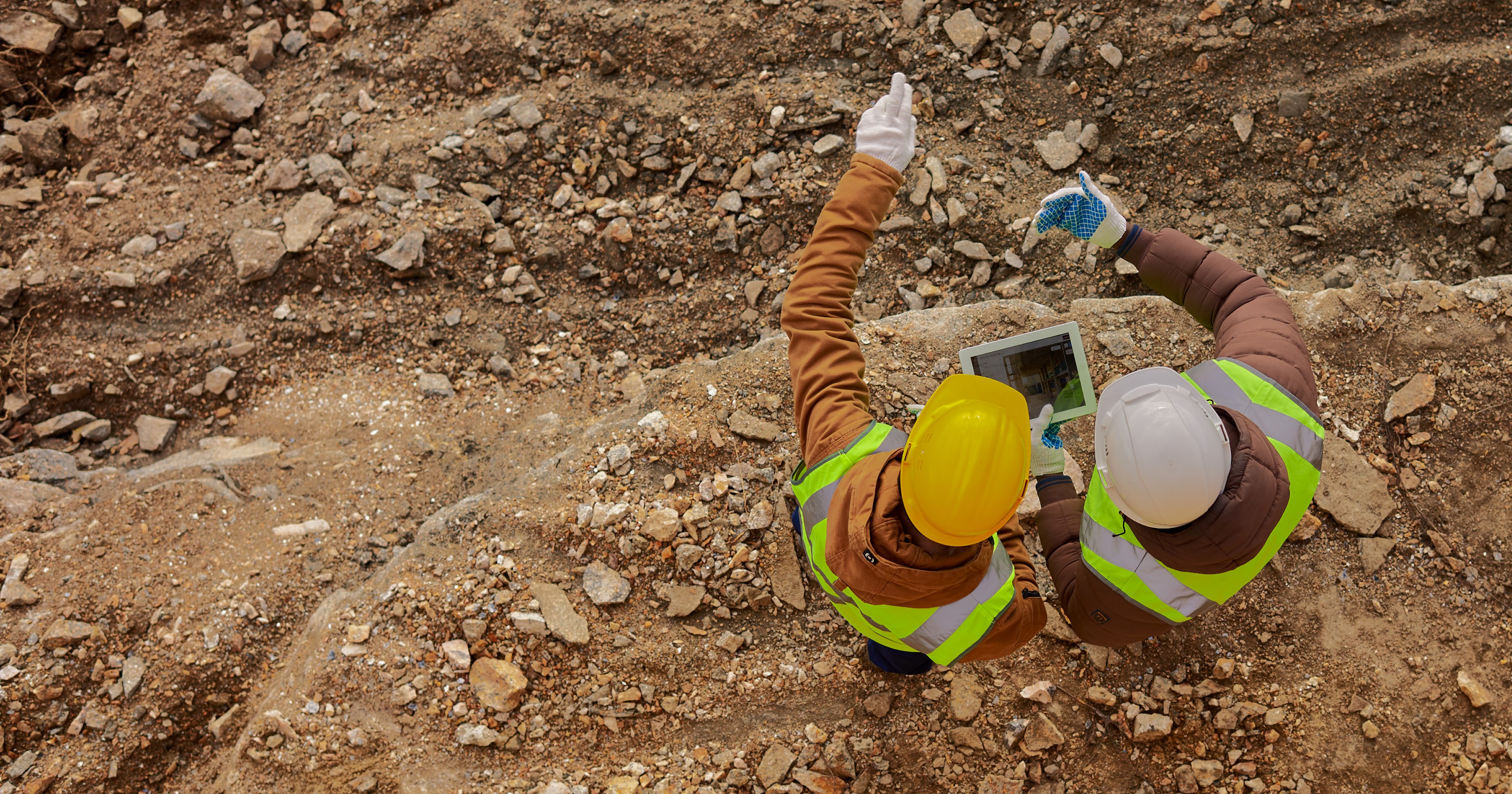
Who Can Benefit from SpatialSense and How?
Dec 30, 2025

Smarter O&M with Temperature Data & Digital Twins
Nov 28, 2025