Solving Real-World Problems with Kodifly's 3D Mapping Technology
Solving Real-World Problems with Kodifly's 3D Mapping Technology

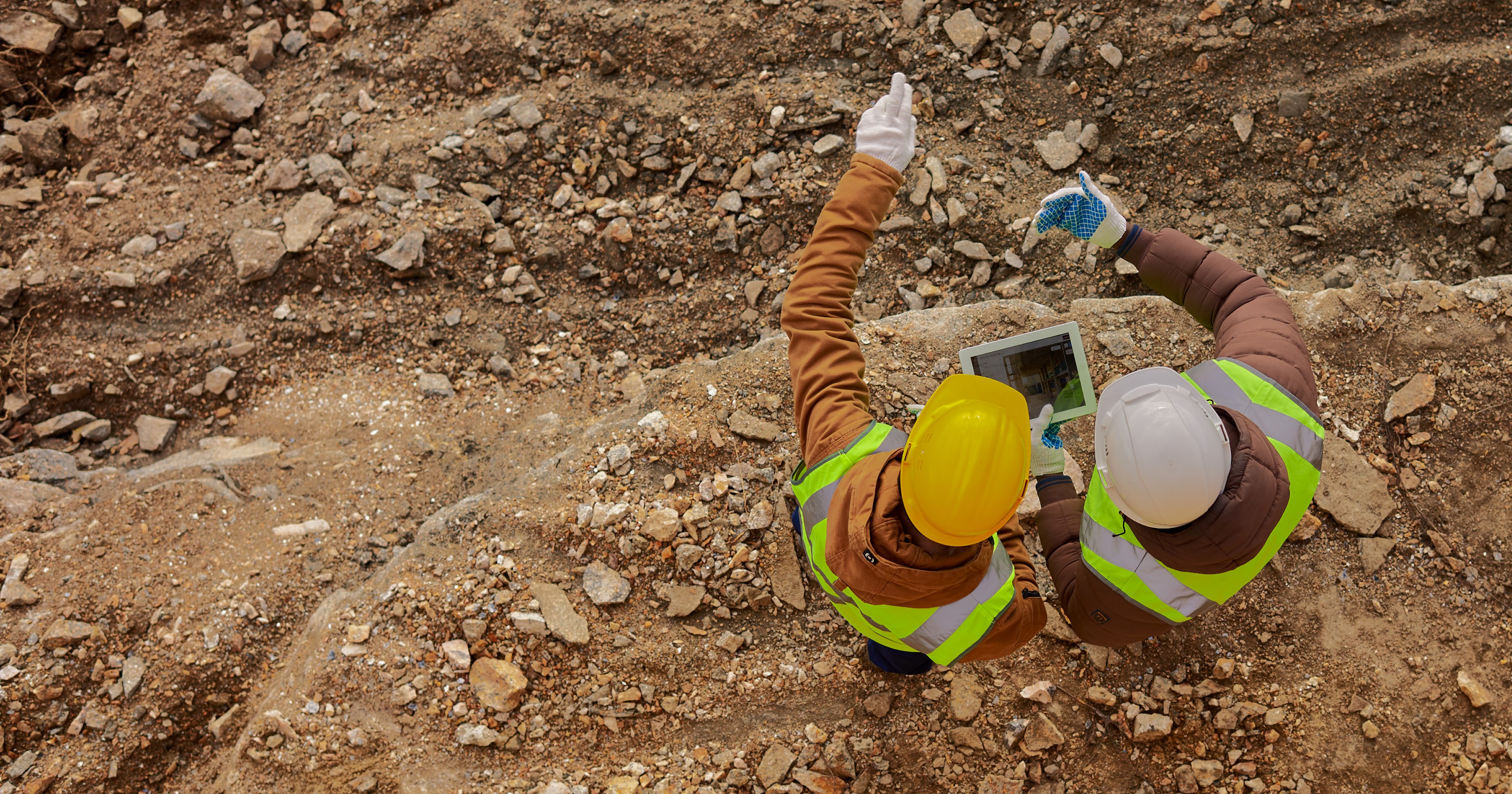
Did you know that 60% of infrastructure failures are attributed to inadequate maintenance and inspection processes? In a world where railways, highways, and airports form the backbone of global connectivity, the stakes for maintaining these critical assets have never been higher. Manual inspections, while traditional, are often time-consuming, costly, and reactive—leaving little room for proactive problem-solving. Add to this the complexities of environmental factors, aging infrastructure, and the need for real-time data, and it’s clear that traditional methods are no longer sufficient.
Kodifly pioneers in advanced 3D mapping, helping industries manage infrastructure more efficiently and effectively. By leveraging cutting-edge tools like LiDAR (Light Detection and Ranging), photogrammetry, and colorised SLAMs, Kodifly is transforming raw spatial data into actionable insights. Whether it’s monitoring railway tracks, optimizing airport runways, or maintaining urban road networks, Kodifly’s solutions are designed to enhance safety, reduce costs, and ensure operational efficiency.
But how exactly is Kodifly solving these real-world problems? In this blog, we’ll explore how Kodifly’s innovative 3D mapping technologies tackle some of the biggest challenges across industries. From automated inspections and predictive maintenance to environmental monitoring and disaster prevention, Kodifly is helping shape a smarter, safer, and more efficient future for infrastructure.
The Power of 3D Mapping: LiDAR, Photogrammetry, and Colorised SLAM
At the heart of Kodifly’s innovative solutions are three powerful components of 3D mapping: LiDAR, a cutting-edge sensor technology; photogrammetry, a sophisticated process for creating 3D models; and colorised SLAM (Simultaneous Localization and Mapping), a real-time mapping technology that adds visual context to spatial data. Together, they form the foundation of Kodifly’s ability to capture, analyze, and transform spatial data into actionable insights. Let’s break down how each works and why their combination is so powerful.
LiDAR: Precision in Every Pulse
LiDAR (Light Detection and Ranging) is a sensor-based technology that uses laser pulses to measure distances and create highly accurate 3D models of physical environments. Here’s why it’s a game-changer:
Unmatched Accuracy: LiDAR can capture data with centimeter-level precision, making it ideal for applications like railway track monitoring, tunnel inspections, and landslide detection.
Versatility: It works in complex or hard-to-reach areas, such as dense vegetation or underground tunnels, where traditional methods struggle.
Real-Time Data: LiDAR sensors can collect and process data in real time, enabling immediate insights and decision-making.
In essence, LiDAR is the physical tool that captures the raw data needed for 3D mapping. It’s the backbone of Kodifly’s high-precision solutions.

Photogrammetry: Adding Depth and Context
Photogrammetry, on the other hand, is a process that uses high-resolution photographs to create detailed 3D models. Here’s how it complements LiDAR:
Rich Visual Context: By stitching together multiple images, photogrammetry adds texture, color, and visual depth to 3D models, making them more intuitive and actionable.
Cost-Effective: For applications where visual context is critical (e.g., urban planning or asset visualization), photogrammetry provides a cost-effective alternative to LiDAR.
Scalability: It can be used for large-scale projects, such as mapping entire cities or monitoring vast infrastructure networks.
While LiDAR provides the precision, photogrammetry adds the visual context, creating a comprehensive digital twin of the physical environment.

Colorised SLAM: Enhancing 3D Models with Visual Context
Colorised SLAM (Simultaneous Localization and Mapping) is a powerful mapping technology that combines LiDAR’s precision with photogrammetry’s visual richness. Here’s why it’s a game-changer:
Real-Time 3D Modeling: SLAM creates 3D maps of an environment while simultaneously tracking the device’s location within that space. When colorised, it adds visual context to the map, making it more intuitive and actionable.
Dynamic Environments: Unlike traditional mapping methods, SLAM works in dynamic environments, such as moving trains or drones, making it ideal for applications like railway inspections or urban mobility.
Enhanced Insights: By combining spatial data with visual context, colorised SLAM provides deeper insights into infrastructure conditions, enabling better decision-making.

Why Kodifly’s Approach is Unique
Kodifly doesn’t just use LiDAR, photogrammetry, and SLAM—it integrates them with AI-powered analytics and cloud-based platforms to deliver end-to-end solutions. Here’s what sets Kodifly apart:
Seamless Integration:
Kodifly combines the precision of LiDAR, the visual richness of photogrammetry, and the real-time capabilities of colorised SLAM, creating 3D models that are both accurate and intuitive.Real-Time Insights:
With on-site data processing and cloud-based analytics, Kodifly delivers actionable insights in real time, enabling immediate decision-making.AI-Powered Intelligence:
Kodifly’s AI-driven tools transform raw data into actionable intelligence, whether it’s predicting vegetation growth, detecting structural deformations, or optimizing traffic flow.Scalability and Flexibility:
Kodifly’s solutions are designed to scale with your needs, from small-scale projects to vast infrastructure networks.
By combining the physical tool (LiDAR), the process (photogrammetry), and the real-time technology (colorised SLAM), Kodifly is redefining how industries interact with and manage their infrastructure.
3. Real-World Problems Solved by Kodifly
Kodifly’s advanced 3D mapping technologies are not just theoretical—they’re solving real-world problems across industries. From railways and airports to highways and urban infrastructure, Kodifly’s solutions are transforming how organizations manage their assets. Here’s a closer look at some of the key challenges Kodifly is addressing:
3.1 Railway Infrastructure Management
Railway networks are among the most complex and critical infrastructures, requiring constant monitoring to ensure safety and efficiency. Traditional methods of inspection are often manual, time-consuming, and prone to errors. Kodifly’s SpatialSense Suite is changing the game by:
Automating Inspections:
Using LiDAR-equipped scanners mounted on trains, Kodifly captures detailed 3D data of tracks, tunnels, overhead lines, and vegetation. This eliminates the need for manual inspections, reducing costs and improving accuracy.Managing Vegetation Risks:
Overgrown trees near tracks pose significant risks, especially during extreme weather. Kodifly’s TreeGuard system uses LiDAR to monitor vegetation growth and predict potential hazards, enabling proactive maintenance.Ensuring Structural Integrity:
With TunnelGuard, Kodifly provides precise 3D models of tunnels, detecting deformations, cracks, and clearance issues to ensure structural safety.
Impact:
Reduced manual inspections by 80%, leading to significant cost savings.
Enhanced safety by detecting vegetation hazards early.
Proactive maintenance through predictive analytics.

3.2 Airport Infrastructure Optimization
Airports are critical hubs that demand seamless operations and safety. Kodifly’s solutions enhance airport management through:
Runway and Taxiway Monitoring:
Using LiDAR and AI, Kodifly’s RunwayGuard detects foreign object debris (FOD), cracks, and wear on runways, ensuring safe operations and reducing downtime.Asset Tracking:
The AssetTrack system creates digital twins of airport assets, from runways to lighting systems, enabling predictive maintenance and efficient resource allocation.Perimeter Security:
Kodifly’s FenceVue combines LiDAR and cameras to monitor airport perimeters, detecting breaches and ensuring robust security.
Impact:
Enhanced safety and operational efficiency.
Reduced downtime and maintenance costs.
Improved resource allocation through data-driven insights.

3.3 Highway and Urban Infrastructure Maintenance
Road networks are the lifelines of cities, and maintaining them is a constant challenge. Kodifly’s RoadSense and MobilityMetrics solutions provide:
Road Surface Analysis:
High-resolution LiDAR and cameras capture road conditions, identifying potholes, cracks, and wear. This data helps municipalities prioritize repairs and extend the lifespan of road infrastructure.Traffic Flow Optimization:
By analyzing real-time traffic data, Kodifly’s systems reduce congestion, improve safety, and enhance urban mobility.Signboard Detection:
The SignTrack system ensures road signs are visible and intact, improving navigation and safety for drivers.
Impact:
Improved road safety and reduced congestion.
Optimized maintenance schedules and resource allocation.
Enhanced urban mobility and driver safety.

3.4 Environmental Monitoring and Disaster Prevention
Kodifly’s technologies also play a crucial role in environmental conservation and disaster management:
Landslide Detection:
The SlopeGuard system uses LiDAR to monitor ground movements, providing early warnings for landslides and ensuring the safety of railway and highway networks.Vegetation Management:
Beyond railways, Kodifly’s solutions help manage vegetation along highways and urban areas, reducing risks and improving aesthetics.
Impact:
Early detection of environmental risks, enhancing safety.
Reduced costs and improved efficiency in vegetation management.

4. Case Study: Railway Vegetation Management in Hong Kong
The Challenge
A leading railway operator in Hong Kong faced a significant challenge: managing over 25,000 trees along its extensive railway network. Overgrown vegetation posed serious risks, especially during typhoons and heavy rains, which could lead to operational disruptions and safety hazards. Traditional manual inspections were not only costly and time-consuming but also reactive, often failing to prevent issues before they escalated. The operator needed a solution that could provide real-time monitoring, predictive insights, and proactive maintenance capabilities.
Kodifly’s Solution
Kodifly stepped in with a state-of-the-art solution that integrated LiDAR sensors and high-resolution cameras on trains for daily vegetation scanning. Here’s how it worked:
Real-Time Data Collection:
LiDAR sensors captured detailed 3D data of vegetation along the railway tracks.
High-resolution cameras provided visual context, enabling precise analysis of overgrowth and potential hazards.
AI-Powered Analytics:
Kodifly’s TreeGuard system analyzed the data in real time, identifying trees encroaching on the railway’s Kinematic Envelope (KE)—the space required for safe train operation.
The system automatically alerted maintenance teams about critical hazards, enabling immediate action.
Predictive Maintenance:
Using historical data, Kodifly’s solution forecasted future vegetation growth patterns.
This allowed the operator to plan maintenance activities proactively, reducing the risk of disruptions.

Impactful Results
The implementation of Kodifly’s solution delivered transformative results for the railway operator:
80% Reduction in Manual Inspections:
By automating data collection and analysis, Kodifly significantly reduced the need for costly and labor-intensive manual inspections.Enhanced Safety:
Real-time alerts and predictive analytics enabled the early detection of potential vegetation hazards, improving overall safety for passengers and staff.Cost Savings:
Proactive maintenance planning reduced emergency repair costs and minimized operational disruptions, leading to substantial savings.Data-Driven Decision-Making:
The operator gained access to actionable insights, allowing for targeted and efficient maintenance scheduling.
Why This Matters
This case study exemplifies how Kodifly’s advanced 3D mapping technologies are solving real-world problems. By combining LiDAR, photogrammetry, and AI-powered analytics, Kodifly not only addressed the immediate challenge of vegetation management but also empowered the railway operator with tools for long-term, data-driven decision-making.

5. Why Choose Kodifly?
In a world where infrastructure demands are growing exponentially, Kodifly stands out as a leader in advanced 3D mapping technologies. But what makes Kodifly the preferred choice for industries like railways, airports, and highways? Here’s why organizations around the globe trust Kodifly to solve their most pressing challenges:
1. End-to-End Solutions
Kodifly doesn’t just provide tools—it delivers comprehensive solutions that cover every stage of infrastructure management:
Data Capture: Using cutting-edge LiDAR and photogrammetry technologies, Kodifly captures highly accurate 3D data of physical environments.
Data Processing: Advanced algorithms process raw data in real time, transforming it into actionable insights.
Analytics and Reporting: Kodifly’s AI-powered analytics provide predictive maintenance insights, risk assessments, and performance monitoring.
This end-to-end approach ensures seamless integration and maximum efficiency for clients.
2. AI-Powered Intelligence
Kodifly’s AI-driven tools transform raw data into actionable intelligence, enabling smarter decision-making. Whether it’s predicting vegetation growth, detecting structural deformations, or optimizing traffic flow, Kodifly’s analytics empower industries to stay ahead of challenges.
3. Proven Expertise
With successful implementations across railways, airports, and highways, Kodifly has a proven track record of delivering measurable results. From reducing manual inspections by 80% to enhancing safety through real-time monitoring, Kodifly’s solutions drive tangible impact.
4. Scalability and Flexibility
Kodifly’s solutions are designed to scale with your needs, whether you’re managing a small urban road network or a vast railway system. Its modular design ensures flexibility, allowing clients to customize solutions based on their specific challenges.
5. Commitment to Innovation
Kodifly is at the forefront of technological innovation, constantly evolving its solutions to meet the demands of modern infrastructure. By integrating the latest advancements in LiDAR, photogrammetry, and AI, Kodifly ensures its clients always have access to state-of-the-art tools.
6. Customer-Centric Approach
Kodifly’s success is built on a customer-first philosophy. The company works closely with clients to understand their unique challenges and tailor solutions that deliver maximum value. From initial consultation to post-implementation support, Kodifly is committed to ensuring client satisfaction at every step.
Kodifly’s advanced 3D mapping technologies are not just about data—they’re about transforming industries. By combining precision, intelligence, and innovation, Kodifly empowers organizations to:
Enhance safety and reduce risks.
Optimize operations and reduce costs.
Plan for the future with confidence.
From automating inspections and predicting maintenance needs to enhancing safety and optimizing operations, Kodifly’s solutions are delivering measurable results. Whether it’s managing vegetation along railway tracks, monitoring airport runways, or analyzing road surfaces, Kodifly’s innovative approach is setting new standards for efficiency, safety, and sustainability.
But Kodifly isn’t just about technology—it’s about empowering industries to make smarter, data-driven decisions. With end-to-end solutions, proven expertise, and a commitment to innovation, Kodifly is helping organizations around the globe build a safer, more efficient, and sustainable future.
Did you know that 60% of infrastructure failures are attributed to inadequate maintenance and inspection processes? In a world where railways, highways, and airports form the backbone of global connectivity, the stakes for maintaining these critical assets have never been higher. Manual inspections, while traditional, are often time-consuming, costly, and reactive—leaving little room for proactive problem-solving. Add to this the complexities of environmental factors, aging infrastructure, and the need for real-time data, and it’s clear that traditional methods are no longer sufficient.
Kodifly pioneers in advanced 3D mapping, helping industries manage infrastructure more efficiently and effectively. By leveraging cutting-edge tools like LiDAR (Light Detection and Ranging), photogrammetry, and colorised SLAMs, Kodifly is transforming raw spatial data into actionable insights. Whether it’s monitoring railway tracks, optimizing airport runways, or maintaining urban road networks, Kodifly’s solutions are designed to enhance safety, reduce costs, and ensure operational efficiency.
But how exactly is Kodifly solving these real-world problems? In this blog, we’ll explore how Kodifly’s innovative 3D mapping technologies tackle some of the biggest challenges across industries. From automated inspections and predictive maintenance to environmental monitoring and disaster prevention, Kodifly is helping shape a smarter, safer, and more efficient future for infrastructure.
The Power of 3D Mapping: LiDAR, Photogrammetry, and Colorised SLAM
At the heart of Kodifly’s innovative solutions are three powerful components of 3D mapping: LiDAR, a cutting-edge sensor technology; photogrammetry, a sophisticated process for creating 3D models; and colorised SLAM (Simultaneous Localization and Mapping), a real-time mapping technology that adds visual context to spatial data. Together, they form the foundation of Kodifly’s ability to capture, analyze, and transform spatial data into actionable insights. Let’s break down how each works and why their combination is so powerful.
LiDAR: Precision in Every Pulse
LiDAR (Light Detection and Ranging) is a sensor-based technology that uses laser pulses to measure distances and create highly accurate 3D models of physical environments. Here’s why it’s a game-changer:
Unmatched Accuracy: LiDAR can capture data with centimeter-level precision, making it ideal for applications like railway track monitoring, tunnel inspections, and landslide detection.
Versatility: It works in complex or hard-to-reach areas, such as dense vegetation or underground tunnels, where traditional methods struggle.
Real-Time Data: LiDAR sensors can collect and process data in real time, enabling immediate insights and decision-making.
In essence, LiDAR is the physical tool that captures the raw data needed for 3D mapping. It’s the backbone of Kodifly’s high-precision solutions.
Photogrammetry: Adding Depth and Context
Photogrammetry, on the other hand, is a process that uses high-resolution photographs to create detailed 3D models. Here’s how it complements LiDAR:
Rich Visual Context: By stitching together multiple images, photogrammetry adds texture, color, and visual depth to 3D models, making them more intuitive and actionable.
Cost-Effective: For applications where visual context is critical (e.g., urban planning or asset visualization), photogrammetry provides a cost-effective alternative to LiDAR.
Scalability: It can be used for large-scale projects, such as mapping entire cities or monitoring vast infrastructure networks.
While LiDAR provides the precision, photogrammetry adds the visual context, creating a comprehensive digital twin of the physical environment.
Colorised SLAM: Enhancing 3D Models with Visual Context
Colorised SLAM (Simultaneous Localization and Mapping) is a powerful mapping technology that combines LiDAR’s precision with photogrammetry’s visual richness. Here’s why it’s a game-changer:
Real-Time 3D Modeling: SLAM creates 3D maps of an environment while simultaneously tracking the device’s location within that space. When colorised, it adds visual context to the map, making it more intuitive and actionable.
Dynamic Environments: Unlike traditional mapping methods, SLAM works in dynamic environments, such as moving trains or drones, making it ideal for applications like railway inspections or urban mobility.
Enhanced Insights: By combining spatial data with visual context, colorised SLAM provides deeper insights into infrastructure conditions, enabling better decision-making.
Why Kodifly’s Approach is Unique
Kodifly doesn’t just use LiDAR, photogrammetry, and SLAM—it integrates them with AI-powered analytics and cloud-based platforms to deliver end-to-end solutions. Here’s what sets Kodifly apart:
Seamless Integration:
Kodifly combines the precision of LiDAR, the visual richness of photogrammetry, and the real-time capabilities of colorised SLAM, creating 3D models that are both accurate and intuitive.Real-Time Insights:
With on-site data processing and cloud-based analytics, Kodifly delivers actionable insights in real time, enabling immediate decision-making.AI-Powered Intelligence:
Kodifly’s AI-driven tools transform raw data into actionable intelligence, whether it’s predicting vegetation growth, detecting structural deformations, or optimizing traffic flow.Scalability and Flexibility:
Kodifly’s solutions are designed to scale with your needs, from small-scale projects to vast infrastructure networks.
By combining the physical tool (LiDAR), the process (photogrammetry), and the real-time technology (colorised SLAM), Kodifly is redefining how industries interact with and manage their infrastructure.
3. Real-World Problems Solved by Kodifly
Kodifly’s advanced 3D mapping technologies are not just theoretical—they’re solving real-world problems across industries. From railways and airports to highways and urban infrastructure, Kodifly’s solutions are transforming how organizations manage their assets. Here’s a closer look at some of the key challenges Kodifly is addressing:
3.1 Railway Infrastructure Management
Railway networks are among the most complex and critical infrastructures, requiring constant monitoring to ensure safety and efficiency. Traditional methods of inspection are often manual, time-consuming, and prone to errors. Kodifly’s SpatialSense Suite is changing the game by:
Automating Inspections:
Using LiDAR-equipped scanners mounted on trains, Kodifly captures detailed 3D data of tracks, tunnels, overhead lines, and vegetation. This eliminates the need for manual inspections, reducing costs and improving accuracy.Managing Vegetation Risks:
Overgrown trees near tracks pose significant risks, especially during extreme weather. Kodifly’s TreeGuard system uses LiDAR to monitor vegetation growth and predict potential hazards, enabling proactive maintenance.Ensuring Structural Integrity:
With TunnelGuard, Kodifly provides precise 3D models of tunnels, detecting deformations, cracks, and clearance issues to ensure structural safety.
Impact:
Reduced manual inspections by 80%, leading to significant cost savings.
Enhanced safety by detecting vegetation hazards early.
Proactive maintenance through predictive analytics.
3.2 Airport Infrastructure Optimization
Airports are critical hubs that demand seamless operations and safety. Kodifly’s solutions enhance airport management through:
Runway and Taxiway Monitoring:
Using LiDAR and AI, Kodifly’s RunwayGuard detects foreign object debris (FOD), cracks, and wear on runways, ensuring safe operations and reducing downtime.Asset Tracking:
The AssetTrack system creates digital twins of airport assets, from runways to lighting systems, enabling predictive maintenance and efficient resource allocation.Perimeter Security:
Kodifly’s FenceVue combines LiDAR and cameras to monitor airport perimeters, detecting breaches and ensuring robust security.
Impact:
Enhanced safety and operational efficiency.
Reduced downtime and maintenance costs.
Improved resource allocation through data-driven insights.
3.3 Highway and Urban Infrastructure Maintenance
Road networks are the lifelines of cities, and maintaining them is a constant challenge. Kodifly’s RoadSense and MobilityMetrics solutions provide:
Road Surface Analysis:
High-resolution LiDAR and cameras capture road conditions, identifying potholes, cracks, and wear. This data helps municipalities prioritize repairs and extend the lifespan of road infrastructure.Traffic Flow Optimization:
By analyzing real-time traffic data, Kodifly’s systems reduce congestion, improve safety, and enhance urban mobility.Signboard Detection:
The SignTrack system ensures road signs are visible and intact, improving navigation and safety for drivers.
Impact:
Improved road safety and reduced congestion.
Optimized maintenance schedules and resource allocation.
Enhanced urban mobility and driver safety.
3.4 Environmental Monitoring and Disaster Prevention
Kodifly’s technologies also play a crucial role in environmental conservation and disaster management:
Landslide Detection:
The SlopeGuard system uses LiDAR to monitor ground movements, providing early warnings for landslides and ensuring the safety of railway and highway networks.Vegetation Management:
Beyond railways, Kodifly’s solutions help manage vegetation along highways and urban areas, reducing risks and improving aesthetics.
Impact:
Early detection of environmental risks, enhancing safety.
Reduced costs and improved efficiency in vegetation management.
4. Case Study: Railway Vegetation Management in Hong Kong
The Challenge
A leading railway operator in Hong Kong faced a significant challenge: managing over 25,000 trees along its extensive railway network. Overgrown vegetation posed serious risks, especially during typhoons and heavy rains, which could lead to operational disruptions and safety hazards. Traditional manual inspections were not only costly and time-consuming but also reactive, often failing to prevent issues before they escalated. The operator needed a solution that could provide real-time monitoring, predictive insights, and proactive maintenance capabilities.
Kodifly’s Solution
Kodifly stepped in with a state-of-the-art solution that integrated LiDAR sensors and high-resolution cameras on trains for daily vegetation scanning. Here’s how it worked:
Real-Time Data Collection:
LiDAR sensors captured detailed 3D data of vegetation along the railway tracks.
High-resolution cameras provided visual context, enabling precise analysis of overgrowth and potential hazards.
AI-Powered Analytics:
Kodifly’s TreeGuard system analyzed the data in real time, identifying trees encroaching on the railway’s Kinematic Envelope (KE)—the space required for safe train operation.
The system automatically alerted maintenance teams about critical hazards, enabling immediate action.
Predictive Maintenance:
Using historical data, Kodifly’s solution forecasted future vegetation growth patterns.
This allowed the operator to plan maintenance activities proactively, reducing the risk of disruptions.
Impactful Results
The implementation of Kodifly’s solution delivered transformative results for the railway operator:
80% Reduction in Manual Inspections:
By automating data collection and analysis, Kodifly significantly reduced the need for costly and labor-intensive manual inspections.Enhanced Safety:
Real-time alerts and predictive analytics enabled the early detection of potential vegetation hazards, improving overall safety for passengers and staff.Cost Savings:
Proactive maintenance planning reduced emergency repair costs and minimized operational disruptions, leading to substantial savings.Data-Driven Decision-Making:
The operator gained access to actionable insights, allowing for targeted and efficient maintenance scheduling.
Why This Matters
This case study exemplifies how Kodifly’s advanced 3D mapping technologies are solving real-world problems. By combining LiDAR, photogrammetry, and AI-powered analytics, Kodifly not only addressed the immediate challenge of vegetation management but also empowered the railway operator with tools for long-term, data-driven decision-making.
5. Why Choose Kodifly?
In a world where infrastructure demands are growing exponentially, Kodifly stands out as a leader in advanced 3D mapping technologies. But what makes Kodifly the preferred choice for industries like railways, airports, and highways? Here’s why organizations around the globe trust Kodifly to solve their most pressing challenges:
1. End-to-End Solutions
Kodifly doesn’t just provide tools—it delivers comprehensive solutions that cover every stage of infrastructure management:
Data Capture: Using cutting-edge LiDAR and photogrammetry technologies, Kodifly captures highly accurate 3D data of physical environments.
Data Processing: Advanced algorithms process raw data in real time, transforming it into actionable insights.
Analytics and Reporting: Kodifly’s AI-powered analytics provide predictive maintenance insights, risk assessments, and performance monitoring.
This end-to-end approach ensures seamless integration and maximum efficiency for clients.
2. AI-Powered Intelligence
Kodifly’s AI-driven tools transform raw data into actionable intelligence, enabling smarter decision-making. Whether it’s predicting vegetation growth, detecting structural deformations, or optimizing traffic flow, Kodifly’s analytics empower industries to stay ahead of challenges.
3. Proven Expertise
With successful implementations across railways, airports, and highways, Kodifly has a proven track record of delivering measurable results. From reducing manual inspections by 80% to enhancing safety through real-time monitoring, Kodifly’s solutions drive tangible impact.
4. Scalability and Flexibility
Kodifly’s solutions are designed to scale with your needs, whether you’re managing a small urban road network or a vast railway system. Its modular design ensures flexibility, allowing clients to customize solutions based on their specific challenges.
5. Commitment to Innovation
Kodifly is at the forefront of technological innovation, constantly evolving its solutions to meet the demands of modern infrastructure. By integrating the latest advancements in LiDAR, photogrammetry, and AI, Kodifly ensures its clients always have access to state-of-the-art tools.
6. Customer-Centric Approach
Kodifly’s success is built on a customer-first philosophy. The company works closely with clients to understand their unique challenges and tailor solutions that deliver maximum value. From initial consultation to post-implementation support, Kodifly is committed to ensuring client satisfaction at every step.
Kodifly’s advanced 3D mapping technologies are not just about data—they’re about transforming industries. By combining precision, intelligence, and innovation, Kodifly empowers organizations to:
Enhance safety and reduce risks.
Optimize operations and reduce costs.
Plan for the future with confidence.
From automating inspections and predicting maintenance needs to enhancing safety and optimizing operations, Kodifly’s solutions are delivering measurable results. Whether it’s managing vegetation along railway tracks, monitoring airport runways, or analyzing road surfaces, Kodifly’s innovative approach is setting new standards for efficiency, safety, and sustainability.
But Kodifly isn’t just about technology—it’s about empowering industries to make smarter, data-driven decisions. With end-to-end solutions, proven expertise, and a commitment to innovation, Kodifly is helping organizations around the globe build a safer, more efficient, and sustainable future.
Table of Content
Mar 20, 2025
Interested to find out how Kodifly transforms the infrastructure space?

Revolutionizing Site Supervision Powered by SpatialSense’s Site Diary Feature
Mar 2, 2026

10 Construction Site Operations Powered by SpatialSense
Jan 29, 2026
Who Can Benefit from SpatialSense and How?
Dec 30, 2025

Smarter O&M with Temperature Data & Digital Twins
Nov 28, 2025