Smart City Innovation Starts with Accurate 3D Mapping
Smart City Innovation Starts with Accurate 3D Mapping

For our cities to work better, they need to see better. This simple idea is the key to the "smart city" revolution. It’s not just about adding more sensors or cameras; it’s about giving our urban environments a deep, three-dimensional understanding of themselves. By leveraging data and technology to see and comprehend their own complex structures, cities can enhance the quality of life for citizens, streamline operations, and foster sustainable growth.
Beyond the Flat Map: Visualizing the City in 3D
Traditional 2D maps, while useful for basic navigation, fall short of providing the nuanced, multi-layered understanding required for a truly smart city. The urban environment is a complex, three-dimensional ecosystem. To manage it effectively, we need to see it in its entirety – from the sprawling subway networks beneath our feet to the towering skyscrapers that shape our skylines.
This is where the power of advanced 3D mapping, particularly the fusion of Light Detection and Ranging (LiDAR) and high-resolution cameras, comes into play. This cutting-edge approach provides a granular, data-rich digital replica of a city, capturing not just the "what" but the "where" and "how" of urban infrastructure. This detailed spatial data is the bedrock upon which innovative smart city applications are built.
Fueling the Future of Mobility and Road Infrastructure
The promise of autonomous vehicles (AVs) is a cornerstone of the smart city vision. For self-driving cars to navigate safely and efficiently, they require a level of environmental perception that surpasses human capabilities. High-definition 3D maps provide AVs with a detailed "memory" of the road, including lane markings, curb heights, and traffic signal locations.
However, the intelligence required goes beyond just navigation. The very ground beneath the vehicles must be maintained for optimal safety and efficiency. This is where continuous infrastructure monitoring becomes critical. At Kodifly, our Road Scanning solution utilizes mobile LiDAR and cameras to conduct high-speed, detailed road inspections. By identifying and mapping defects like potholes, cracks, and surface wear, we empower municipalities to shift from reactive repairs to proactive maintenance. This not only ensures safer journeys for all vehicles but also extends the lifespan of critical road assets, a core goal of any smart city.

Building Smarter from the Ground Up with Intelligent Construction Management
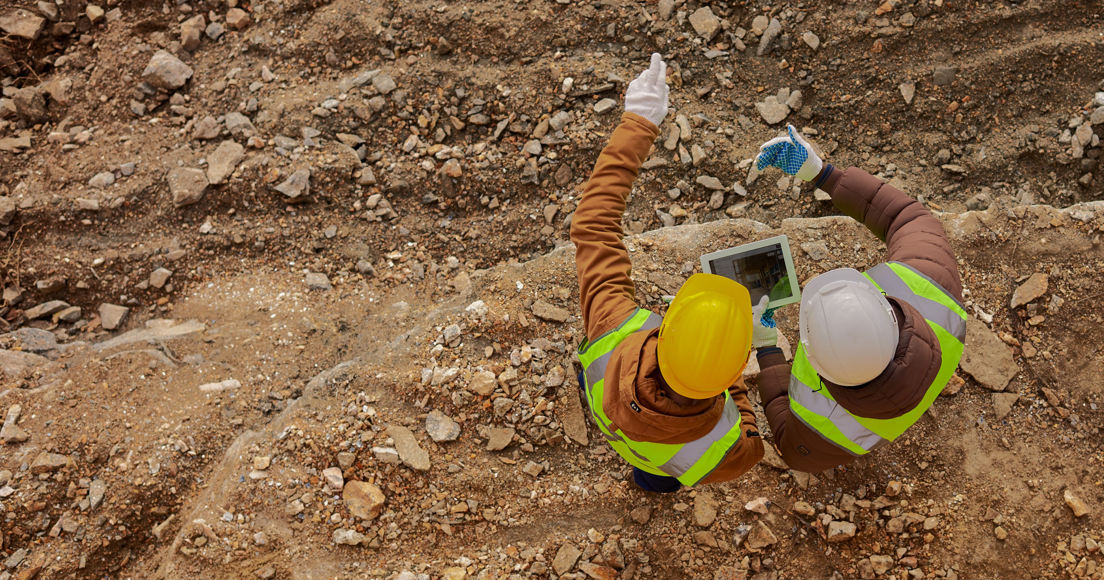
A truly smart city is not only intelligently managed but also intelligently built. The construction phase of urban development is a massive opportunity to embed efficiency, safety, and quality from the very beginning. Traditional construction management, often reliant on manual checks and 2D blueprints, is prone to delays, budget overruns, and errors.
Smart construction management, powered by 3D mapping, offers a transformative alternative. By creating a continuous, high-fidelity 4D digital twin of an active construction site, project stakeholders can achieve unprecedented oversight.
Kodifly's SpatialSense solution is purpose-built for this challenge. By deploying fixed LiDAR systems on-site, we provide 24/7 automated reality capture. This allows construction teams to:
Track Progress in Real-Time: Continuously compare the as-built reality with Building Information Modeling (BIM) designs to instantly spot deviations.
Enhance Safety: Monitor site activities and identify potential hazards without putting personnel at risk.
Automate Audits: Streamline documentation and quality control, ensuring every phase of the project meets exacting standards.
This level of insight ensures that the skyscrapers, bridges, and tunnels that form the backbone of a smart city are built on a foundation of data-driven precision.
Enhancing Public Safety and Emergency Response
The safety and security of citizens are paramount in any urban environment. Accurate 3D mapping offers a powerful toolkit for enhancing public safety and streamlining emergency response. Imagine a scenario where a fire breaks out in a dense urban area. With a detailed 3D model of the city, emergency services can:
Visualize the incident scene in 3D: Gaining a comprehensive understanding of the building's layout, access points, and surrounding environment before arriving on-site.
Optimize evacuation routes: Identifying the safest and most efficient paths for civilians to exit a hazardous area.
Deploy resources effectively: Strategically positioning personnel and equipment based on a clear understanding of the terrain and potential obstacles.

The Road Ahead: Building Smarter Cities, Together
The smart city revolution is not a distant dream; it is happening now. The cities that will thrive in the coming decades will be those that embrace the power of data and technology to create more efficient, sustainable, and livable urban spaces. Accurate, real-time 3D mapping is the non-negotiable foundation for this transformation, impacting everything from the construction of new infrastructure to the maintenance of existing assets and the safety of future mobility.
At Kodifly, we are committed to providing the cutting-edge technology and expertise necessary to build the smart cities of tomorrow. By empowering decision-makers with unparalleled spatial intelligence, we are helping to pave the way for a future where our cities are not just smart, but truly intelligent.
To learn more about how Kodifly's 3D mapping solutions can accelerate your smart city initiatives, contact us today for a consultation.
For our cities to work better, they need to see better. This simple idea is the key to the "smart city" revolution. It’s not just about adding more sensors or cameras; it’s about giving our urban environments a deep, three-dimensional understanding of themselves. By leveraging data and technology to see and comprehend their own complex structures, cities can enhance the quality of life for citizens, streamline operations, and foster sustainable growth.
Beyond the Flat Map: Visualizing the City in 3D
Traditional 2D maps, while useful for basic navigation, fall short of providing the nuanced, multi-layered understanding required for a truly smart city. The urban environment is a complex, three-dimensional ecosystem. To manage it effectively, we need to see it in its entirety – from the sprawling subway networks beneath our feet to the towering skyscrapers that shape our skylines.
This is where the power of advanced 3D mapping, particularly the fusion of Light Detection and Ranging (LiDAR) and high-resolution cameras, comes into play. This cutting-edge approach provides a granular, data-rich digital replica of a city, capturing not just the "what" but the "where" and "how" of urban infrastructure. This detailed spatial data is the bedrock upon which innovative smart city applications are built.
Fueling the Future of Mobility and Road Infrastructure
The promise of autonomous vehicles (AVs) is a cornerstone of the smart city vision. For self-driving cars to navigate safely and efficiently, they require a level of environmental perception that surpasses human capabilities. High-definition 3D maps provide AVs with a detailed "memory" of the road, including lane markings, curb heights, and traffic signal locations.
However, the intelligence required goes beyond just navigation. The very ground beneath the vehicles must be maintained for optimal safety and efficiency. This is where continuous infrastructure monitoring becomes critical. At Kodifly, our Road Scanning solution utilizes mobile LiDAR and cameras to conduct high-speed, detailed road inspections. By identifying and mapping defects like potholes, cracks, and surface wear, we empower municipalities to shift from reactive repairs to proactive maintenance. This not only ensures safer journeys for all vehicles but also extends the lifespan of critical road assets, a core goal of any smart city.
Building Smarter from the Ground Up with Intelligent Construction Management
A truly smart city is not only intelligently managed but also intelligently built. The construction phase of urban development is a massive opportunity to embed efficiency, safety, and quality from the very beginning. Traditional construction management, often reliant on manual checks and 2D blueprints, is prone to delays, budget overruns, and errors.
Smart construction management, powered by 3D mapping, offers a transformative alternative. By creating a continuous, high-fidelity 4D digital twin of an active construction site, project stakeholders can achieve unprecedented oversight.
Kodifly's SpatialSense solution is purpose-built for this challenge. By deploying fixed LiDAR systems on-site, we provide 24/7 automated reality capture. This allows construction teams to:
Track Progress in Real-Time: Continuously compare the as-built reality with Building Information Modeling (BIM) designs to instantly spot deviations.
Enhance Safety: Monitor site activities and identify potential hazards without putting personnel at risk.
Automate Audits: Streamline documentation and quality control, ensuring every phase of the project meets exacting standards.
This level of insight ensures that the skyscrapers, bridges, and tunnels that form the backbone of a smart city are built on a foundation of data-driven precision.
Enhancing Public Safety and Emergency Response
The safety and security of citizens are paramount in any urban environment. Accurate 3D mapping offers a powerful toolkit for enhancing public safety and streamlining emergency response. Imagine a scenario where a fire breaks out in a dense urban area. With a detailed 3D model of the city, emergency services can:
Visualize the incident scene in 3D: Gaining a comprehensive understanding of the building's layout, access points, and surrounding environment before arriving on-site.
Optimize evacuation routes: Identifying the safest and most efficient paths for civilians to exit a hazardous area.
Deploy resources effectively: Strategically positioning personnel and equipment based on a clear understanding of the terrain and potential obstacles.
The Road Ahead: Building Smarter Cities, Together
The smart city revolution is not a distant dream; it is happening now. The cities that will thrive in the coming decades will be those that embrace the power of data and technology to create more efficient, sustainable, and livable urban spaces. Accurate, real-time 3D mapping is the non-negotiable foundation for this transformation, impacting everything from the construction of new infrastructure to the maintenance of existing assets and the safety of future mobility.
At Kodifly, we are committed to providing the cutting-edge technology and expertise necessary to build the smart cities of tomorrow. By empowering decision-makers with unparalleled spatial intelligence, we are helping to pave the way for a future where our cities are not just smart, but truly intelligent.
To learn more about how Kodifly's 3D mapping solutions can accelerate your smart city initiatives, contact us today for a consultation.
Table of Content
Jul 4, 2025
Interested to find out how Kodifly transforms the infrastructure space?

Revolutionizing Site Supervision Powered by SpatialSense’s Site Diary Feature
Mar 2, 2026

10 Construction Site Operations Powered by SpatialSense
Jan 29, 2026
Who Can Benefit from SpatialSense and How?
Dec 30, 2025

Smarter O&M with Temperature Data & Digital Twins
Nov 28, 2025