TRACKVISION
Advanced Clearance Solution for Safer and Reliable Rail Operations
TRACKVISION
Advanced Clearance Solution for Safer and Reliable Rail Operations
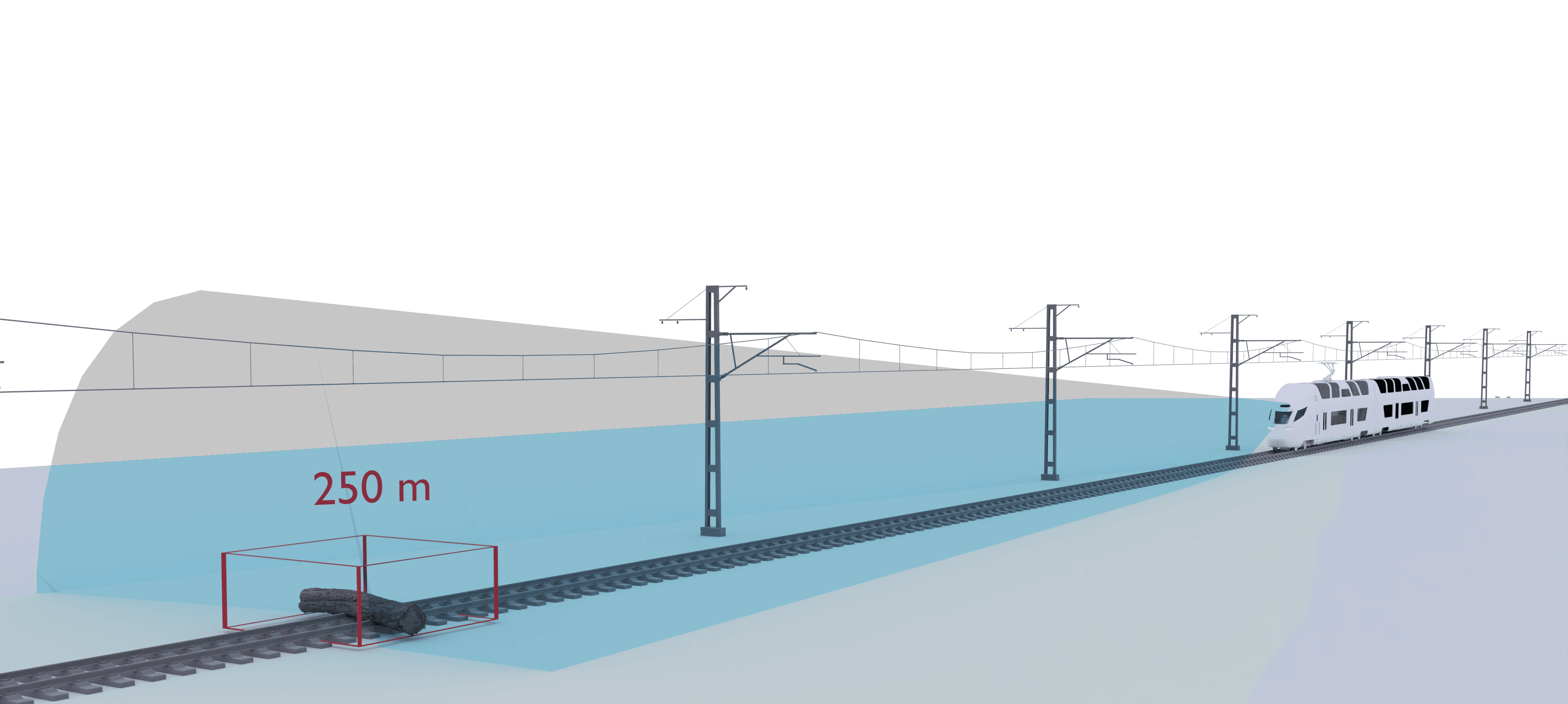
TrackVision is a system designed for detection and identification of objects on the railway tracks during traffic hour operations.
The system can be installed on locomotives, light rail, heavy rail vehicles operating in the depots/light rail network/heavy rail line.
The system helps maintenance teams to reduce inspection hours, increase safety and longevity of the railway assets.
At a Glance
Clearance Intrusion Detection
Foreign Object on Track
Remaining Distance Alert
Clearance Intrusion Detection
Foreign Object on Track
Remaining Distance Alert
At a Glance
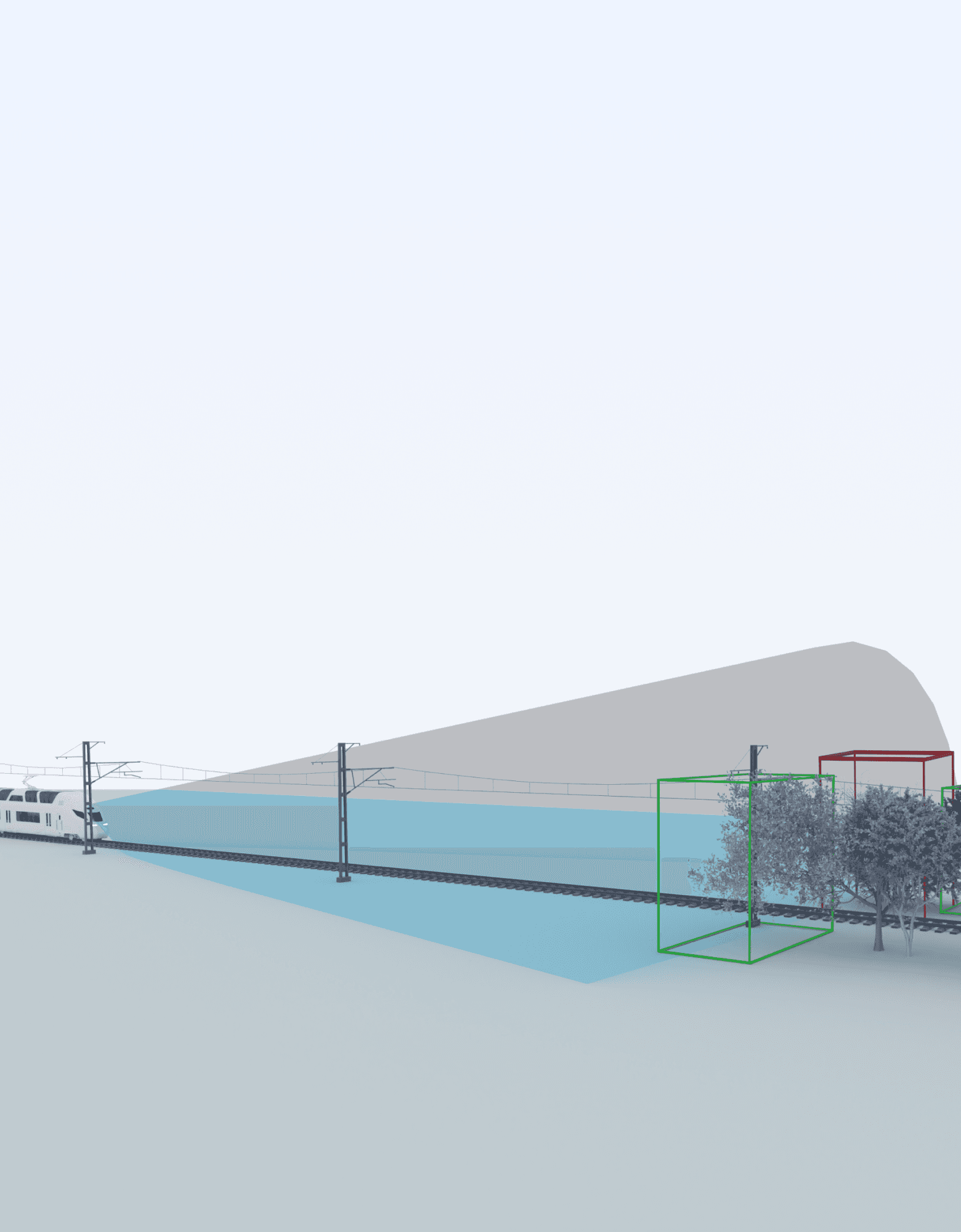
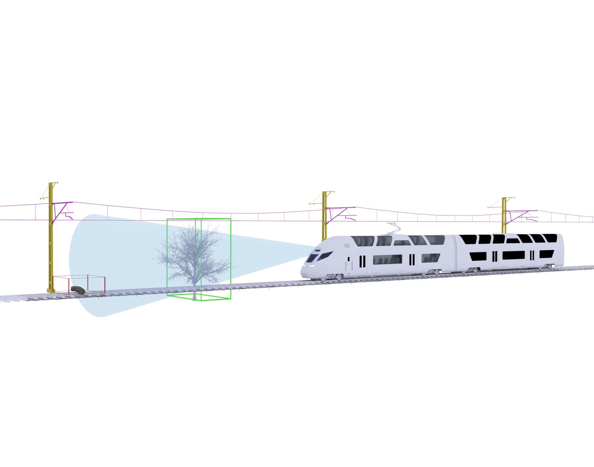
Tree Intrusion into Train's KE
Risk Level Analysis
Tree Growth Monitoring
Problem
Replacing Manual and Inefficient Inspections with Automated, Up-to-date Spatial and Video Information
Track clearance management is essential for railway safety but faces significant challenges. Traditional assessment methods, relying on 2D static drawings, are labor-intensive and prone to misinterpretation.
As rolling stock sizes increase and speeds rise, the risk of clearance infringements escalates, potentially leading to accidents and delays. Accurately predicting the dynamic kinematic envelope under various operational conditions complicates this further.
Without advanced modeling techniques, identifying clearance conflicts becomes time-consuming, impeding timely decision-making and project timelines.
How to Get Started With TrackVision?
Three Steps to Enhance your Railway Clearance Management
Step 01
Install the Scanner
Install the Scanner
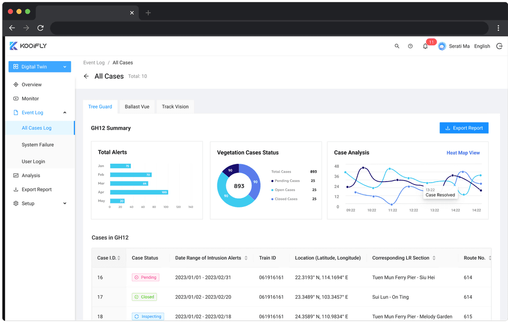
Quickly mount the Spatial Sense Scanner on a railway vehicle to map and monitor corridors with precision. The kit includes all tools, hardware, and a user guide for easy setup and high-accuracy data collection.
Quickly mount the Spatial Sense Scanner on a railway vehicle to map and monitor corridors with precision. The kit includes all tools, hardware, and a user guide for easy setup and high-accuracy data collection.

Step 02
Scan Real-Time
3D Models
Scan Real-Time
3D Models
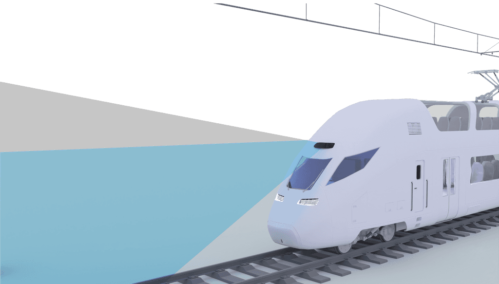
Once mounted, the Spatial Sense Scanner captures real-time 3D point cloud data, delivering precise and comprehensive mapping of railway corridors for monitoring and analysis.
Once mounted, the Spatial Sense Scanner captures real-time 3D point cloud data, delivering precise and comprehensive mapping of railway corridors for monitoring and analysis.
Learn More
Step 03
Actionable Alert Generation
Actionable Alert Generation
After scanning, the Spatial Sense Scanner analyzes data to detect objects intruding the clearance of rolling stock. Alerts are generated automatically for each instance, enabling proactive maintenance and ensuring safe operations.
After scanning, the Spatial Sense Scanner analyzes data to detect objects intruding the clearance of rolling stock. Alerts are generated automatically for each instance, enabling proactive maintenance and ensuring safe operations.
Want More Details? Download Our Leaflet.
Looking for more information? Get our detailed guide.
TreeGuard Solution
Advanced Monitoring for Safer Rail Operations
Advanced Monitoring for Safer Rail Operations
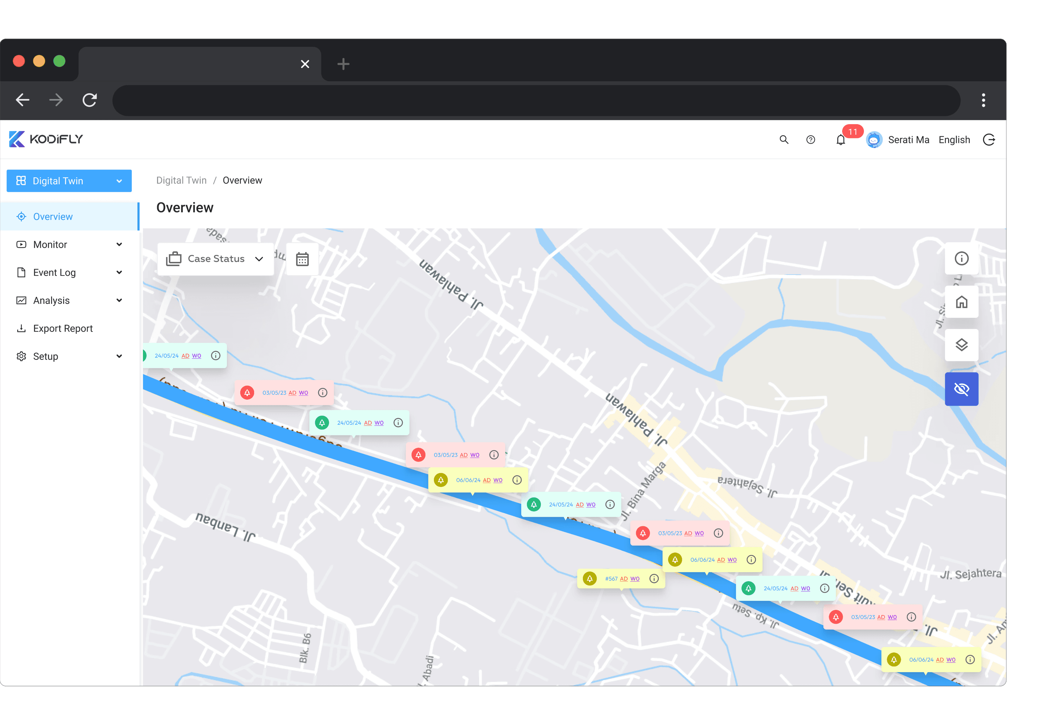
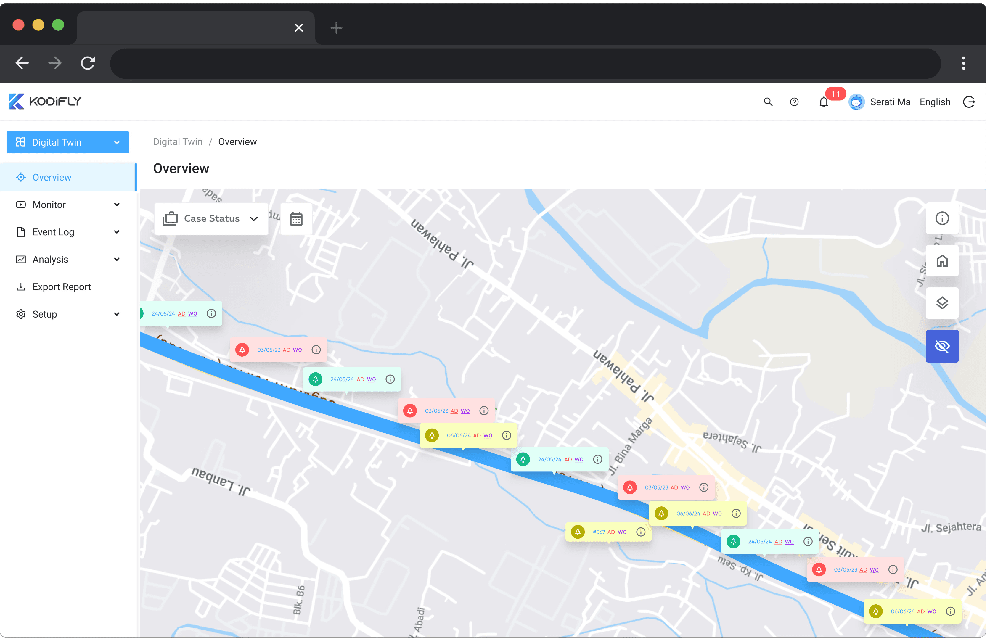
Get instantly notified about clearance intrusions
Get instantly notified about clearance intrusions
Have remote site visits with railway section data updated daily
Have remote site visits with railway section data updated daily
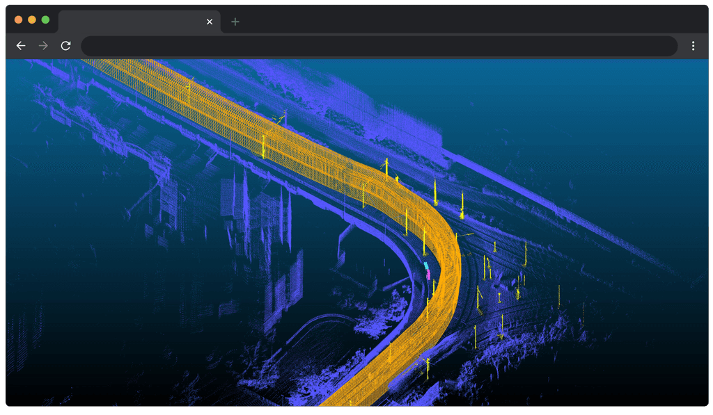


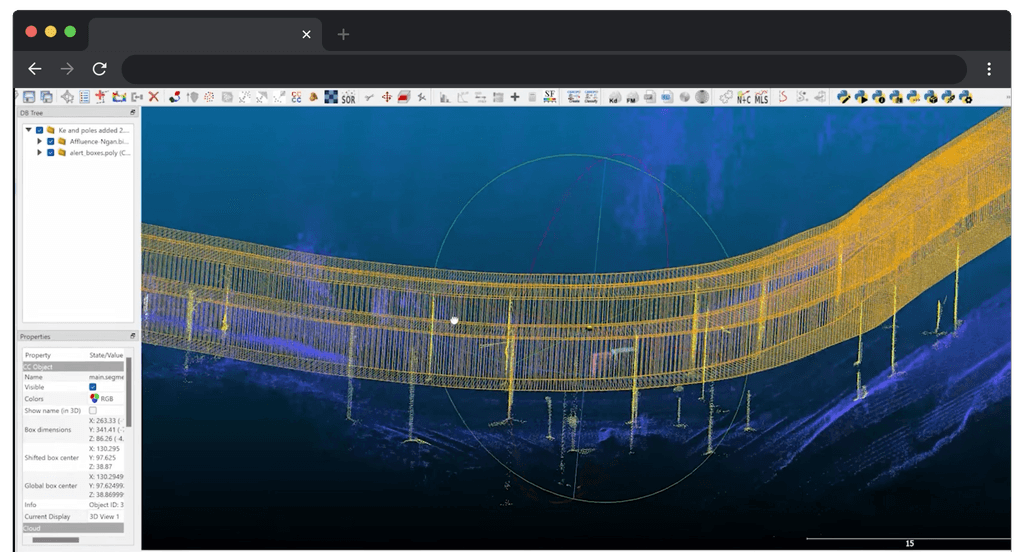


Get comprehensive measurements of trackside assets
Get comprehensive measurements of trackside assets
Create and export work orders and maintenance reports for on-ground staff
Create and export work orders and maintenance reports for on-ground staff


Want More Details? Download Our Leaflet.
Impact
Why Choose TrackVision?
Faster
50%
Inspection process
Reduced
70%
Operational risks
Higher
95%
Accuracy in results
Comparison
TrackVision vs. Traditional Clearance Inspection
Seamless Data Automation
Seamless Data Automation
Seamless Data Automation
Dynamic Spatial Mapping
Dynamic Spatial Mapping
Dynamic Spatial Mapping
Precision Object Recognition
Precision Object Recognition
Precision Object Recognition
Predictive Maintenance Insights
Predictive Maintenance Insights
Predictive Maintenance Insights
Simplified Data Sharing
Simplified Data Sharing
Simplified Data Sharing
Enhanced Safety Measures
Enhanced Safety Measures
Enhanced Safety Measures
Kodifly's TrackVision System
Kodifly's TrackVision System
Kodifly's TrackVision System
Traditional Clearance Inspection
Traditional Clearance Inspection
Traditional Clearance Inspection
Our Solutions
Explore Our Cutting-Edge Solutions
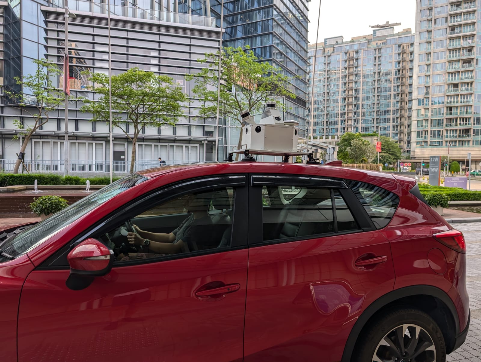
Mobile Mapping System
With SS360 MMS, you can capture high-resolution data without disrupting traffic. Our system uses LiDAR and IoT for precise mapping of highways and railways, providing critical insights for infrastructure management.

Tree Guard :
Vegetation Management SystemTreeGuard automatically scans for vegetation encroachment into the rail corridor. It provides detailed 3D models of the rail corridor for accurate analysis.
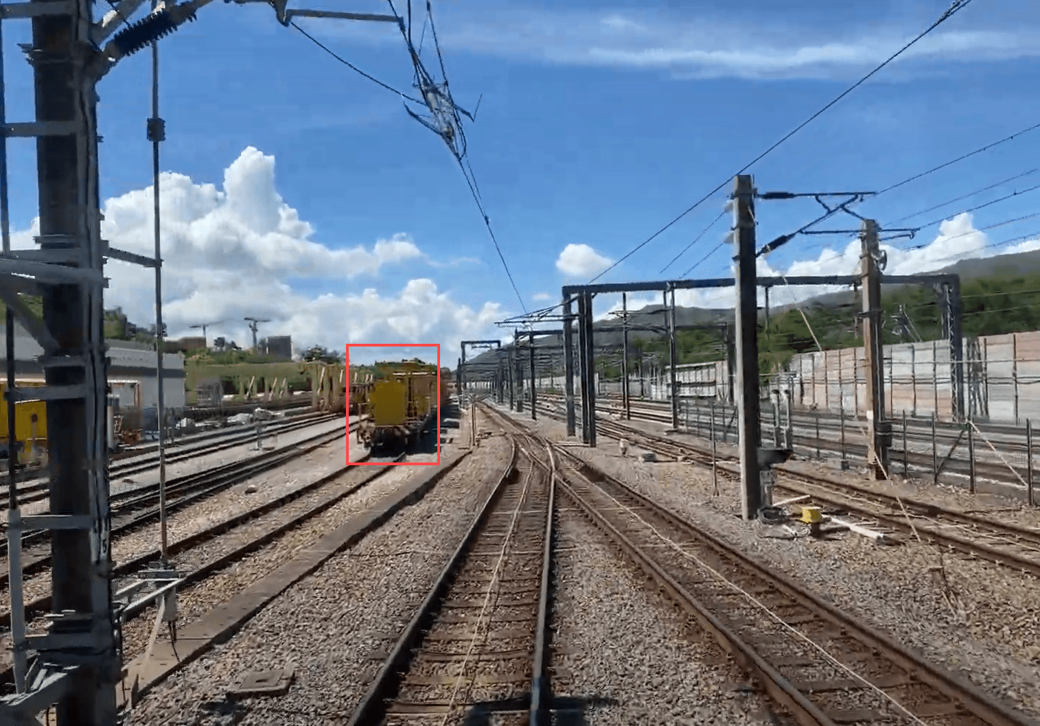
Track Vision :
Train Perception SystemThe system’s advanced automatic obstacle detection continuously scans the tracks for potential hazards, alerting drivers in real time. This proactive feature minimizes collision risks, enhancing safety and ensuring smoother operations.
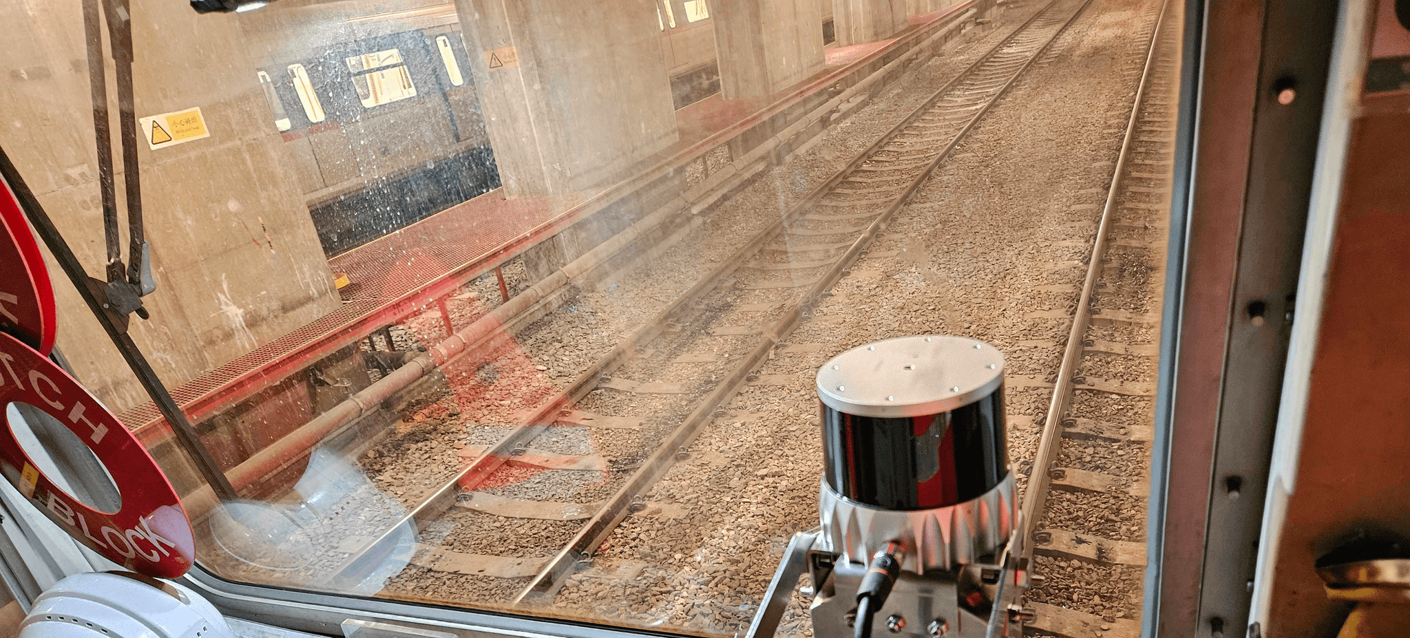
Ballast Vue :
Ballast Profile MonitoringBallastVue combines advanced LiDAR and camera fusion to generate real-time 3D models of track ballast. This technology ensures optimal distribution and stability, enhancing overall track performance.

Mobile Mapping System
With SS360 MMS, you can capture high-resolution data without disrupting traffic. Our system uses LiDAR and IoT for precise mapping of highways and railways, providing critical insights for infrastructure management.

Tree Guard :
Vegetation Management SystemTreeGuard automatically scans for vegetation encroachment into the rail corridor. It provides detailed 3D models of the rail corridor for accurate analysis.

Track Vision :
Train Perception SystemThe system’s advanced automatic obstacle detection continuously scans the tracks for potential hazards, alerting drivers in real time. This proactive feature minimizes collision risks, enhancing safety and ensuring smoother operations.

Ballast Vue :
Ballast Profile MonitoringBallastVue combines advanced LiDAR and camera fusion to generate real-time 3D models of track ballast. This technology ensures optimal distribution and stability, enhancing overall track performance.

Mobile Mapping System
With SS360 MMS, you can capture high-resolution data without disrupting traffic. Our system uses LiDAR and IoT for precise mapping of highways and railways, providing critical insights for infrastructure management.

Tree Guard :
Vegetation Management SystemTreeGuard automatically scans for vegetation encroachment into the rail corridor. It provides detailed 3D models of the rail corridor for accurate analysis.

Track Vision :
Train Perception SystemThe system’s advanced automatic obstacle detection continuously scans the tracks for potential hazards, alerting drivers in real time. This proactive feature minimizes collision risks, enhancing safety and ensuring smoother operations.

Ballast Vue :
Ballast Profile MonitoringBallastVue combines advanced LiDAR and camera fusion to generate real-time 3D models of track ballast. This technology ensures optimal distribution and stability, enhancing overall track performance.

Mobile Mapping System
With SS360 MMS, you can capture high-resolution data without disrupting traffic. Our system uses LiDAR and IoT for precise mapping of highways and railways, providing critical insights for infrastructure management.

Tree Guard :
Vegetation Management SystemTreeGuard automatically scans for vegetation encroachment into the rail corridor. It provides detailed 3D models of the rail corridor for accurate analysis.

Track Vision :
Train Perception SystemThe system’s advanced automatic obstacle detection continuously scans the tracks for potential hazards, alerting drivers in real time. This proactive feature minimizes collision risks, enhancing safety and ensuring smoother operations.

Ballast Vue :
Ballast Profile MonitoringBallastVue combines advanced LiDAR and camera fusion to generate real-time 3D models of track ballast. This technology ensures optimal distribution and stability, enhancing overall track performance.

Ballast Vue : Ballast Profile Monitoring
BallastVue combines advanced LiDAR and camera fusion to generate real-time 3D models of track ballast. This technology ensures optimal distribution and stability, enhancing overall track performance.

Track Vision : Train Perception System
The system’s advanced automatic obstacle detection continuously scans the tracks for potential hazards, alerting drivers in real time. This proactive feature minimizes collision risks, enhancing safety and ensuring smoother operations.

Tree Guard : Vegetation Management System
TreeGuard automatically scans for vegetation encroachment into the rail corridor. It provides detailed 3D models of the rail corridor for accurate analysis.

Mobile Mapping System
With SS360 MMS, you can capture high-resolution data without disrupting traffic. Our system uses LiDAR and IoT for precise mapping of highways and railways, providing critical insights for infrastructure management.

Ballast Vue : Ballast Profile Monitoring
BallastVue combines advanced LiDAR and camera fusion to generate real-time 3D models of track ballast. This technology ensures optimal distribution and stability, enhancing overall track performance.

Track Vision : Train Perception System
The system’s advanced automatic obstacle detection continuously scans the tracks for potential hazards, alerting drivers in real time. This proactive feature minimizes collision risks, enhancing safety and ensuring smoother operations.

Tree Guard : Vegetation Management System
TreeGuard automatically scans for vegetation encroachment into the rail corridor. It provides detailed 3D models of the rail corridor for accurate analysis.

Mobile Mapping System
With SS360 MMS, you can capture high-resolution data without disrupting traffic. Our system uses LiDAR and IoT for precise mapping of highways and railways, providing critical insights for infrastructure management.

Ballast Vue : Ballast Profile Monitoring
BallastVue combines advanced LiDAR and camera fusion to generate real-time 3D models of track ballast. This technology ensures optimal distribution and stability, enhancing overall track performance.

Track Vision : Train Perception System
The system’s advanced automatic obstacle detection continuously scans the tracks for potential hazards, alerting drivers in real time. This proactive feature minimizes collision risks, enhancing safety and ensuring smoother operations.

Tree Guard : Vegetation Management System
TreeGuard automatically scans for vegetation encroachment into the rail corridor. It provides detailed 3D models of the rail corridor for accurate analysis.

Mobile Mapping System
With SS360 MMS, you can capture high-resolution data without disrupting traffic. Our system uses LiDAR and IoT for precise mapping of highways and railways, providing critical insights for infrastructure management.

Ballast Vue : Ballast Profile Monitoring
BallastVue combines advanced LiDAR and camera fusion to generate real-time 3D models of track ballast. This technology ensures optimal distribution and stability, enhancing overall track performance.

Track Vision : Train Perception System
The system’s advanced automatic obstacle detection continuously scans the tracks for potential hazards, alerting drivers in real time. This proactive feature minimizes collision risks, enhancing safety and ensuring smoother operations.

Tree Guard : Vegetation Management System
TreeGuard automatically scans for vegetation encroachment into the rail corridor. It provides detailed 3D models of the rail corridor for accurate analysis.

Mobile Mapping System
With SS360 MMS, you can capture high-resolution data without disrupting traffic. Our system uses LiDAR and IoT for precise mapping of highways and railways, providing critical insights for infrastructure management.

Mobile Mapping System
With SS360 MMS, you can capture high-resolution data without disrupting traffic. Our system uses LiDAR and IoT for precise mapping of highways and railways, providing critical insights for infrastructure management.

Tree Guard : Vegetation Management System
TreeGuard automatically scans for vegetation encroachment into the rail corridor. It provides detailed 3D models of the rail corridor for accurate analysis.

Track Vision : Train Perception System
The system’s advanced automatic obstacle detection continuously scans the tracks for potential hazards, alerting drivers in real time. This proactive feature minimizes collision risks, enhancing safety and ensuring smoother operations.

Ballast Vue : Ballast Profile Monitoring
BallastVue combines advanced LiDAR and camera fusion to generate real-time 3D models of track ballast. This technology ensures optimal distribution and stability, enhancing overall track performance.

Mobile Mapping System
With SS360 MMS, you can capture high-resolution data without disrupting traffic. Our system uses LiDAR and IoT for precise mapping of highways and railways, providing critical insights for infrastructure management.

Tree Guard : Vegetation Management System
TreeGuard automatically scans for vegetation encroachment into the rail corridor. It provides detailed 3D models of the rail corridor for accurate analysis.

Track Vision : Train Perception System
The system’s advanced automatic obstacle detection continuously scans the tracks for potential hazards, alerting drivers in real time. This proactive feature minimizes collision risks, enhancing safety and ensuring smoother operations.

Ballast Vue : Ballast Profile Monitoring
BallastVue combines advanced LiDAR and camera fusion to generate real-time 3D models of track ballast. This technology ensures optimal distribution and stability, enhancing overall track performance.

Mobile Mapping System
With SS360 MMS, you can capture high-resolution data without disrupting traffic. Our system uses LiDAR and IoT for precise mapping of highways and railways, providing critical insights for infrastructure management.

Tree Guard : Vegetation Management System
TreeGuard automatically scans for vegetation encroachment into the rail corridor. It provides detailed 3D models of the rail corridor for accurate analysis.

Track Vision : Train Perception System
The system’s advanced automatic obstacle detection continuously scans the tracks for potential hazards, alerting drivers in real time. This proactive feature minimizes collision risks, enhancing safety and ensuring smoother operations.

Ballast Vue : Ballast Profile Monitoring
BallastVue combines advanced LiDAR and camera fusion to generate real-time 3D models of track ballast. This technology ensures optimal distribution and stability, enhancing overall track performance.

Mobile Mapping System
With SS360 MMS, you can capture high-resolution data without disrupting traffic. Our system uses LiDAR and IoT for precise mapping of highways and railways, providing critical insights for infrastructure management.

Tree Guard : Vegetation Management System
TreeGuard automatically scans for vegetation encroachment into the rail corridor. It provides detailed 3D models of the rail corridor for accurate analysis.

Track Vision : Train Perception System
The system’s advanced automatic obstacle detection continuously scans the tracks for potential hazards, alerting drivers in real time. This proactive feature minimizes collision risks, enhancing safety and ensuring smoother operations.

Ballast Vue : Ballast Profile Monitoring
BallastVue combines advanced LiDAR and camera fusion to generate real-time 3D models of track ballast. This technology ensures optimal distribution and stability, enhancing overall track performance.
Schedule a Meeting With Our Sales Team
Find out how SpatialSense can help transform your business.