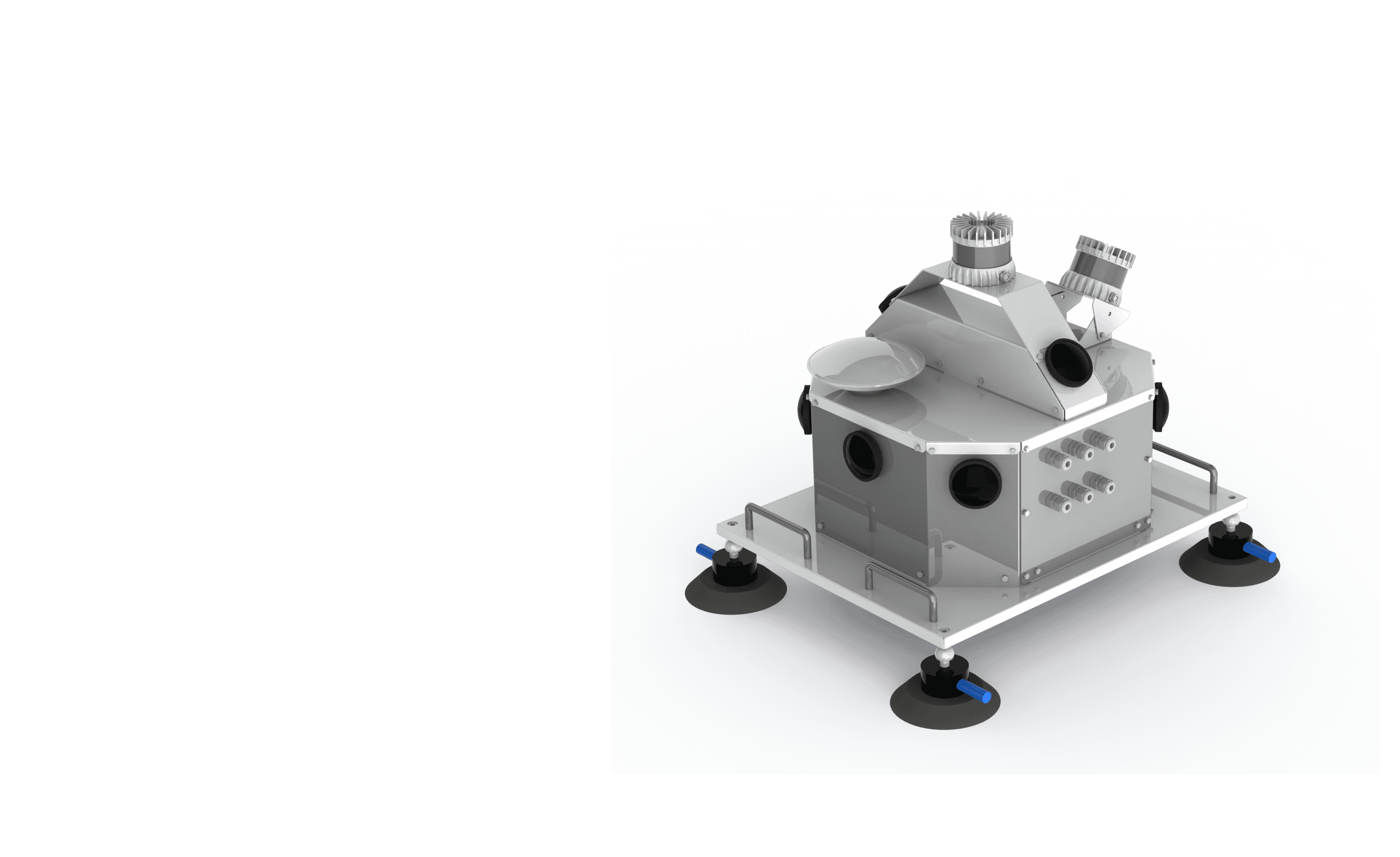
SS360 MMS
SpatialSense-360 Mobile Mapping System
Advanced Vision Systems for Automated Infrastructure Mapping
SS360 MMS
SpatialSense-360 Mobile Mapping System
Advanced Vision Systems for Automated Infrastructure Mapping
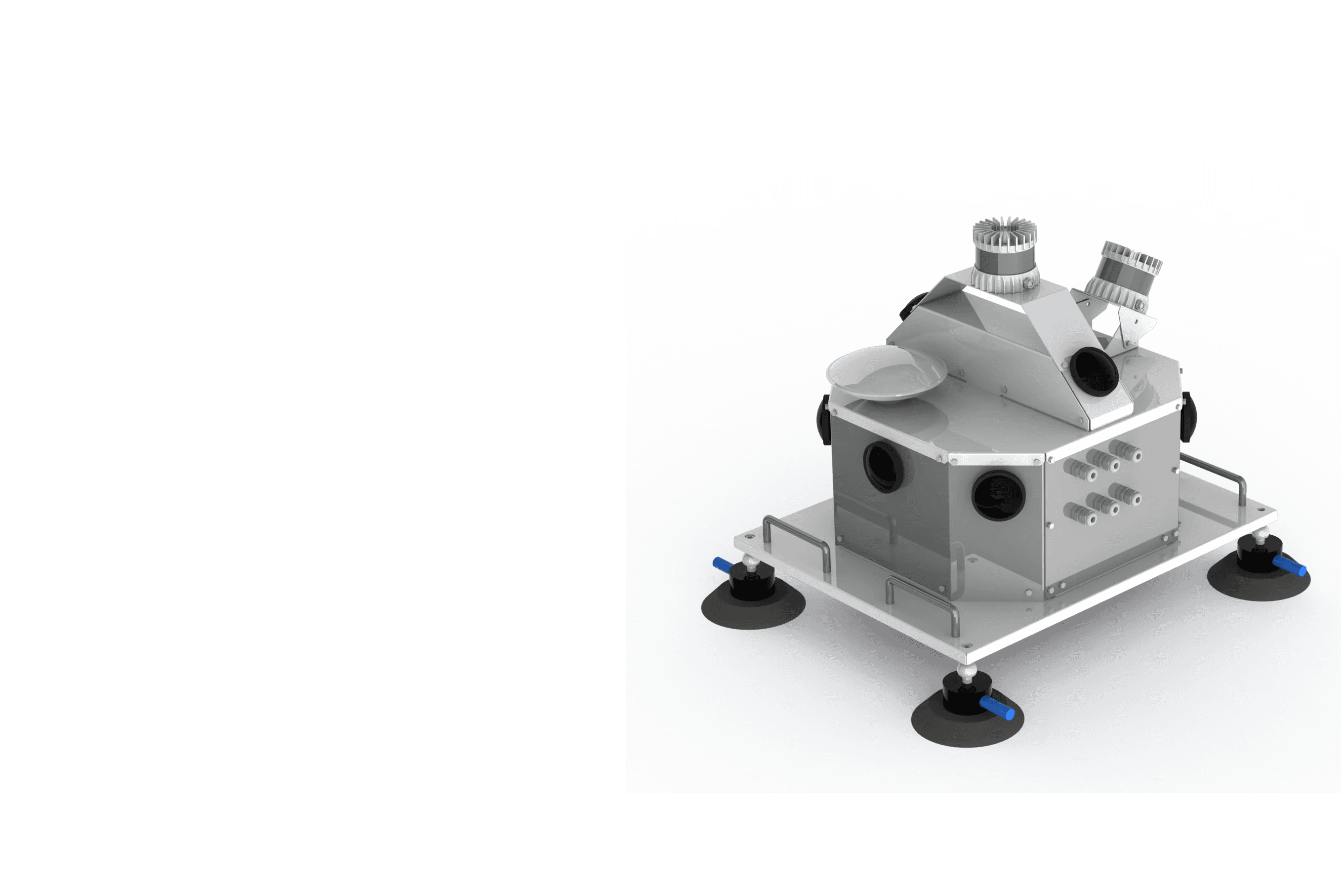
SS360 MMS
SpatialSense-360 Mobile Mapping System
Advanced Vision Systems for Automated Infrastructure Mapping
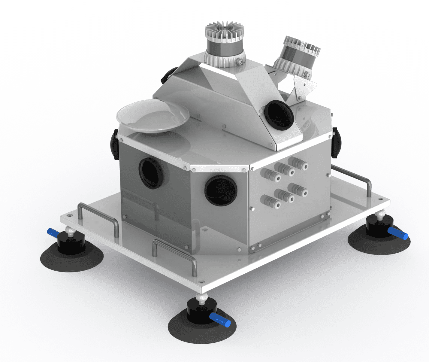
The SS360 MMS is a high speed, high performance mobile mapping system which provides dense, accurate maps of the urban environment.
The powerful technology uses two high accuracy LiDAR sensors, high definition cameras, and IMU/GNSS unit for precise survey of data.
The SS360 MMS is a high speed, high performance mobile mapping system which provides dense, accurate maps of the urban environment.
The powerful technology uses two high accuracy LiDAR sensors, high definition cameras, and IMU/GNSS unit for precise survey of data.

At a Glance
Transport Infrastructure Mapping
GIS Mapping and Asset Management
City Modeling
Transport Infrastructure Mapping
GIS Mapping and Asset Management
City Modeling
At a Glance
At a Glance
Transport Infrastructure Mapping
GIS Mapping & Asset Management
City Modeling
Problem
Problem
Problem
Streamlining Infrastructure Projects with Up-to-Date Data
The rapid evolution of infrastructure development demands precise and up-to-date geographic data, yet traditional surveying methods often prove costly and time-consuming. Many organizations struggle with outdated information, leading to inefficiencies and increased project costs. Inaccurate or infrequent data collection can result in design flaws, regulatory compliance issues, and delays in project timelines. Additionally, the reliance on manual processes can hinder responsiveness to changing site conditions.
Our Mobile Mapping System (MMS) addresses these challenges by providing a cost-effective solution to capture high-resolution, real-time data. With advanced sensors and technology, our system ensures high availability of current information, enabling organizations to make informed decisions swiftly and optimize project outcomes.
The rapid evolution of infrastructure development demands precise and up-to-date geographic data, yet traditional surveying methods often prove costly and time-consuming.
Many organizations struggle with outdated information, leading to inefficiencies and increased project costs. Inaccurate or infrequent data collection can result in design flaws, regulatory compliance issues, and delays in project timelines.
Additionally, the reliance on manual processes can hinder responsiveness to changing site conditions.
Our mobile mapping system addresses these challenges by providing a cost-effective solution to capture high-resolution, real-time data.
With advanced sensors and technology, our system ensures high availability of current information, enabling organizations to make informed decisions swiftly and optimize project outcomes.
The rapid evolution of infrastructure development demands precise and up-to-date geographic data, yet traditional surveying methods often prove costly and time-consuming.
Many organizations struggle with outdated information, leading to inefficiencies and increased project costs. Inaccurate or infrequent data collection can result in design flaws, regulatory compliance issues, and delays in project timelines.
Additionally, the reliance on manual processes can hinder responsiveness to changing site conditions.
Our mobile mapping system addresses these challenges by providing a cost-effective solution to capture high-resolution, real-time data. With advanced sensors and technology, our system ensures high availability of current information, enabling organizations to make informed decisions swiftly and optimize project outcomes.
How to Get Started With SS360 MMS?
How to Get Started With SS360 MMS?
How to Get Started With SS360 MMS?
Three Steps to Streamline Your GIS Data Acquisition
Step 01
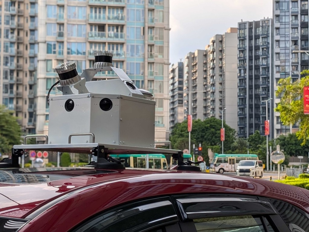
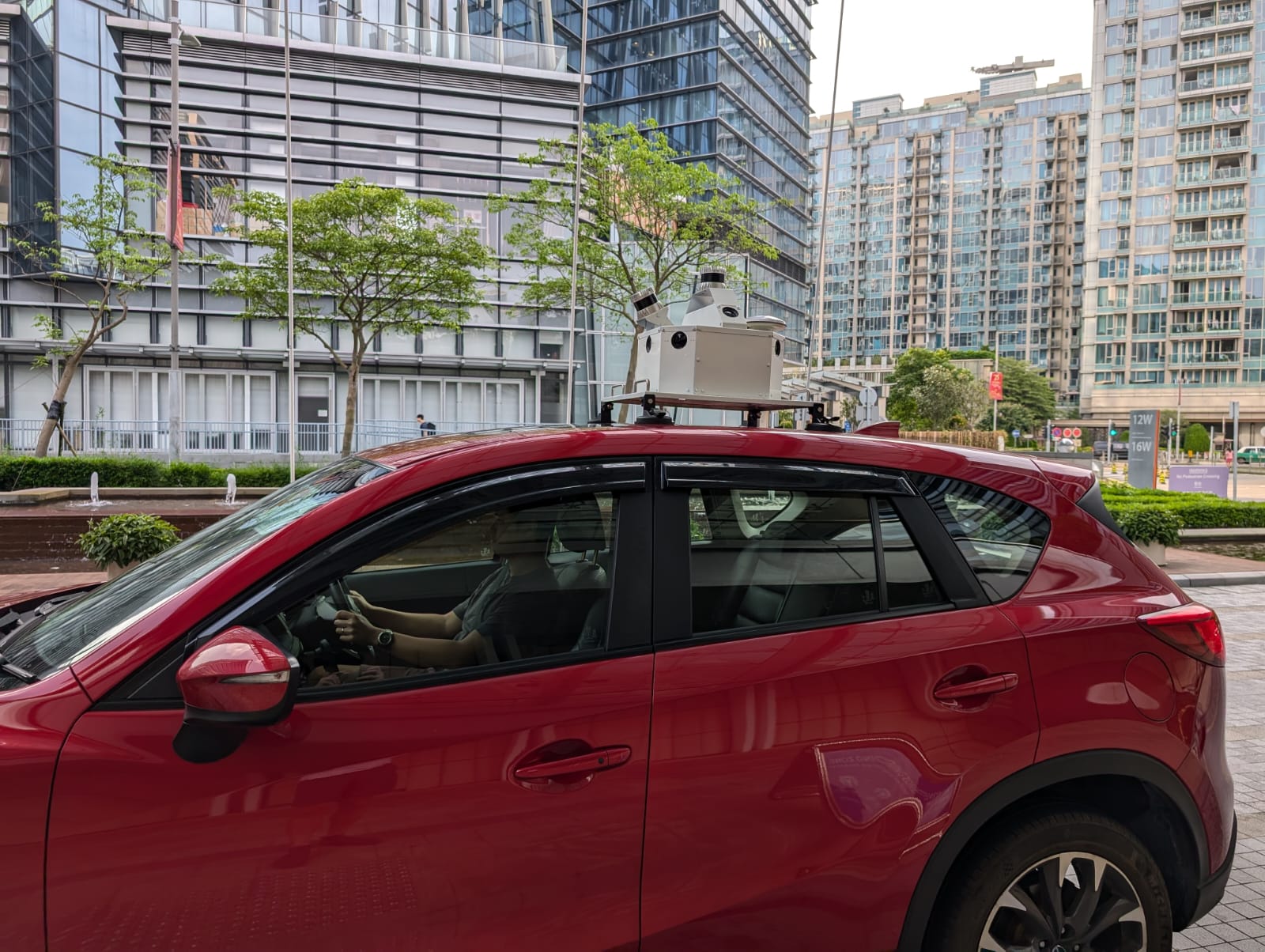
Mount the SS360 on the Inspection Vehicle
Mount the SS360 on the Inspection Vehicle
SS360 can be mounted on an inspection vehicle of your choice. The installation kit includes necessary materials such as suction cups, data collection unit, control unit, and power supply battery.
SS360 can be mounted on an inspection vehicle of your choice. The installation kit includes necessary materials such as suction cups, data collection unit, control unit, and power supply battery.


Step 02
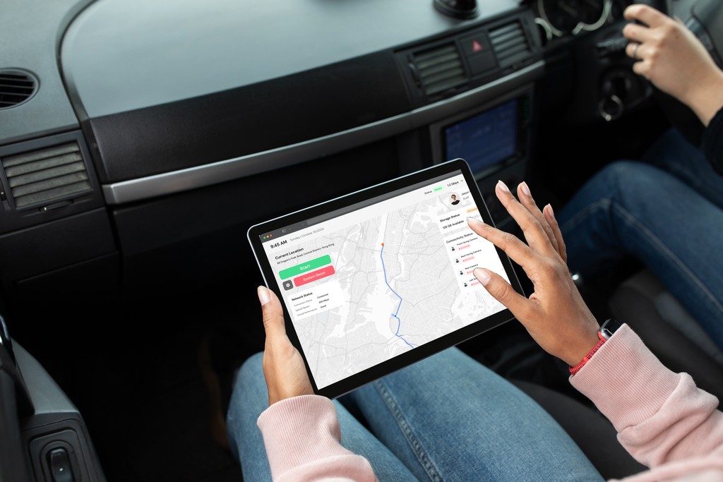
Start the Data Collection
Start the Data Collection
Once mounted, the user can use SS360 app to start the data collection, check equipment status, etc.
Once mounted, the user can use SS360 app to start the data collection, check equipment status, etc.
Learn More
Step 03
View Generated 3D Map
View Generated 3D Map
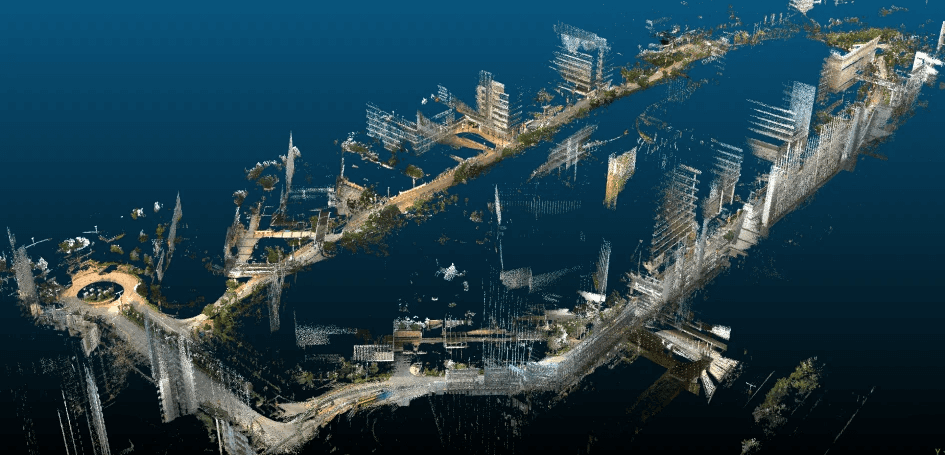
After scanning, the user can upload data to the server/cloud for further processing. The app will let the user know the status of upload, remaining time, and necessary information.
The system creates colourized point cloud models of the environment and is ideal for cost-effective and scalable mapping of urban environment.


Want More Details? Download Our Leaflet.
Comparison
Comparison
Comparison
SS360 MMS vs. Manual Inspection
Hundreds of pictures on your phone
Hundreds of pictures on your phone
Hundreds of pictures on your phone
Automated Data Collection
Automated Data Collection
Automated Data Collection
Non-proprietary Output Files
Non-proprietary Output Files
Non-proprietary Output Files
High Data Accuracy
High Data Accuracy
High Data Accuracy
Proactive Maintenance Support
Proactive Maintenance Support
Proactive Maintenance Support
Easy Report Export
Easy Report Export
Easy Report Export
Kodifly's
SS360 MMS
Kodifly's
SS360 MMS
Traditional Inspection of Infrastructure
Traditional Inspection
Traditional Inspection of Infrastructure
Our Solutions
Our Solutions
Our Solutions
Explore Our Cutting-Edge Solutions
Mobile Mapping System
With SS360 MMS, you can capture high-resolution data without disrupting traffic. Our system uses LiDAR and IoT for precise mapping of highways and railways, providing critical insights for infrastructure management.

Tree Guard :
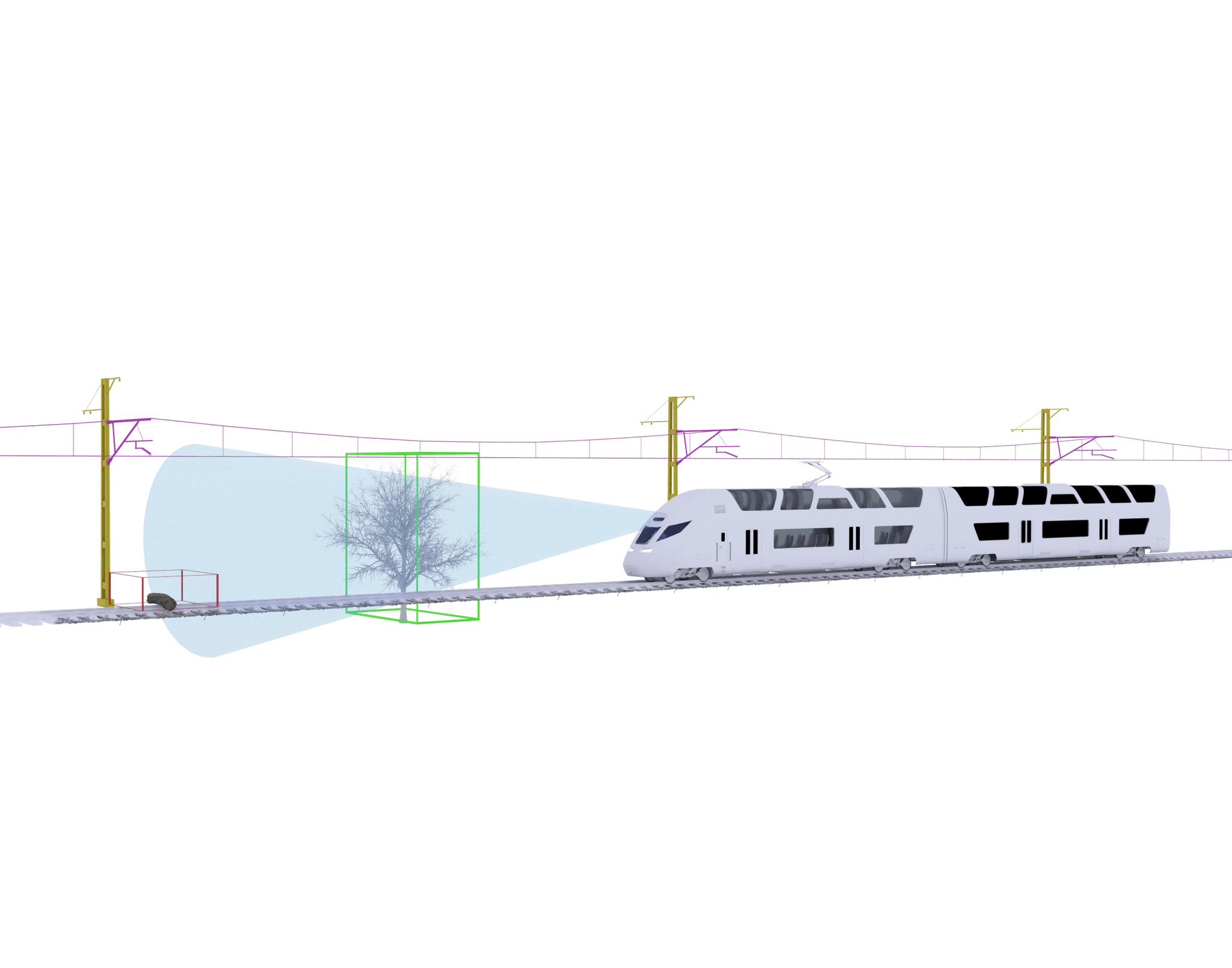
Vegetation Management SystemTreeGuard automatically scans for vegetation encroachment into the rail corridor. It provides detailed 3D models of the rail corridor for accurate analysis.
Track Vision :
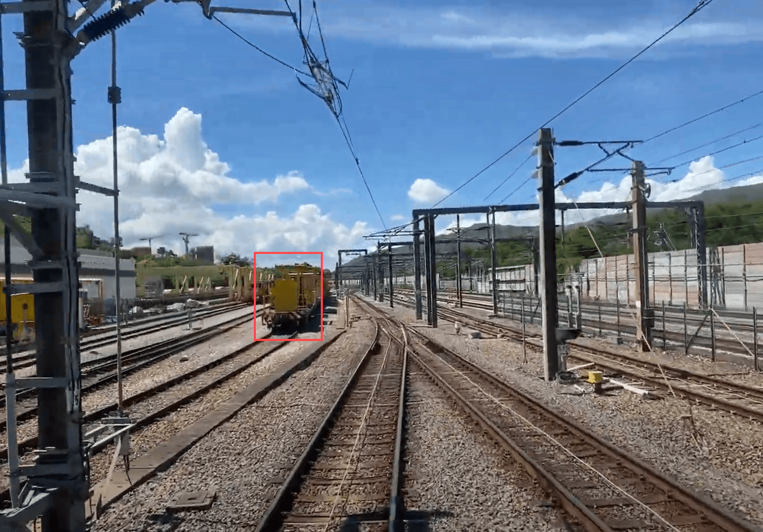
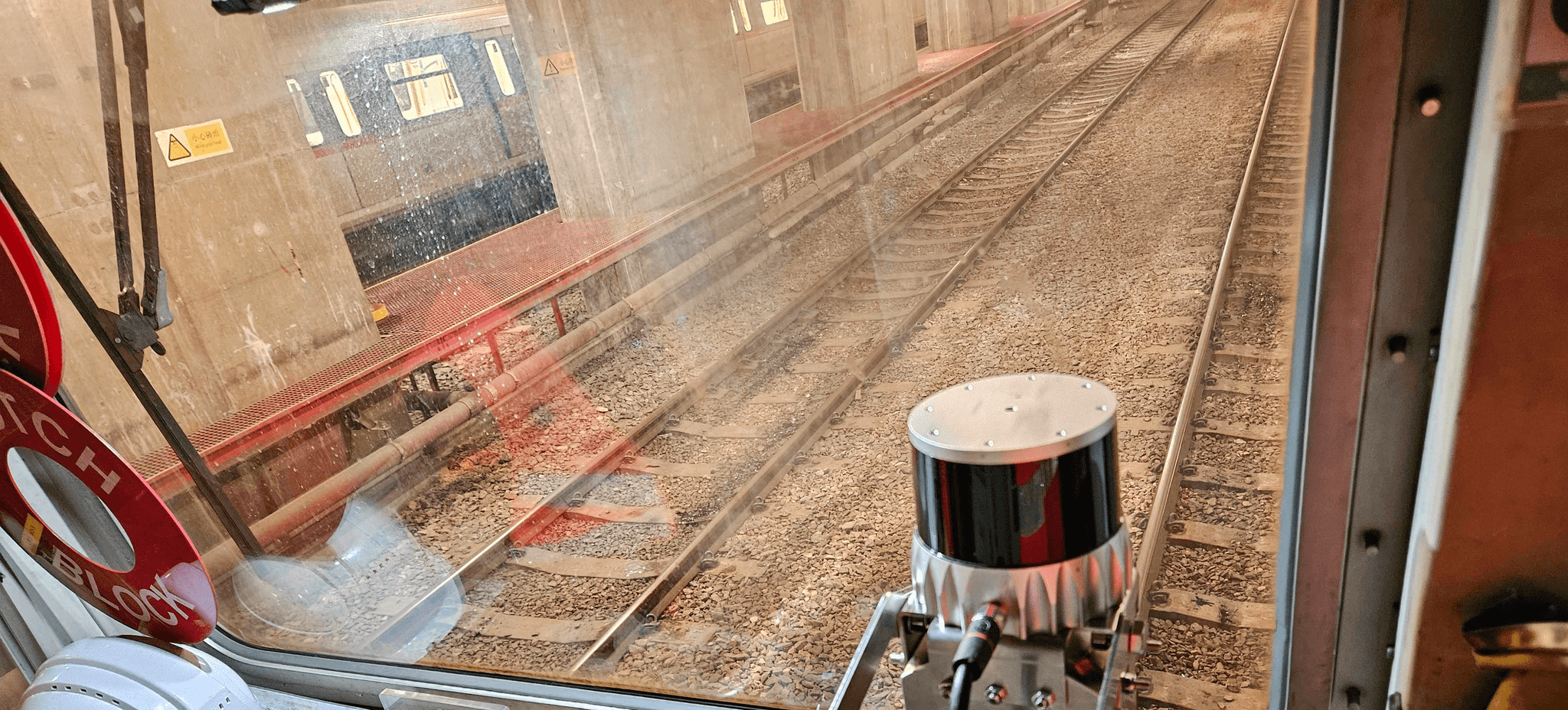
Train Perception SystemThe system’s advanced automatic obstacle detection continuously scans the tracks for potential hazards, alerting drivers in real time. This proactive feature minimizes collision risks, enhancing safety and ensuring smoother operations.
Ballast Vue :
Ballast Profile MonitoringBallastVue combines advanced LiDAR and camera fusion to generate real-time 3D models of track ballast. This technology ensures optimal distribution and stability, enhancing overall track performance.

Mobile Mapping System
With SS360 MMS, you can capture high-resolution data without disrupting traffic. Our system uses LiDAR and IoT for precise mapping of highways and railways, providing critical insights for infrastructure management.

Tree Guard :
Vegetation Management SystemTreeGuard automatically scans for vegetation encroachment into the rail corridor. It provides detailed 3D models of the rail corridor for accurate analysis.

Track Vision :
Train Perception SystemThe system’s advanced automatic obstacle detection continuously scans the tracks for potential hazards, alerting drivers in real time. This proactive feature minimizes collision risks, enhancing safety and ensuring smoother operations.

Ballast Vue :
Ballast Profile MonitoringBallastVue combines advanced LiDAR and camera fusion to generate real-time 3D models of track ballast. This technology ensures optimal distribution and stability, enhancing overall track performance.

Mobile Mapping System
With SS360 MMS, you can capture high-resolution data without disrupting traffic. Our system uses LiDAR and IoT for precise mapping of highways and railways, providing critical insights for infrastructure management.

Tree Guard :
Vegetation Management SystemTreeGuard automatically scans for vegetation encroachment into the rail corridor. It provides detailed 3D models of the rail corridor for accurate analysis.

Track Vision :
Train Perception SystemThe system’s advanced automatic obstacle detection continuously scans the tracks for potential hazards, alerting drivers in real time. This proactive feature minimizes collision risks, enhancing safety and ensuring smoother operations.

Ballast Vue :
Ballast Profile MonitoringBallastVue combines advanced LiDAR and camera fusion to generate real-time 3D models of track ballast. This technology ensures optimal distribution and stability, enhancing overall track performance.

Mobile Mapping System
With SS360 MMS, you can capture high-resolution data without disrupting traffic. Our system uses LiDAR and IoT for precise mapping of highways and railways, providing critical insights for infrastructure management.

Tree Guard :
Vegetation Management SystemTreeGuard automatically scans for vegetation encroachment into the rail corridor. It provides detailed 3D models of the rail corridor for accurate analysis.

Track Vision :
Train Perception SystemThe system’s advanced automatic obstacle detection continuously scans the tracks for potential hazards, alerting drivers in real time. This proactive feature minimizes collision risks, enhancing safety and ensuring smoother operations.

Ballast Vue :
Ballast Profile MonitoringBallastVue combines advanced LiDAR and camera fusion to generate real-time 3D models of track ballast. This technology ensures optimal distribution and stability, enhancing overall track performance.

Ballast Vue : Ballast Profile Monitoring
BallastVue combines advanced LiDAR and camera fusion to generate real-time 3D models of track ballast. This technology ensures optimal distribution and stability, enhancing overall track performance.

Track Vision : Train Perception System
The system’s advanced automatic obstacle detection continuously scans the tracks for potential hazards, alerting drivers in real time. This proactive feature minimizes collision risks, enhancing safety and ensuring smoother operations.

Tree Guard : Vegetation Management System
TreeGuard automatically scans for vegetation encroachment into the rail corridor. It provides detailed 3D models of the rail corridor for accurate analysis.

Mobile Mapping System
With SS360 MMS, you can capture high-resolution data without disrupting traffic. Our system uses LiDAR and IoT for precise mapping of highways and railways, providing critical insights for infrastructure management.

Ballast Vue : Ballast Profile Monitoring
BallastVue combines advanced LiDAR and camera fusion to generate real-time 3D models of track ballast. This technology ensures optimal distribution and stability, enhancing overall track performance.

Track Vision : Train Perception System
The system’s advanced automatic obstacle detection continuously scans the tracks for potential hazards, alerting drivers in real time. This proactive feature minimizes collision risks, enhancing safety and ensuring smoother operations.

Tree Guard : Vegetation Management System
TreeGuard automatically scans for vegetation encroachment into the rail corridor. It provides detailed 3D models of the rail corridor for accurate analysis.

Mobile Mapping System
With SS360 MMS, you can capture high-resolution data without disrupting traffic. Our system uses LiDAR and IoT for precise mapping of highways and railways, providing critical insights for infrastructure management.

Ballast Vue : Ballast Profile Monitoring
BallastVue combines advanced LiDAR and camera fusion to generate real-time 3D models of track ballast. This technology ensures optimal distribution and stability, enhancing overall track performance.

Track Vision : Train Perception System
The system’s advanced automatic obstacle detection continuously scans the tracks for potential hazards, alerting drivers in real time. This proactive feature minimizes collision risks, enhancing safety and ensuring smoother operations.

Tree Guard : Vegetation Management System
TreeGuard automatically scans for vegetation encroachment into the rail corridor. It provides detailed 3D models of the rail corridor for accurate analysis.

Mobile Mapping System
With SS360 MMS, you can capture high-resolution data without disrupting traffic. Our system uses LiDAR and IoT for precise mapping of highways and railways, providing critical insights for infrastructure management.

Ballast Vue : Ballast Profile Monitoring
BallastVue combines advanced LiDAR and camera fusion to generate real-time 3D models of track ballast. This technology ensures optimal distribution and stability, enhancing overall track performance.

Track Vision : Train Perception System
The system’s advanced automatic obstacle detection continuously scans the tracks for potential hazards, alerting drivers in real time. This proactive feature minimizes collision risks, enhancing safety and ensuring smoother operations.

Tree Guard : Vegetation Management System
TreeGuard automatically scans for vegetation encroachment into the rail corridor. It provides detailed 3D models of the rail corridor for accurate analysis.

Mobile Mapping System
With SS360 MMS, you can capture high-resolution data without disrupting traffic. Our system uses LiDAR and IoT for precise mapping of highways and railways, providing critical insights for infrastructure management.

Mobile Mapping System
With SS360 MMS, you can capture high-resolution data without disrupting traffic. Our system uses LiDAR and IoT for precise mapping of highways and railways, providing critical insights for infrastructure management.

Tree Guard : Vegetation Management System
TreeGuard automatically scans for vegetation encroachment into the rail corridor. It provides detailed 3D models of the rail corridor for accurate analysis.

Track Vision : Train Perception System
The system’s advanced automatic obstacle detection continuously scans the tracks for potential hazards, alerting drivers in real time. This proactive feature minimizes collision risks, enhancing safety and ensuring smoother operations.

Ballast Vue : Ballast Profile Monitoring
BallastVue combines advanced LiDAR and camera fusion to generate real-time 3D models of track ballast. This technology ensures optimal distribution and stability, enhancing overall track performance.

Mobile Mapping System
With SS360 MMS, you can capture high-resolution data without disrupting traffic. Our system uses LiDAR and IoT for precise mapping of highways and railways, providing critical insights for infrastructure management.

Tree Guard : Vegetation Management System
TreeGuard automatically scans for vegetation encroachment into the rail corridor. It provides detailed 3D models of the rail corridor for accurate analysis.

Track Vision : Train Perception System
The system’s advanced automatic obstacle detection continuously scans the tracks for potential hazards, alerting drivers in real time. This proactive feature minimizes collision risks, enhancing safety and ensuring smoother operations.

Ballast Vue : Ballast Profile Monitoring
BallastVue combines advanced LiDAR and camera fusion to generate real-time 3D models of track ballast. This technology ensures optimal distribution and stability, enhancing overall track performance.

Mobile Mapping System
With SS360 MMS, you can capture high-resolution data without disrupting traffic. Our system uses LiDAR and IoT for precise mapping of highways and railways, providing critical insights for infrastructure management.

Tree Guard : Vegetation Management System
TreeGuard automatically scans for vegetation encroachment into the rail corridor. It provides detailed 3D models of the rail corridor for accurate analysis.

Track Vision : Train Perception System
The system’s advanced automatic obstacle detection continuously scans the tracks for potential hazards, alerting drivers in real time. This proactive feature minimizes collision risks, enhancing safety and ensuring smoother operations.

Ballast Vue : Ballast Profile Monitoring
BallastVue combines advanced LiDAR and camera fusion to generate real-time 3D models of track ballast. This technology ensures optimal distribution and stability, enhancing overall track performance.

Mobile Mapping System
With SS360 MMS, you can capture high-resolution data without disrupting traffic. Our system uses LiDAR and IoT for precise mapping of highways and railways, providing critical insights for infrastructure management.

Tree Guard : Vegetation Management System
TreeGuard automatically scans for vegetation encroachment into the rail corridor. It provides detailed 3D models of the rail corridor for accurate analysis.

Track Vision : Train Perception System
The system’s advanced automatic obstacle detection continuously scans the tracks for potential hazards, alerting drivers in real time. This proactive feature minimizes collision risks, enhancing safety and ensuring smoother operations.

Ballast Vue : Ballast Profile Monitoring
BallastVue combines advanced LiDAR and camera fusion to generate real-time 3D models of track ballast. This technology ensures optimal distribution and stability, enhancing overall track performance.
Looking for more information? Get our detailed guide.
Schedule a Meeting With Our Sales Team
Find out how SpatialSense can help transform your business.